Avalanche Report for Lochaber
Issued
Avalanche Hazard Forecast
FOR PERIOD 18:00 Thu 16/04/2026 TO 18:00 Fri 17/04/2026

Forecast Snow Stability & Avalanche Hazard
Reports for have now finished for the winter
Forecast Weather Influences

Observed Avalanche Hazard -
Observed Weather Influences
Observed Snow Stability and Avalanche Hazard
Reports for Lochaber have now finished for the winter
Mountain Conditions
Recent Avalanche Activity
Avalanches recorded in this forecast region within 7 days of this report.
8 Avalanches
View details | View on map
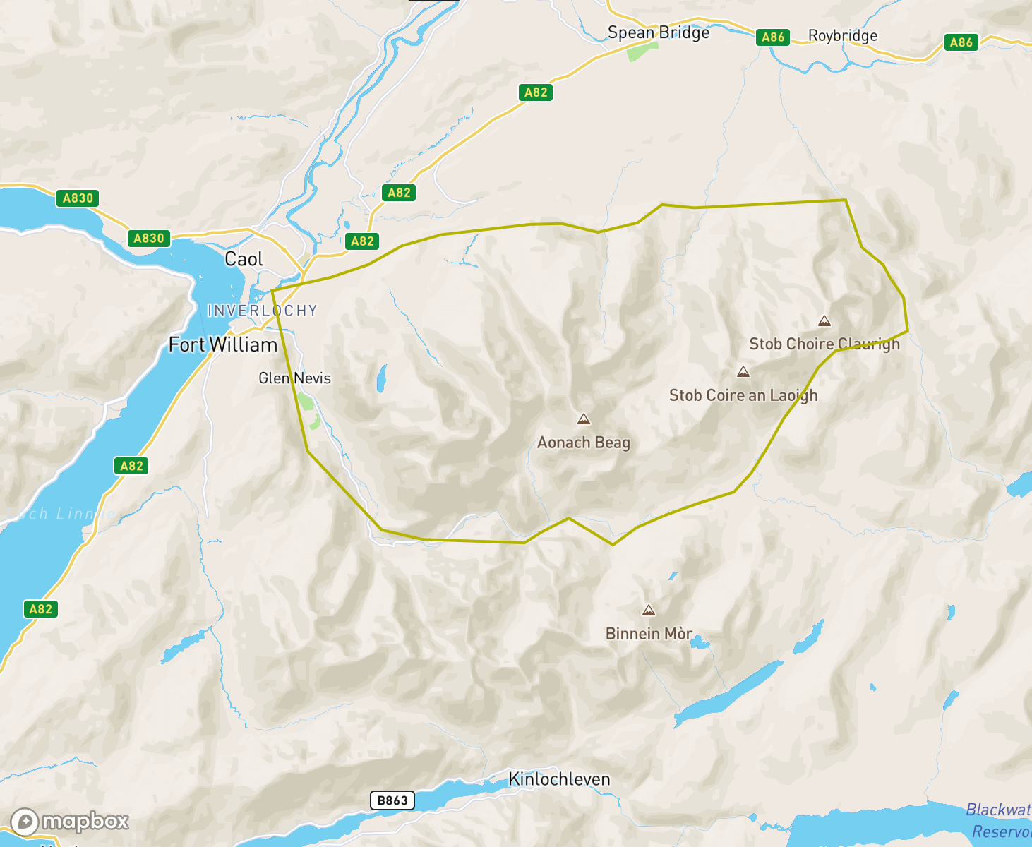
The Lochaber avalanche forecast region
When producing daily avalanche forecasts for the Lochaber region the whole area and summits as indicated on the map are considered by SAIS forecasters when writing their daily reports.
In the Lochaber region the “core” forecast area primarily visited are the mountains comprising the Aonach Mor range and the highest UK summit of Ben Nevis. Knowledge from the core area is applied to the more outlying mountains such as the Grey Corries range to the east where field observations are carried out in turn as the winter progresses, or specific snowpack assessments are required.
-
A Roller Coaster of Conditions
The week started with substantial snowfall, followed on Tuesday by a massive thaw. Only to return to winter conditions by Thursday with fresh snow on the tops and the freezing level lowering to around 600m.
ChangeableThe period started with unstable windslab mainly on North to East aspects with further windslab developing on these aspects during the period. A short warming on Saturday night triggered some avalanche activity with another warming on Monday night which lasted through to Wednesday resulting in a lot of avalanche activity. A refreeze at the end of the period has stabilised the snowpack.
Winter ReturnsThe start of the period was marked with a stable spring snowpack. It was thawing gently over the weekend then refroze on Monday. The hazard was low during these days. Winter then returned with snow falling on Tuesday and continuing through Wednesday. There was significant amount of fresh snow which was deposited as soft slab on higher lee aspects. Some large unstable cornices formed. The hazard rose to Moderate on Tuesday and Considerable for Wednesday and Thursday.
ConsolidationA South-westerly airstream brought wind and snow and significant windslab deposits built up during the first half of the week. A period of instability followed with rain at all levels and several avalanches. The snowpack then rapidly consolidated and is now well bonded and stable.
Spring then winterThe period started with a generally stable snowpack with isolated and shallow areas of windslab and settled spring like weather conditions. On Wednesday and Thursday fresh snow along with strong and at time storm force winds made it feel quite wintery. As of Thursday afternoon the older snowpack is becoming firm and stable and fresh unstable windslab is developing mainly on North to East aspects.
Thaw conditionsSoutherly winds and mild temperatures have brought a period of predominately thaw conditions. There has been a gradual thaw of the remaining snow pack with a more noticeable loss of snow at lower elevations. Reasonable cover of generally stable snow remains above around 900metres.
MildTemperatures rose at the start of the period and it remained mild throughout. Many wet snow avalanches were recorded at the start of the period, mainly on North to East aspects. Stability then improved but some we snow instabilities persisted and cornices remained prone to collapse. It was slightly cooler today (Thursday) and fresh unstable windslab was developing on North to East aspects above 1150 metres.
ChangeableThe period started with good snow cover above 600 metres, South-Easterly winds and windslab on West to North aspects. The weekend brought an Atlantic low giving initial heavy snow with windslab on North to East aspects with a warming on Sunday when several avalanches were recorded. This windslab persisted on Monday and Tuesday with further avalanches. Redistribution to West to North aspects on Wednesday gave further avalanches and the period ended with rain and rising temperatures.
Shallow Windslab, Slight thawSnow cover remains good above about 700 metres. Last Friday and Saturday the snowpack generally quite firm with some, generally shallow, patches of windslab. A gentle thaw on all but the highest tops on Sunday and Monday wetted and consolidated these patches of slab. This was followed by a temperature drop which firmed up the snowpack. However, there were then some fresh deposits of windslab, but again these were shallow and not extensive. The hazard has been low or moderate throughout.
A wintery weekThere was a strong East to South-Easterly air stream for the whole period. Initial deep but reasonably bonded windslab slowly consolidated, helped by small rises and falls in the freezing level. The snowpack then developed an icy surface in most places with isolated and shallow accumulations of unstable windslab in very sheltered locations. Debris from one small natural avalanche was observed today (Thursday).
Stormy periodIt has been a generally stormy week with persistent S and SE winds, summit temperatures a few degrees below freezing and periods of snowfall. Much of the fresh snow has been blown off the hill, and what has stuck has been densely packed into sheltered N to W aspects. The hazard has generally been moderate or considerable. However, one human triggered avalanche was noted on a W aspect. Natural avalanches may have occurred but not recorded due to persistent poor visibility.
WindslabWeaknesses in windslab present on North-West through North to East aspects persisted for several days. South-East winds and snow showers then deposited further unstable windslab on West to North aspects. A warming on Wednesday night helped stabilise the snowpack but further windslab then developed on South-West through West to North aspects on Thursday.
A wintry weekA wintry week with fresh snowfall most days and the snowpack continuing to build through the week. On Sunday evening there was a brief thaw with rain to summit level which soaked the snowpack through. This soon refroze and consolidated on Monday with fresh windslab soon starting to build. There was a large snowfall today (Thursday). There were a number of avalanches recorded around the weekend and on Thursday. More avalanches likely occurred but were not observed due to poor visibility.
Cold and snowyIt was a cold week with North-Westerly winds initially giving areas of windslab on South to East aspects. On Tuesday the wind came round to the South-West with heavier snow producing larger areas of deeper unstable windslab mainly on North to East aspects above 800 metres with rain at lower elevations. Three avalanches were recorder at this time. Cold, drier conditions for the rest of the period with weaknesses in the windslab persisting and a crust forming at lower elevations.
Change in conditions on the 1stFrom Christmas to Hogmanay the weather was settled. The patchy snowpack which was mainly found in higher North to East aspects was hard, icy and stable. Today (Thurs 1st) there was a change with fresh snow falling during the day. Although quantities of fresh were not significant, and much of it has landed on bared ground. However, where it has landed on the old hard icy snowpack such as at the top of gullies, it was not well bonded. Fresh cornices are prone to collapse.
ChangeableThe period started with unstable windslab developing mainly on North to East aspects. Varying freezing levels helped this consolidate giving a breakable crust on top. Mild conditions then gave a wet and thawing snowpack for a couple of days which then froze hard as the temperature dropped on Wednesday and Thursday.
Starting to buildThe snowpack extent at the start of the period was limited to patches and strips on mainly N to E aspects above 1000m. This depleted further with mild conditions during the weekend. However, snow showers for the past few days have started to build up deposits in sheltered locations at higher levels. There is one avalanche recorded on Wednesday morning in Easy Gully on Aonach Mor triggered by a brief thaw and rain. The snowpack is still not extensive for the time or year, but better than it was.
Snowpack retreating.At the start of the period there was reasonable snow cover above about 950 metres. This slowly consolidated during Friday and weekend as the freezing level hovered around the 1200 metres. However, rain and some very mild temperatures from Monday to today has decimated the snowpack. All that remains is a patchy stable spring snowpack.
Start of WinterPredominantly Southerly winds over the past week with frequent showers. Earlier in the week the snow level was around 800m, as the week went on the freezing level rose and the snow line was generally above 900m by the end of the week. Wind slab problems headlined, with Northerly aspects affected at higher elevations.
Forecasting starts again today.The first report was issued today for the 2025/26 season. There is a superficial covering of snow on all aspects above 900 metres. The greatest accumulations are present on steep North to Easterly aspects mainly above 1000m which is often icy in places or a breakable crust exists. The snowpack is generally stable in most locations and the avalanche hazard is Low.
High pressure conditionsAfter some fresh snow at the start of the period, warm weather returned and the new snow quickly consolidated. We have had high pressure bringing fine sunny weather for the last few days and the limited remaining snow continues to thaw and diminish. Greatest amounts remain in the highest North and East facing corries and gullies with little snow elsewhere.
Spring snowpackThe freezing level remained above all summits for most of the period. The stable patchy snowpack slowly thawed, and is very spring like. Most remaining deposits are in high N-E coires and gullies.
Spring conditions developingThe period started with a few centimetres fresh snow on all aspects above 500 metres. Settled weather for the rest of the period with frosty nights and sunny days led to a quick consolidation of the new snow with thawing at lower elevations and on aspects exposed to the sun. The period ends with mild conditions with a patchy, stable, thawing snowpack mainly in high, North to East facing gullies and corries. The avalanche hazard has been Low throughout.
Dry, Patchy snowpack.It has been generally dry in Lochaber for the last seven days. The end of last week and the weekend were mild and very spring like. On Sunday night the freezing level dropped to around mid mountain level where it has remained since. There is very little snow for this time of year. The spring snowpack has been patchy and stable throughout. There was a slight dusting of fresh snow on Tuesday evening, but not enough to make a difference. The hazard has been low throughout the period.
Back to SpringThe first few days of the period were below freezing on the tops with some areas of moderately bonded cold snow, primarily at the tops of slopes and gullies. The freezing level rose above the summits on Monday evening, and it remained mild after that, with some periods of rain. The snowpack became wet and thawed through the rest of the period. Overall there is very little snow of the time of year. The hazard was moderate for the start of the period, dropping to low for the final few days.
A return to winterThe start of the period was very mild, very wet and very windy resulting in depleted snow cover. Winter returned with a bump and within a few days snow accumulations started to develop with snow lying above c.650 metres. Windslab and cornices problems started to develop mainly on North-West through North to South-East aspects above 900 metres. These have started to consolidate over time but still remain.
Cold becoming mildThe start of the period was cold with a generally stable snowpack. Some unstable windslab developed in the middle of the period mainly on Northerly aspects but this consolidated fairly quickly in milder conditions. The temperature rose further at the end of the period leading to significant thawing. The snowpack is currently wet with good stability. Greatest accumulations are on high North to East aspects.
Cold and dryThe period has been remarkably cold and dry with summit temperatures continually below zero. The wind has been generally from the South-East and fairly strong. This weather has resulted in very little change in the snowpack and windslab that was present at the start of the period is still there, albeit with slightly improved stability. It is currently a very varied snowpack with windslab, crust, hard neve and ice all present.
Three Weather TypesThe first couple of days of this period were cold with some substantial but reasonably well bonded areas of windslab from storms of the previous week. Unfortunately, the next few days were mild and wet, and much of the snowpack melted. Another change in conditions for the final few days when there was a return to cool settled conditions with some isolated areas of unstable windslab and some small up unstable sections of cornice. No significant avalanche activity was recorded during the period.
Winter returnsVery little snow at the start of the period. This changed on Friday and Saturday as Storm Eowyn passed over giving storm force winds and significant windslab deposits mainly on North-West through North to East aspects. There has been some consolidation in this windslab but weaknesses have persisted. Some light snow falls since have not resulted in significant accumulations.
Very Little SnowOver the weekend and during Monday it remained mild. Snow cover was restricted to a few isolated patches above about 1000 metres. It is very unusual to have such a limited snow cover for the time of year. In the past few days there has been a dusting of snow above 900 metres, and the summit temperatures have been below freezing. These fresh deposits remain very shallow. However, the hills are at least looking a bit more wintry.
Mild and thawingAfter a couple of days of continuing wintry weather the conditions changed dramatically as a mild air flow arrived from the South-West on Sunday evening. The relatively thin snow cover quickly thawed to leave a very spring like picture. Summit temperatures on Aonach Mor were recorded at 6.9 degrees.
Cold with some snowIt has remained cold and settled throughout the period with some fresh snow to sea level. In most places the snow has been soft and unconsolidated with good stability. Localised accumulations of windslab have developed at altitude mainly on Easterly and Southerly aspects with fragile cornices developing above these aspects. Ice has also been slowly building through the period.
Light coverAfter a warm end to 2024, Wednesday saw a light dusting of snow on most slopes above 300m. This cover mainly lies on bare ground and is not really significant in depth, except for a few localised locations.
No snowThe recent thaw conditions have depleted the snowpack in Lochaber. Lal that remains are a few patches in the backs of gullies and corries at higher elevations
Thin coverThere has been a significant thaw of the snow pack over the past week. The older snowpack is patchy with greatest amounts remaining around Coire rims and gully tops. A thin covering of fresh snow currently present is likely to rapidly diminish at most levels tomorrow, with some localised windslab deposits remaining above 1100metres.
Winter starts earlyThis week has seen some light snowfall at all levels over Lochaber and some very cold temperatures. Due to the light winds, most of the lying snow is unconsolidated with only some localised areas of windslab on the highest aspects
Variable conditionsThere have been several short periods of snow in the period but this has given a limited hazard and consolidated quickly in the mild and sometimes very wet conditions experienced at other times. There's currently a well bonded spring snowpack with greatest amounts on North to East aspects above 900 metres.
Moderate become Low hazardIt has been a relatively dry week with some snow showers from time to time. The freezing level has generally been below the summits, but it has not been cold. The snowpack has generally been slowly consolidating, and fresh amounts have not been particularly significant. The hazard was moderate the first few days, dropping to low for the final few days. Cover remains reasonable above 900 metres, but there not a great deal of snow below this level.
Moderate hazard above 900m.It has been a cool and generally settled week with a small amount of fresh snow. Summit temperature have generally be below or around freezing although with some diurnal variation. Below 900 metres the snowpack has been generally stable. Above this height some instabilities remain, but these are not particularly extensive. Some weak cornices have been observed. The hazard has been moderate most of the period.
Generally good stabilityThe period started with localised areas of unstable windslab on Westerly aspects. Temperature fluctuations caused this to consolidate and further limited snow accumulations consolidated quickly in further temperature fluctuations. the period ended with greatest accumulations of older snow on high North to East aspects with some fresh windslab on Easterly aspects.
Generally good stabilityThe period has been mainly dry with a freezing level around 600 to 800 metres. The older snowpack has been stable and fresh snow deposits have been isolated and shallow. The exception to this was on Tuesday night when the freezing level rose well above the summits and there was heavy rain causing cornice collapse and at least one wet snow avalanche.
A stabilising trendSnowfall at the start and middle of the period, between dry settled spells. Instabilities have remained in the snowpack for most of the week, these were most significant on Monday due new snow followed by drifting on very strong winds. Weaknesses at depth were noted at higher levels due to a combination of a steep temperature gradient and a friable crust within the snowpack. Since then the snowpack is on a consolidating trend and it's becoming stable in most locations
Weak CornicesThe start of the week was cold with some fresh snow and moderate winds. The wind seemed to be around about the correct speed to form some large weak cornices, and a number of cornice triggered avalanches were recorded. There was then a few days of cold settled conditions during which the snowpack consolidated slightly. The couple of days there were some temperature fluctuations which have consolidated the existing snowpack. However snow showers then started to deposit fresh areas of windslab.
A mild weekIt was a generally mild week with the freezing level above the summits for most of the time, and periods of rain. The snowpack thawed and consolidated for most of time, and the hazard was generally low. On Wednesday evening the temperature dropped marking a return to cooler showery conditions which started to build up the snowpack again.
Another Cold SpellIt was cold through the majority of the last 7 days with periods of snowfall. An Easterly wind for the first few days then swung round to the West. The old snowpack remained very hard and icy, but gradually got buried in many places. A complex distribution for fresh weak windslab developed, with a number of dry snow slab avalanches both natural and human trigger occurring. On the Wednesday night mild and wet conditions returned causing some further avalanche activity and cornice collapse
Storms easingThe first four days of this period were windy and wet. There was some fresh snow at higher levels over the weekend, but quantities were not significant. A mild and particularly wet day on Monday stripped the snowpack right back. It then became colder and more settled, with the existing snowpack become very hard, icy and stable. There was a dusting of fresh snow on Tuesday night, and a couple of size 1 avalanche occurred. The was removed by strengthening winds on Thursday.
Even More StormyIt has been an unsettled week with very strong winds South-Westerly winds most days and some exceptionally mild days. There has been a significant amount of precipitation, much of which has been rain. When there has been snow (such as on Friday) it has tended to consolidate quickly in the temperature fluctuations. There is a spring snowpack with little snow on windward aspects but a reasonable amount on high lee aspects. The hazard has generally been low or moderate with one day of considerable.
StormyVery variable and rapidly changing conditions in the last week as Storms Isha and Jocelyn passed by giving very strong winds and heavy rain. There were several cycles of fresh windslab followed by a period of instability caused by rising temperatures and rain, and then improving stability as the temperature dropped again. North through East to South-East aspects were most affected. Several avalanches were recorded. We are currently in the warm and wet phase of another cycle.
Development of unstable windslabThis period started with a stable snowpack. After the weekend an Arctic air stream produced very cold temperatures and a showery precipitation, these falling as snow at all levels. Unstable windslab continued to be deposited in sheltered areas, mainly on N through E to S aspects.
A Dry WeekIt has been a generally dry week with plenty of cloud for the first few days, but much clearer and sunny the past few days. Temperatures have generally been below freezing. Winds have been relatively light. There has been little change in the snowpack other than a slight firming up at lower levels. Stability has remained good throughout other than a few very shallow and isolated patches of windslab which easily avoidable.
Snow cover gradually buildingThere has been a net gain of snow this week. Over the past few days, the freezing level has been hovering around 1200m so much of the snowpack has consolidated ad is generally well bonded
The Snow Finally ArrivesThe first few days of the period were mild with little snow. Conditions changed on Christmas day and although it turned colder, little fresh snow fell. A storm on Wednesday finally brought some fresh snow, with a bit more on Thursday. The observed hazard was low (or non-existent) for the most of the period, increasing to moderate in the final few days.
Mild with no substantial snow coverIt has been predominately mild. There was a dusting of fresh snow on a couple of occasions but in each case it was followed by rising temperatures, rain at all levels and a rapid thaw. No significant areas of lasting snow have accumulated.
Winter returnsOver the Easter weekend, the Spring like conditions continued however overnight and into Wednesday there was significant new snow above 600m accompanied by strong Southerly winds. These instabilities have started to gradually consolidate with the freezing level rising to around 1100m.
Generally stable snowpack.The snowpack thawed and consolidated throughout the period, and was generally stable on all aspects and at all levels. The freezing level was generally above all summits, though occasionally dipped below overnight.
ChangableThe period started with some unstable windslab which soon consolidated. It was then colder for a few days with a firm stable snowpack. Further snow on Tuesday gave some instabilities which consolidated as the temperature rose late in the day, with mild, thawing conditions and a generally stable snowpack for the rest of the period. Greatest snow amounts are currently in high North and East facing corries and gullies.
Consolidation followed by fresh snowThe period started with 2 days of thaw conditions, a couple of freeze thaw cycles then followed. The snowpack was stable throughout this period and the older snowpack remains well bonded and stable. Some localised areas of windslab have developed at the end of the period affecting North-West through North to East aspects above 1000 metres.
The start of a thawIN general the period has been cold with little snowfall. Some windslab had formed on Westerly aspects and some weaknesses caused but the cold temperatures were developing on Northerly aspects. During Thursday however, this all changed with a dramatic thaw with rain at all levels. This has started to consolidate and stabilise the snowpack
Some snow at lastThe period started cold and dry but on Monday we had some fresh snow. This fell with no wind so there was a 10-15cm cover of fresh soft snow above around 1000m with shallow deposits down to sea level. It has remained cold for the rest of the period with some snow melting at were elevations when it is exposed to the sun. Stability has been generally good
A stable weekThe recent period has seen prolonged cold and dry conditions. The snowpack has remained frozen at all levels
New snow consolidating quicklyThe period started with storm Otto bringing warm, wet and windy conditions and a stable snowpack. Fresh snow on Friday night was immediately followed by a warming giving a widespread breakable crust. This consolidated quickly and the middle of the period was warm with a stable thawing snowpack. Further light snowfall towards the end of the period gave minor surface instabilities but then consolidated quickly.
Generally stable snowpackThe period started with the freezing level above all summits and some wet snow instabilities. Thereafter the freezing level was mainly just below the summits and the snowpack consolidated in the settled conditions. At the end of the period mainly shallow windslab deposits formed mainly on NW-N-E aspects.
A stable weekThis week has been dominated by a stable snowpack which has been gradually diminishing. Overnight on Wednesday and into Thursday there have been some snow showers, but these have not produced any significant accumulations, and look unlikely to remain due to another impending thaw......
Cold then warmIt has been a cold start to the period with low freezing levels and a generally well bonded and stable snowpack. Over the past couple of days, some shallow new snow amounts were present. This all changed during Wednesday night and Thursday with a period of warm temperatures(+2 degree summit temperatures) and heavy rain, thus rendering the snowpack wet, generally stable and consolidating rapidly!
Snow loss and warmer temperatures.Considerable amounts of unstable windslab at the beginning of the period were present on North through East to South aspects. During the weekend temperatures rose to above the summits giving a period of instability and cornice collapse. Then, until Wednesday, milder, wet conditions persisted and the snowpack slowly became saturated and consolidated. There was significant snow loss. From Wednesday evening summit temperatures fell below freezing and the remaining snowpack refroze and is stable.
Cold and snowyFrequent snow showers and variable wind directions at the start of the period resulted in unstable windslab accumulations on many aspects with North through East to South-East most affected. The cold conditions resulted in these instabilities persisting through the period. Further snowfall on Wednesday and Thursday has added a poorly bonded surface layer of windslab mainly on North through East to South aspects. Large and fragile cornices have developed above these aspects.
A turbulent weekThe weather this last week has been typical January. Strong winds, snow and rain. The freezing level has been above the summits a couple of times but more recently been around 1000m. The snowpack has spent some time consolidating with further fresh wind slab accumulations on higher elevations
Variable conditionsThere were several avalanches at the start of the period during a brief warming. The wet snowpack then developed an icy crust which lasted for several days with some further unstable windslab developing on top of the crust. Towards the end of the period fluctuating temperatures helped to consolidate the snowpack which is now has generally good stability apart from the most recent further windslab.
Fluctuating TemperaturesThis week main weather pattern was a series of thaw freeze cycles. The freezing level rose above summits on 3 occasions followed by colder temperates with freezing levels lowering to around 700m. With some snow showers, this has resulted in much of the snowpack being stabilised and forming a promising base for the future
Colds and dryThe last week has been mainly cold and dry with Easterly winds. There is a dusting of fresh snow at all elevations but no significant accumulations. Patches of older snow persist above around 900 metres and are firm and stable.
Stable snowpack, thaw conditionsThe period started cold with a stable snowpack and some shallow deposits of fresh snow. It then turned milder and the freezing level has been above the summits since Monday. The snowpack has been thawing and consolidating since. The snowpack has diminished significantly since the start of the period with greatest accumulations remaining in high North and East facing Corries. Cornices are prone to collapse and icefall is currently a hazard.
Freeze Thaw CyclesThe week started with a stable frozen snowpack. A period of thaw followed, stability remained good. Some localised shallow windslab deposits developed as the temperatures dropped towards the end of the week. The snowpack is currently generally well bonded and stable with some shallow, moderately bonded but easily avoidable windslab deposits present on most aspects.
Settled SpellIt has been a very settled spell of weather with no precipitation and plenty of sunshine. The first five days or so were very warm, with the temperature dropping in the final couple of days. The snowpack was generally soft when it was warm, and then turned very hard and icy when the temperatures dropped. Stable was generally good with the avalanche hazard being low throughout. Cornice collapse was a concern on the warmer days, and some collapse was reported.
Dry and becoming mild.The period started with strong South-East winds, and fluctuating freezing levels which facilitated the consolidation of unstable windslab. From Monday the freezing level has mainly been above the summits, stabilising the snowpack but leading to multiple cornice collapses and some associated avalanches.
A brief return to winter?The freeing level have been around 900m - 1100m for much of the period with a generally stable snowpack with localised instabilities. Overnight into Thursday saw fresh snowfall and more widespread instabilities developing with an avalanche cycle, mainly on Ben Nevis, on Thursday which coincided in a brief freezing level rise
A stable start...The period started with a stable snowpack, which was mostly frozen and firm, which lasted from Friday till Tuesday. Fresh snow and fluctuating temperatures for the remainder of the period gave windslab and wet snow instabilities mainly on higher North-West through North to East aspects.
ConsolidationThe period started with large areas of unstable windslab mainly on North through East to South-East aspects. Fluctuating temperatures through the period consolidated and stabilised this snowpack. Further windslab accumulations were isolated and shallow and off minimal significance.
Windy weekYet another windy week. Some temperature fluctuations helped with consolidation earlier in the week, through the second half of the week windslab has developed and gain depth in the cold windy conditions.
A wild weekThis past period has seen some fluctuating temperatures but latterly a few days of wind and snow which has produced unstable windslab in sheltered corries and gullies. There have also ben a series of avalanches on Ben Nevis
Winter is back!We have had a period of snow and strong South-West winds over the past week. This has culminated in some large areas of unstable windslab developing and several avalanche cycles producing some large releases in the main gullies of Ben Nevis
Limited snow coverThe period has again been dominated by predominantly warm conditions with a depleted and stable snowpack
Stable snowpackThere has been little change to the current limited snowpack. The remaining snow has gone through a thaw/freeze process int he past week and is currently refrozen and stable.
A week of two halvesThe first half of the period was quite wintry with fresh snow falling on Friday and Saturday. Snow cover was reasonable at higher levels by Sunday which was a dry and cool day. It turned mild on Monday, and remained generally mild through the rest of the period. There was some avalanche activity around Monday when mild air and rain fall arrived. After a day or two the snowpack consolidated and remained wet and stable throughout the rest of the period.
ChangeableThis week saw some light snowfall over a few days then culminating in some heavy snow and strong winds on Thursday with freezing levels rising to 1000m before dropping again. After a reasonably stable start, the most recent snowfall has produced some widespread instabilities on high North, North-East and East aspects
Limited snowpackEarlier int he week there was a light dusting of fresh snow, but not enough do be of any significance. From Thursday, thaw conditions have returned and the snowpack is thawing at all levels. Limited distribution restricted to high North and East facing corries
Old and frozen snowpackThere has been little change over theist week int he snowpack. It has remained largely frozen in the dry air. Limited accumulations, mainly confined to high North and East aspects
Limited snowpackThere is a limited snowpack in Lochaber. Main accumulations are in the high North and East facing worries. Recent rain and warm temperatures has created a stable snowpack
Returning to spring conditionsFresh unstable windslab was present at the start of the period mainly on North-East to South-East aspects with the older snowpack frozen and stable. The windslab slowly consolidated through the period with overnight frosts and daytime thawing and stability is now generally good with minor surface instabilities on slopes exposed to the sun.
Spring them return to winterThis period started with spring like conditions. It was mainly dry and the snowpack stable, generally refreezing overnight then softening during the day especially where exposed to solar radiation. From Monday a NW air-stream brought very cold conditions for April, freezing at all levels and some light snow showers but deposits were largely cosmetic. On Thursday the period ended with a milder W airflow and windslab on developing on NE-SE aspects.
A week of 2 halvesThe first half of the period saw snowfall and generally SW winds depositing unstable windslab mainly on North to East aspects above 900m. On Monday there was heavy rain at all levels. Thereafter there was a stable spring snowpack for the remainder of this weekly period.
Spring and then return to winter.The snowpack during most of this period was stable and spring like. Then snow showers on Wednesday and Thursday, with strong SSW winds, deposited unstable windslab on NW-N-E aspects above 900-1000m.
Spring is in the airEarly in the period there was some fresh windslab development with localised instabilities. This was followed by a thaw, which produced a number of mainly small cornice triggered avalanches. Latterly, the freezing level has been above the summits with a generally stable and thawing snowpack
Stable snowpackOver the past week, the snowpack has been subject to a number of thaw/freeze cycles resulting in a stable snowpack
Turning colder with a settling snowpackThursday and Friday had some snow at higher elevations, with freezing levels around the summits and some cornice collapse activity was noted. Saturday into Sunday high pressure began to establish itself with drier conditions. The snowpack continued consolidating. Monday, to Wednesday, high pressure led to temperature inversions. This led to a frozen stable snowpack. Thursday was dry and cold, snowpack remaining stable and frozen.
Milder with AvalanchesThe period has been dominated by milder temperatures, accompanied by heavy rainfall. Over, Thursday and Friday the freezing level was above the summits with significant rainfall at all levels, leading to some natural avalanche activity overnight into Saturday - cornice collapse, the most likely trigger. Mild, fluctuating temperatures continued with the snowpack stabilising and thawing. Snow arrived on Wednesday night and continued into Thursday morning. Some challenging weather this week.
Change in AirmassThe start of the period was dominated by some very low temperatures. On the Sunday there was a change in airmass with milder atlantic air pushing it. This stayed through the rest of the period with with freezing level fluctuating around 1000 metres. It was windy throughout but precipitation but with little precipitation. The hazard was generally moderate at the start of the week rising to considerable as conditions became milder and more variable. Visibility was generally poor.
Cold and windyThe main features this week have been cold temperatures and wind. Initially E to SE wind formed instabilities but these have gradually consolidated and stabilised with time during the week. Cold temperatures have maintained a low snow level with extensive ice formations at lower elevations
Another cold week.It has been a cold and windy week. Although there were a couple of calmer days, most days have been dominated by strong winds from the East or South-East. There has been some fresh snow associated with these winds, but not as much as the other forecast areas have received. The combination of fresh and redistributed snow has focused the avalanche hazard on Westerly aspects. No avalanche activity was recorded, although this is in part due to the poor visibility.
A cold wintry week.It was a consistently cold week with fresh snow at times. The low temperatures have maintained the weaknesses within the snowpack. The hazard level has been Considerable on all but one of the days. Avalanche activity was noted, often associated with the collapse of some of the many large cornices which exist. For most of the period the hazard was focused on North to East aspects, but a significant snowfall with SE winds at the end of the period extended the hazard onto most aspects.
Snowy after a warm startThe weekend saw a brief period of thaw at all but the highest tops, followed by further precipitation, mostly snow. The brief thaw also melted lower lying snow, clearing some of the ice from foot paths. The last few days have seen a return to colder conditions with snow at most levels and recently. Currently large areas of unconsolidated snow are present on many aspects above 900m
Cold, then thaw, then snowInitially cold with light winds and weaknesses in the snowpack on most aspects above 800m. On Saturday and Sunday new unstable windslab was deposited on North to East aspects above 800m. The freezing level rose above the summits on Monday with heavy rain at all levels; this led to a period of instability with several avalanches recorded. A drop in freezing level followed with the wet snowpack refreezing and becoming stable. The period ended with fresh snow at all levels.
Cold and mainly dryWith cold, mainly dry and settled conditions throughout the week the snowpack remained variable with instabilities persisting on all or most aspects above 800m. Initially, significant weaknesses remained in the windslab, especially on North to East aspects. Over several days these instabilities eased somewhat but did not disappear and the hazard level remained Moderate on all or most aspects above 800m.
Cold with snow showersThe period started with average December temperatures and Friday 25th saw the freezing level briefly rise to summit level but from Saturday the temperature started dropping and there was snow to low levels from Sunday onwards. Unstable windslab developed mainly on North to East aspects above 900 metres with varying wind directions giving more localised deposits on all other aspects. Below 900 metres the snowpack has generally been shallow and stable.
Generally thin coverThis week started off cold with windslab on many aspects due to the variable winds; greatest instabilities being on N-E-SE aspects. With stable, mainly dry, conditions these generally localised areas of windslab consolidated. The latter half of the week remained mainly dry with the freezing level rising to 1100m. The generally thin snowpack continued to consolidate and slowly thaw at most levels.
Winter ArrivesAfter a generally mild November with little snow, winter arrived properly on Wednesday the 2nd of December. A couple of cold days since then has left the hills looking quite white, but in general little depth to the snowpack, with it often sitting on warm wet ground. However at the top of higher gullies, there is some localised unstable deposits, particularly where the fresh snow overlies the refrozen patches November snow.
Brief early snowTuesday and Wednesday saw a very brief appearance of winter! Reasonable amounts of fresh snow (for November) down to 600m on Tuesday morning but this started to thaw early Wednesday as the freezing level rose. By Thursday the summit temperatures were around 5 degrees and much of the new snow melted, leaving only a sporadic cover in hollows
AvalanchesIt has been generally cold and windy through out the period with large areas of windslab continually forming mainly on steep North, North-East and East aspects with numerous natural avalanches on these aspects
Warm then more snowThe period started with good weather and a fairly extensive snowpack with greatest accumulations on North to East aspects. There was then a mild period with rain when many avalanches occured. During the rest of the period the older snowpack became frozen and stable but further fresh unstable windslab accumulated, again mainly on North to East aspects, and at the end of the period further avalanches occurred.
More snow!The first half of the week was dominated by snow showers or periods of snow with strong winds from between the South-East and the South-West. This formed some deep areas of windslab and some large cornices. As you would expected there were a number of avalanche recorded during this period. The weather was calmer during the latter part of the period. Initially unstable with some further avalanches and cornices collapse, the snowpack slowly consolidated. Snow cover is good above 600 metres.
SnowThe period started off with a dramatic thaw freeze cycle which caused numerous wet snow avalanches. Since the weekend there have been significant amounts of fresh snow accompanied by moderate to strong winds causing widespread windslab instabilities mainly on N, NE and E aspects
Changing temperaturesThroughout the period there have been several temperature fluctuations resulting in rain at all levels, generally followed by snow at lower levels. Although this has produced a series of avalanche cycles, it has also helped to stabilise and consolidate the snowpack. On Thursday we entered a new cold and unstable phase but this will quickly change overnight with yet another thaw cycle
Stormy WeekIt has been a stormy period dominated by strong winds from between the South and the West. Generally it has been pretty cold with the freezing level only once briefly rising to summit level Significant amounts of hard windslab have been packed in on N through E to SE aspects above 800 metres during the week. Little snow exists on exposed windward aspects. There was a brief respite in the weather on the 13th, when recent avalanche activity was noted on an Easterly aspect at around 1100 meters.
A mixed weekAnother mixed week of weather. At the start of the period there was a significant thaw at all levels followed by some light snow showers. Stability has been mixed but generally improving towards the end of the period resulting in a frozen and stable snowpack
Both winter and summerIt has been a contrasting week! Early on there was a wintery feel with some fairly significant fresh snow accumulations on NW, N, NE and E aspects. A significant thaw later on Wednesday produced several large wet snow avalanches. Continuing thaw through Thursday has started to consolidate the snowpack
ThawingAfter a cooler start to the period, the last few days have been predominantly warm with rain at all levels. The snowpack is diminishing and is generally stable
A stormy week!It has been a very windy week!. Early in the period the freezing level was above the summits but that has been followed by a few days of heavy snow showers and strong winds producing unstable accumulations on N, NE and E aspects. Thursday has seen a significant thaw event with rain on all but the highest summits This has helped consolidate the snowpack in many locations.
Thawing snowpackThe snowpack was thawing for most of the period. The freezing level then dropped and the old snowpack is frozen and stable. There are now localised areas of windslab on North to East aspects above 1000 metres.
ThawingThis past week has seen the snowpack generally thawing and consolidating at all levels. Stability has been good
Mosty frozen and stable snowpackThe snowpack has been generally frozen and stable with some localised fresh windslab on steep N, NE and E aspects at higher elevations. These conditions have persisted through out the period.
Mainly cold, ending mild.Most of this period was cold with freezing level 500-800m. Strong SW winds deposited windslab on N to E aspects above 700m and on Monday strong SSE winds deposited windslab on NW through N to East aspects. Tuesday snowfall fell in calm conditions and Wednesday's increasing SE winds re-distributed this snow onto W to N aspects. Finally on Wednesday night the freezing level rose to around the higher summits and remained there during Thursday leading to some consolidation in the snowpack.
Forecasting begins againMost of the early season snow was lost during some very warm, wet weather on Tuesday. Since then there has been regular snowfall. Snow currently lies above around 500 metres with deepest deposits on North to East aspects above 700 metres. Fragile cornices are present above these aspects.
Consolidating snowpackThe period started with unstable windslab mainly on South through West to North-West aspects above 900 metres with older stable snow on other aspects. Settled mild weather with overnight freezing led to the gradual consolidation of the windslab and the period ends with generally stable spring snow on all aspects.
Changeable conditionsThe period started with a stable, thawing snowpack. Colder conditions then gave spring snow for a couple of days. The remainder of the period saw fresh snow and strong winds from several different directions giving unstable windslab on many different aspects. Currently South through West to North-West aspects are most affected with the older snowpack, mainly on North to East aspects, frozen and stable.
Some snow then consolidationA South-Westerly air-stream dominated the period. During the early part of the period the freezing level fluctuated with snow showers, which deposited generally localised windslab deposits on N to E aspects above 900m. Then the freezing level rose above the summits and the snowpack slowly thawed and consolidated at all levels.
Cold then warmThe period started with unstable windslab mainly on North through East to South-East aspects above 800 metres. This persisted through the first half of the period with temperatures remaining low and some further snowfall. The temperature then rose and during the second half of the period the snowpack was thawing and consolidating at all levels. There were a lot of collapsing cornices at this time some of which triggered avalanches.
Snow and strong windsThe period has seen almost continual strong winds from directions between South and North-West. There has been daily snowfall, often heavy, and a lot of drifting. Several brief warmer periods have given periods of poor stability but have helped with the longer term consolidation of the snowpack. Nine avalanches were reported during the period but there were likely to have been many more that went unreported mainly due to the frequent poor visibility.
Winter returns.The period started mild and settled with little snow and a low avalanche hazard. On Sunday the weather patterns changed, with fresh snow daily at higher levels and a freezing level fluctuating around 900 metres. The winds have been quite variable in direction. This has built up areas of areas on windslab on many aspects above around 900 metres. These areas tend to be quite limited in extend. Some small scale avalanche activity was recorded on Monday and Thursday.
Thawing snowpackIt has been a mild period with the freezing level consistently above the summits. The snowpack has thawed and diminished at all levels. Stability has been generally good.
ThawingThe last period the conditions have been generally mild, although there was a brief spell of snow on Monday and Tuesday.
Currently the freezing level is well above the summits and we have a slowly thawing spring snowpackThe ThawExcept for a brief cold spell on Sunday and Monday, the period has been characterised by warm and wet conditions with the freezing level above the summits. The snowpack is slowly thawing and consolidating and the stability is generally good
Cool with some snowIt has been a cool week with generally Westerly winds and periods of snow. This has helped to improve overall snow cover. Some areas (generally localised) of unstable windslab formed through the week. There was a couple of triggered avalanches recorded on Sunday. There has been a couple of brief thaws to summit level which left thin icy crusts on the surface of the snowpack. These slight thaws have also helped stabilise the snowpack.
Mild start; cold finishMild at first with the freezing level above the summits, rain at all levels on Saturday 26th and strong W and SW winds. On Saturday afternoon the freezing level dropped below the summits with snow showers above 900m. Snow above 300m on Sunday 27th with strong North winds deposited windslab onto SE to SW aspects. During the middle of the period it was cold with WSW winds and snow showers at most levels depositing windslab on N through E to SE aspects. The period ended still cold but dry.
Winter has arrivedIt was defiantly winter this past week. Snow accumulations have been generally shallow with no base. However round the main N NE and E facing scarp slopes, some more significant deposits can be found. Loclaised instabilities have been present in these locations but during the week, the stability has gradually improved
Winter slowly arrivingWarm weather with rain at all levels dominated the early part of the period. On Wednesday fresh snow and strong winds arrived above 500m. This was then followed by some settled cold weather. Main instabilities are now very localised and are generally restricted to the tops of N NE and E facing slopes and gullies at higher elevations. Elsewhere the snowpack is unconsolidated and generally stable
Continuing mildDuring the week the freezing level has fluctuated above and below the summits. There was a very light dusting of snow early in the week but that has now gone. Overall the snowpack is slowly diminishing. Stability is good
Stable snowpackThe period started with a patchy, wet and stable snowpack with greatest amounts on North to East aspects. The weather was warm with the freezing level above the summits and some rain. From New Year's Day onwards it got much colder, causing the older snowpack to freeze hard, and there was a dusting of fresh snow above 700 metres.
Diminishing snowpackThis period started with some fresh snowfall at higher levels and SW winds leading to localised new deposits mainly on N to E aspects. A dry weekend followed with improving stability. On Christmas Day the freezing level rose above the summits, followed by 2 days with light rain at all levels. This produced a moist slowly thawing snowpack at all levels and generally good stability.
Slowly building snowpack.The season started with patchy snow above 900m. Snowfall with mainly Southerly winds deposited windslab mainly on NW through N to E aspects. On Tuesday a significant thaw occurred with rain at all levels. Subsequently the surface of the wet snowpack refroze in cooler conditions. Then at the end of this period snowfall above 800m and mainly Southerly winds has deposited fresh windslab on mainly NW to NE aspects.
Updated Thursday 20th DecemberUpdated Thursday 20th December
Typical Spring ConditionsThe period started with snowfall, rising freezing level and increasingly unstable windslab mainly on NE to SE aspects. Subsequently the snowpack has been slowly thawing and consolidating at all levels. Localised wet snow instabilities remained for a few days, mainly on N to E aspects above 900m, with several surface wet snow avalanches recorded on 9th. By the middle of the week the snowpack was moist and generally stable. Large unstable cornices remain, mainly above N to E aspects
It has been a cold week for the time of year. About half the days were dry, with fresh snow falling (often down to almost sea level) on the other days Winds were quite variable in direction, which lead to a complex distribution of windslab, patches of which could be found on many aspects. Two human triggered avalanches were reported on Ben Nevis on the Tuesday, and one natural avalanche right at the end of the period caused by solar warming on a steep Southerly aspect.
There is a good general snow cover above around 600 metres. The older snowpack has been through several melt/freeze cycles and is generally stable. Snow showers gave periods of unstable windslab mainly on North to East aspects. On Tuesday the freezing level rose briefly above the summits which helped stabilise the windslab. Further windslab then developed mainly on North to East aspects again. Large cornices are present mainly above North to East aspects.
For most of the period the snowpack has been frozen and stable. On Wednesday and Thursday the snowpack has started to thaw. Stability has been good
This period started with W winds and unstable windslab on N to E aspects above 900m. Then strong SE winds redistributed snow creating a complex picture with unstable windslab mainly on W through N to E aspects above 800m. Three dry days with light winds enabled the snow to consolidate. Then on Wednesday a very strong SE airflow started with light snowfall which deposited localised moderately bonded windslab in sheltered areas, mainly on W through N to NE aspects above 900m.
It was a generally cold period with the freezing level c200m at first, rising to c600m. Generally light snow showers through much of this period with East or SE winds depositing generally localised areas of unstable windslab on SW through W to N aspects above 900m. On Thursday the wind was more Southerly with deposition onto Northerly aspects.
For the last week, the snowpack has refrozen and is stable at all levels.
After extensive dry snow instabilities late last week, there was a significant thaw to all levels, which created a period of high instability. The freezing level then dropped to lower levels and the snowpack refroze at all levels. Currently the snowpack is stable
The snowpack has been steadily increasing in depth over the past week with several days of snow down to lower levels. Instabilities have continued to develop and we now have large areas of unstable windslab on many North, North-East and East facing slopes and gullies with a High avalanche hazard. There have been numerous natural avalanches over the past few days but visibility has been poor so probably more activity than reported
The first half of this week was generally settled with a freezing level around 600m and just a little snowfall on Saturday. From Monday winds strengthened with drifting and some snowfall on generally South-Westerly winds.
A nice day on Friday with some recent dry snow avalanche activity noted. A mild weekend with rain at all levels. Avalanche activity and cornice collapse occurring. Colder temperatures on Monday freezing and stabilising the snowpack. Cool through the rest of the period with showers and periods of snow building up fresh layers of windslab and cornices initially above 900 metres, then above 600 metres. However observations of avalanche activity were restricted by poor visibility.
The week began cold with snow at all levels and significant accumulations of windslab on North through East to SE aspects. During Sunday afternoon the freezing level rose towards the summits starting a period of thaw particularly at lower and mid-levels. On Wednesday and Thursday there was further snowfall with strong SW winds and new windslab deposition.
Early in the period, the most significant snow accumulations were mainly on Westerly aspects. This was a result of strong E to SE winds.
Sunday night saw a brief rise the freezing level to above the summits. This helped to stabilise the snowpack considerably.
Since then, there has been significant fresh snowfall accompanied by strong West to South-East winds This has resulted in a generally unstable snowpack on N, NE, E and SE aspects. with localised instabilities even at lower elevations
After some fresh snowfall earlier in the period, the weather has been dominated by periods of strong East or South-East winds and relatively cold temperatures. There has been much redistribution during the period with stability gradually improving, helped by a brief rise in the freezing level. Instabilities are now generally localised in distribution
It has been a relatively cold week with snowfall most night and fairly dry days. Instabilities have been present, mainly at the tops of N, NE and E aspects due to wind transportation. The freezing level has fluctuated between 500m and 800m
The week began mild, wet and thawing at all levels. From Monday 25 Dec it became increasingly cold with light snowfall on almost every day, though winds were generally fairly light. Summit temperatures dropped to -6'C on 28 Dec. The depleted old snowpack was initially wet and generally stable, then refroze in the colder conditions. Localised new windslab developed at the end of the period.
Thaw conditions are continuing to reduce the snowpack. Main accumulations are in high North and East facing corries above 900m. Stability is generally good
The Weekly Snowpack Summary for Lochaber will be updated on Thursday 21st December 2017
For the last week the freezing level has been above the summits. The snowpack is thawing and consolidating at all levels. Stability is generally good with some localised surface instabilities on some steep aspects
The early part of the period saw some good fresh snowfall quickly followed by a period of rain at all levels. Monday and Tuesday saw more snow showers and strong Westerly winds and a period of avalanche activity. Wednesday and Thursday saw the winds changing to the North-East and starting to erode and consolidate some slopes. Thursday afternoon finished sunny and calm. Snowpack slowly consolidating but still some instabilities on steep N NE and E aspects above 1000m
The last week has been generally quite warm with the freezing level at or above summits levels. During this period, the snowpack has slowly consolidated and stabilised. Thursday saw the return to cooler conditions which have started to refreeze the snow surface above 1000m.
The week started off being relatively cold with fresh snow down to around 600m. Freezing level rising to around 100m on Sunday with continuing snow showers. By Tuesday there were some more significant fresh accumulations mainly on North and East aspects. A significant thaw on Wednesday produced a period of higher instability with some large avalanches reported on the Ben. By Thursday the snowpack had consolidated significantly and stability was much improved
It has been a fairly mixed week for weather. On Saturday there was a significant thaw with rain at all levels. Its been cold since then with a reasonable amount of snow on Sunday and overnight into Monday. Since then its stayed cold with snow lying down to around 400m. Winds from different directions has redistributed the fresh snow, but latterly, on Thursday, moderate South-West winds have redistributed the windslab onto North and East aspects where it is unstable, especially on steeper slopes.
The period started with warm weather and a receding, stable snowpack. A dusting of fresh snow on Tuesday melted later in the day. Another dusting on Wednesday was followed by heavier snow overnight and during Thursday with variable wind directions leaving localised areas of unstable windslab on all aspects above 800 metres.
The period started with a generally thin snow covering above 500 metres with deeper deposits of windslab mainly on North-West to North-East aspects above 800 metres. It was cold and dry until Sunday with a strong temperature gradient leading to faceting in the snowpack below a hard slab surface layer. Monday to Wednesday saw a very slow warming leading to some consolidation in the snowpack. Thursday was then warm and wet with a significant loss of snow.
There was little snow at the start of the period. Snow fell on Saturday through to Tuesday. The wind was generally from the South-East, and variable in strength. This led to some localised unstable deposits. A team of three were caught by a small avalanche on a Northerly aspect on Ben Nevis on the Saturday which caused some injuries. The Wednesday and Thursday were dry, but with strong winds which caused the redistribution of the snowpack, leading to further localised unstable deposits.
Saturday saw a layer of fresh snow above 500m over all the hills. This stayed for a few days before strengthening winds and rising freezing levels caused a thaw. By Thursday, summit temperatures of over 3 degrees with rain has reduced the snowpack to minimal cover below 900m and main accumulations of mainly old and stable snow above this. These accumulations are generally restricted to North and East facing corries
It has been a generally dry week. The freezing level was around 600m for a few days but since Tuesday it has been above the summits. Main snow accumulations are limited to high North and East facing corries. Snowpack stability has been good through out the period.
Friday and Saturday saw some good wintery conditions with snow lying to sea level. Since then, the conditions have reverted back to warm and wet with the snowpack thawing al all levels. The last few days have seen the freezing level at around summit level which has helped to slow the gradual thaw. Main snow accumulations are restricted to high North and East facing corries. Stability is good
The first half of the week was characterised by warm conditions with the freezing level above the summits. Since Monday there have been some snow showers accompanied by strong winds. Fresh snow accumulations have been relatively small due to the strong winds but some larger deposits have formed in sheltered locations.
Early in the period there were a couple of days of heavy rain and summit temperatures around +5 degrees. Since Sunday it has been cold and dry with the remaining limited snowpack being stable and frozen
The start of the period was characterised by stormy conditions, with significant temperature variations. On Friday it was mild and wet, cold with snow on Saturday, mild and wet again on Sunday, then colder again on Monday. The snowpack started to build. However, no avalanches were recorded. The latter part of the period was characterised by mild and settled conditions with a slow thaw at all levels. The snowpack was still quite limited and generally stable through this period.
The warm conditions continued through Tuesday when cold, showery and generally windy conditions became established. Significant snow accumulations are restricted to localised sheltered locations on North and East aspects. In other locations there is a fairly thin dusting of fresh snow
During the period the freezing level has fluctuated from below to above the summits with some fresh snowfall down to 900m at times. Localised instabilities have been present at times. Due to changing temperatures, by Wednesday and Thursday the snowpack was stable at all levels
There was a period of instability on Friday the 1st with heavy snow above about 600 metre turning to rain at all levels. Some significant avalanches occurred. The following day the freezing level dropped to 900 metres, after which it fluctuated around summit level. Below 900m the spring snowpack slowly thawed and was generally stable. There was some fresh snow at higher levels. Due to the mild conditions this tended to be quite sticky and relatively stable. However, some weak cornices remained.
After a warm start to the week, there was a marked return to winter conditions with fresh snow down to 500m. Over the past few days there have been snow showers above 900m with the freezing level remaining around there. Stability has been generally good although localised instabilities have developed on many steep North, North-East and East aspects at higher elevations. Wet snow surface instabilities have also been prevalent on steep slopes exposed to solar radiation
The early part of the week was characterised by sunshine and some could invasions. Generally the snowpack was well bonded and slowly thawing. Wednesday saw some colder temperatures causing some freezing of the snowpack. Some fresh snow overnight into Thursday slowly thawed during the day. Snowpack stability has been generally good
The period started with warm wet conditions with a moderately bonded snowpack mainly on North to East aspects and avalanches occurring. This consolidated over a few days and became stable. The remainder of the period had dry, clear, warm weather with light winds and a generally stable snowpack which went through a daily melt freeze cycle.
The period started with unstable windslab mainly on North through East to South-East aspects. Redistribution then resulted in all aspects being affected. Cold, dry weather on the 6th and 7th resulted in little change to the snowpack. Strong South-West winds and snow on the 8th developed fresh unstable windslab mainly on North to East aspects where natural avalanches occurred. More dry, sunny weather then maintained the instabilities in the snowpack and further avalanches occurred.
The first three days were quite settled weather wise, with some instabilities. All change on Monday with fresh snow and strong winds. Some human triggered avalanches occurred. That night the freezing level went above the summit, and it was likely there was a fair number of wet snow avalanches. Tuesday and Wednesday were colder days with a fair bit of fresh snow, very poor visibility, and likely some avalanche activity. Snow and weather conditions on Thursday were similar the start of the week.
After a significant thaw/freeze cycle, the weekend saw a period of significant snowfall and strong Westerly winds resulting in large accumulations of unstable wind slab on many N, NE, E and SE aspects. There were also several large avalanches during this period. During the week there has been cold and settled conditions which has allowed the snowpack to slowly consolidate, although some localised instabilities are still present on steep slopes. Many unstable cornices still remain
The period started with cold temperatures. This contributed to a very varied and locally unstable snowpack. During Tuesday, a significant thaw stabilised the snowpack after a period of wet snow instability. Subsequent snow showers and South-Westerly winds on Wednesday and Thursday have produced many instabilities on steep North, North-East and East aspects with series of natural avalanches during this time
After a stormy weekend with fluctuating freezing levels, Monday saw cold and calm conditions with fresh snowfall. These conditions have lasted through to Thursday. There is a reasonable covering of unconsolidated snow on many aspects with localised instabilities mainly on steep N and NE slopes.
The snowpack has undergone several thaw/freeze cycles during the past week with a combination of fresh snow, rain and some very strong winds. Stability has been variable with localised areas of instability, mainly on steep sheltered scarp slopes. Very strong winds have stripped some of the higher slopes. The wet finishes with yet another thaw freeze cycle!
It has been a week with fluctuating temperatures, heavy precipitation with more rain than snow, and strong mainly South-Westerly winds. This has been good for consolidation and periods of instability have been fairly brief. There has been a significant reduction in the amount of lying snow. Fresh snowfall yesterday and today above 500 metres but another warm, wet period forecast tonight.
The start of the period was cold with snow and variable moderate winds leaving moderately bonded windslab on most aspects. The following days were calm with light snow fall and a freezing level around 900 metres resulting in consolidation of the snowpack at lower levels with instabilities remaining higher up. Today there were strong South-East winds, snow showers and the temperature is rising towards summit level resulting in a period of increased instability.
The last week has been dominated by cold temperatures, some fresh snowfall and winds from every direction! The main instabilities within the snowpack have tended to a localised round the tops of slopes and gullies. The location of these has varied during the week but currently the main accumulations are on Easterly aspects. There are also some significant accumulations of moderately bonded snow in the main corries. Avalanche activity noted on E aspects at 1200m
It has been a relatively dry week in Lochaber with minimal new snow until Wednesday. Strong Easterly winds have predominated with a shift to the west during Thursday afternoon. The snowpack has been fairly stable and thin with any new snow generally restricted to the summits, however on Wednesday evening and Thursday, fresh snow fell to 600m. This was mostly unconsolidated but there was some windslab development on Northerly aspects above 1000m.
It has been a relatively dry week in Lochaber with minimal new snow until Wednesday. Strong Easterly winds have predominated with a shift to the west during Thursday afternoon. The snowpack has been fairly stable and thin with any new snow generally restricted to the summits, however on Wednesday evening and Thursday, fresh snow fell to 600m. This was mostly unconsolidated but there was some windslab development on Northerly aspects above 1000m.
Fairly cold at the start of the period with windslab on many aspects and variable winds. There were then a warm period with heavy rain to well above summit level. This consolidated the remaining snowpack. The period ended with much colder temperatures, freezing and further consolidating the old snowpack. Fresh windslab is starting to accumulate again mainly on North-West to North-East aspects.
The week started with freezing levels above the summits, strong winds and heavy rain leaving snow only in gullies and corries. The 20th and 21st saw fresh snow above 900 metres with strong South-West winds. Since then there have been 2 periods with freezing levels above the summits, but also reasonable accumulations of fresh snow down to about 500 metres in the colder periods. Winds were mainly strong South-Westerly. Some instabilities in fresh windslab.
A stormy period over the weekend brought fresh snow to the mountains with associated windslab. A thaw on Tuesday saturated the snowpack and many of the instabilities consolidated at this time. Cold temperatures on Wednesday froze and stabilised the snowpack at all levels. Gradual warming on Thursday has softened the snowpack surface at lower levels. Stability is generally good
It has been a generally mild and settled week, often sunny. Most days the spring snowpack has firmed up overnight and softened during the day, particularly in locations exposed to the strong sunshine. Although one full depth avalanche was noted, the snowpack has been relatively stable. There has been a fair amount of cornice collapse through the period. Ice and rock fall has also been a hazard.
A generally unsettled week with a lot of fresh snow being deposited. The freezing level was around 700 metres, and winds mainly from the South-West or West. There were a couple of brief thaws on Friday night and Monday night when it rained to summit level. Thursday was a warm settled day. There was some avalanche activity on North-East to South-East aspects through the week, most of which was not recorded at the time due to poor visibility. Large and fragile looking cornices formed and remain.
The early part of the period saw several days of spring like conditions with cold temperatures overnight and thawing of the snowpack in sunshine. Snowpack stability was generally good. Some fresh snow on Tuesday made for more wintery conditions and fresh snow and wind overnight into Thursday has started to form fresh areas of unstable windslab again.
After a few snow showers last Friday it has been dry, settled and often sunny. There has been little change in the snowpack through the week, it has generally been firm and stable on most aspects with some areas of windslab on steep, sheltered North to East aspects above 900 metres. The hazard has been moderate through most of the period.
It has been another very stormy week. Initially wet at all levels with numerous wet snow avalanches. By Sunday there was a return to snow showers but strong winds have continued to be a feature. Fluctuating temperatures, with the freezing level rising above the summits on both Wednesday and Thursday have helped to consolidate the snowpack with localised instabilities persisting
It has been a stormy week! Generally strong SW winds. A brief thaw on Sunday followed by snow showers giving significant fresh snow accumulations by Tuesday, even down to lower elevations. Thursday saw the start of a significant thaw with rain on the summits. Snowpack stability has been generally poor since Sunday with significant wet snow instabilities developing during Thursday
Snowfall occurred most days during the week, with Sunday and Monday in particular seeing large snow falls. There was some natural avalanche activity through the week, again mainly occurring on Sunday and Monday. On Wednesday night there was a mild spell with rain at all level. This triggered some avalanches and cornice collapse. Lower temperature consolidated the existing snowpack on Thursday, but snow showers started to deposit fresh windslab through the day.
The start of the period quite settled weather wise. The snowpack was generally stable, with just a few minor instabilities. The weather then changed on Monday and Tuesday, with some fresh windslab being deposited, but no avalanche activity reported. There was then a major thaw on Wednesday with a substantial avalanche in Observatory Gully on Ben Nevis. Winter returned on Thursday with the exiting snowpack consolidating, but fresh unstable windslab deposits building through the day.
It has been a generally settled spell of weather with the freezing level remaining between 900m and the summits. There was a brief period of drizzle which has formed a crust on much of the snowpack. SNowpack stability is generally good with the snowpack slowly consolidating through out the period. Some very isolated pockets of unstable snow have persisted but these tend to be in high and shady locations
This period started with windslab being mainly on NE to SE aspects. Cold temperatures, a moderate to strong generally Northerly airstream and some further snowfall led to redistribution of windslab onto SE to SW (and some W) aspects. The end of the period was dry with light winds and a variable snowpack on most aspects: unstable windslab, more consolidated windslab, frozen snow-ice and soft snow.
The start of the period was quite variable with rain and mild temperatures on Friday, Sunday and Tuesday, and cooler conditions with some snow showers in between. It was particularly wet on the Sunday, with some avalanche and cornice collapse activity. Wednesday and Thursday were much colder with a significant snowfall on Wednesday night and Westerly winds, which caused some cornice collapse and natural avalanche activity on higher North-East to South-East aspects.
Last Friday marked the end of significant storm cycle which deposited a lot of snow above 500 metres. During this storm a number of natural avalanches were recorded. During the next three days conditions were cold, clear and calm, and the snowpack seemed to consolidate a bit. Through the final three days of this period, conditions remained cold and dry, but with some drifting on increasing Southerly winds. However, the redistribution was not extensive and no further avalanches were recorded.
After a big thaw on Friday night, the freezing level has been generally around 4-600m with 2 rises to around 1100m on Sunday and Wednesday night. Very strong W-SW winds have been a feature of the week with a reasonable amount of snow showers. The snowpack has been generally weak, with heavy snow showers over the past few days producing some considerable amounts of fresh unstable windslab
After a wintery start to the period there have been 2 major thaw/freeze cycles with summit temperatures rising to around plus 5 degrees on both Monday and Wednesday. These were separated by days with summit temperatures of minus 4 degrees on Tuesday and Thursday. Windy towards the end of the period with some snow showers
From Friday until Monday it was quite cold with a little fresh snow. This drifted in strengthening winds to form some shallow but quite unstable deposits on Monday afternoon. From Tuesday until Thursday the weather became progressively milder and wetter. The snowpack soon became a wet spring snowpack, and gradually consolidated through this mild period. A few minor avalanches were recorded on Saturday the 27th
The cold and wintery conditions early in the period but by Sunday there was a major thaw with heavy rain over the summits. Monday saw a gradual return to colder conditions with the freezing level gradually lowering to around 799m by Tuesday with snow showers and drifting on strong WSW winds. Overnight into Thursday there was the start of a period of cold, calm and dry conditions. Following the Sunday thaw, all of the older snowpack has now refrozen with fresh windslab accumulating after Monday.
There have been a number of thaw/freeze cycles during the past week: Friday and Saturday saw cold and snowy conditions followed by the freezing level rising above the summits on Saturday night. This was followed by cold and snowy conditions again until a second major thaw early in Wednesday which has continued through out most of Thursday. There were several avalanche events associated with the rising freezing levels
It has been another week of generally mild conditions. There has been the odd dusting of fresh snow over the summits but overall the snowpack has been thawing at all levels. Stability has been generally good
This week has seen predominantly Spring conditions. The freezing level has fluctuated between 1000m and well above the summits and there has been no significant precipitation. The snowpack is generally stable and gradually thawing, although there is still a reasonable cover above 650m. Glide cracks are appearing on many steep snow slopes and along cornice edges
Early in the period there was a return to winter conditions with fresh snow at most levels with strong South-Westerly winds. Monday saw the wind swing round to the South-East with extensive redistribution of fresh snow. Tuesday and Wednesday saw the freezing level rising and the snowpack gradually thawing at all levels. Colder temperatures on Thursday have frozen and stabilised the snowpack. There has been no fresh precipitation since Saturday night.
The majority of the week has seen rain at all levels and a considerable thaw of the existing snowpack. There have been some spectacular cornice collapses during this period with some long run-outs. Thursday afternoon has seen a return to colder conditions with the wet snowpack starting to stabilise and some fresh windslab development.
It was a variable week weather wise, with a big thaw and heavy rain on Saturday, before becoming more settled from Monday onwards. There was a small amount of fresh snow on Friday and Sunday, but not much. Some significant full depth avalanches occurred in the Mamores and Grey Coires following Saturdays thaw. On Monday and Tuesday there were some significant cornice collapses, in some cases triggering the slope below on Aonach Mor and Ben Nevis.
It has been a mixed week. Initially the freeing level was around 600m with several days of snow showers, mainly overnight. Winds have been predominately from the West or South-West. Wednesday saw the freezing level starting to rise and by Wednesday night there was a significant thaw with heavy rain at all levels. Fairly constant avalanche activity through out the period with some large wet snow avalanches on Wednesday night. Stability improving greatly during Thursday.
There were snow showers during Friday Saturday before the freezing level rose above the summits on Saturday night and heavy rain fell. This caused numerous substantial avalanches, including some large full depth ones in the Mamores running out to low levels. The freezing level fluctuated over the rest of the time with snow showers. Some avalanche activity was recorded, but they were not particularly large.
Earlier in the week, the freezing level was around 6-700m and mainly Westerly winds producing an avalanche cycle on Sunday. Tuesday say a brief rise in the freezing level to the summits before cold and dry on Wednesday. Wednesday night saw a significant that with rain at all levels causing a series of wet snow avalanches. This has helped to consolidate the old snowpack however further windslab development on Thursday is producing fresh areas of hazard
There has been further snowfall and drifting throughout this period. The freezing level was around 850m at first, dropping during the period to 300m. On Tuesday, Wednesday and Thursday snow fell at most levels. It has remained generally windy with the direction varying but mainly between SE and W. Extensive areas of unstable windslab have been present on most aspects; greatest accumulations on W through N and E to SE aspects.
Snow has fallen most days during the week. It has been quite windy, with the main wind direction being South or South-East. The avalanche hazard has remained considerable or high throughout the week, and avalanches have been recorded particularly on Sunday when some large ones were observed on Ben Nevis.
On Friday evening the freezing level rose above the summits with rain causing a period of high instability. SInce then the freezing level has been around 5-800m. The old snowpack has been stabilised. Heavy snow showers since Saturday have produced extensive areas of fresh unstable windslab. Strong Southerly winds, backing to the Easterly quadrant in the early part of the week before easing slightly. Extensive areas of moderately to poorly bonded snow on many aspects.
It has been a slightly milder week dominated by SE to SW winds and snow showers. The freezing level has generally been about 1000 metres, although Tuesday and Thursday were colder. Although further windslab has been building up during the period, this has tended to begin to consolidate relatively quickly in the slightly milder conditions. Although some smaller scale avalanche activity was observed, particularly on Monday, no large avalanches were recorded.
On Friday and Saturday there were frequent snow showers above 900m with strong winds producing a period in instability. Generally colder for the next few days with some shower activity before a thaw to all levels on Wednesday afternoon and early evening. The thaw was followed by colder conditions which refroze and stabilised the snowpack
This week started with a storm on Friday, with large natural avalanches releasing on N to E aspects, either during this storm or during the overnight rise in temperature. Thereafter fluctuating freezing level 700-1100m. Further natural avalanches on Monday. After Fridays storm there were snow showers each day, with moderate or strong generally SW winds. Snowpack consolidating but fresh windslab each day mainly on higher N to E to SE aspects.
Over the past 7 days there has been fresh snowfall every day with significant accumulations, mainly above 900m. Winds have generally been strong and between SE and SW, though also some W. On Sunday and Wednesday nights the freezing level rose briefly to, or near, the summits, before falling again. This helped consolidate the snowpack. Instabilities persist in the snowpack on higher W through N to NE aspects and currently there is fresh unstable windslab mainly on N to E aspects above 900m.
The theme for the past week has been very strong Southerly or Westerly winds with a significant amount of fresh snow above 600m. On Friday and Monday evening there were some brief warm periods with the freezing level rising above the summits which helped consolidate the snowpack slightly. Currently there are significant fresh unstable snow deposits in many N and E facing corries above 700m.
After some significant snowfall on Tuesday consolidation took place during Wednesday with the freezing level rising above the summits. Colder again on Thursday with snow to approx. 300m. Strong SW winds have also been a feature with new accumulations forming mainly on sheltered locations only. Old snow remains in many of the deeper gully lines and high corries.
Limited snowpack. Localised deposits of old, wet, stable snow on some steep N, NE and E aspects above 1000m.

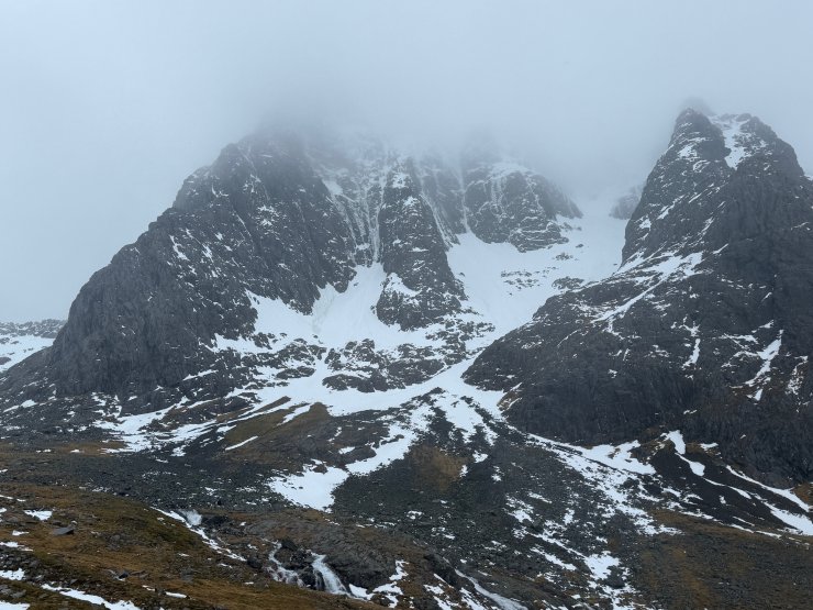
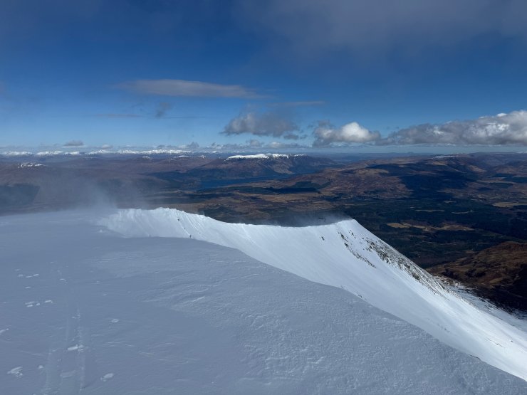
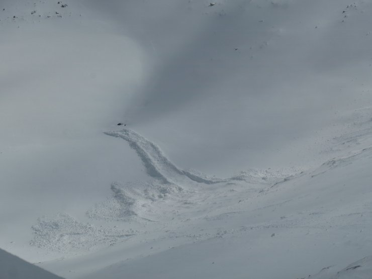
Keep up to date by subscribing to our RSS feed
This report is supported by