Avalanche Report for Torridon
Issued
Avalanche Hazard Forecast
FOR PERIOD 18:00 Tue 07/04/2026 TO 18:00 Wed 08/04/2026

Forecast Snow Stability & Avalanche Hazard
Reports for Torridon have now finished for the winter
Forecast Weather Influences

Observed Avalanche Hazard -
Observed Weather Influences
Observed Snow Stability and Avalanche Hazard
Reports for Torridon have now finished for the winter
Mountain Conditions
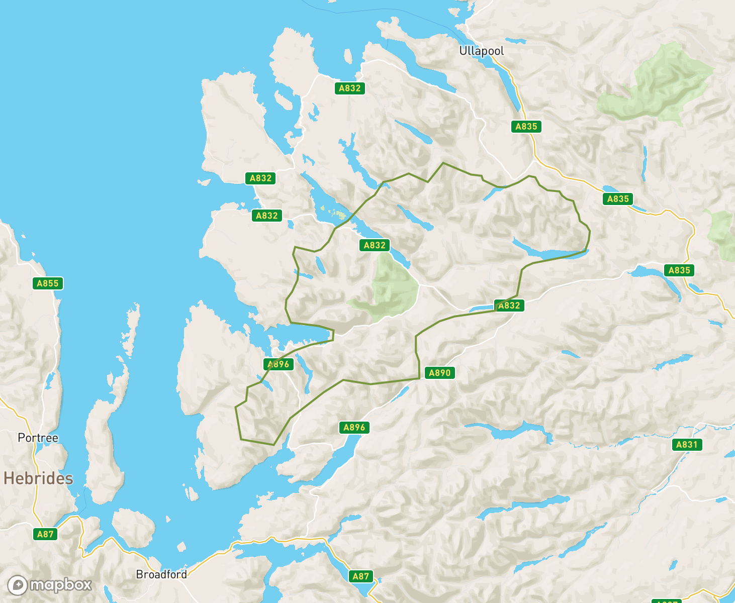
The Torridon avalanche forecast Area
When producing daily avalanche forecasts for the Torridon region the whole area and summits as indicated on the map are considered by SAIS forecasters when writing their daily reports.
In the Torridon region the “core” forecast area primarily visited are the mountains and corries that surround Beinn Eighe and Liathach, then from Slioch in the North to Bhein Liath Mhor nr Loch Carron. Knowledge from the core area is applied to the more outlying mountains such as the Fannichs and the Applecross range, where field observations are carried out in turn as the winter progresses, or specific snowpack assessments are required.
-
Spring-like then winter returns
It was a settled start to the period with only patchy thawing snow mainly on high North to East aspects around corrie rims, along ridge flanks and in gullies. From Tuesday onwards there was further snow turning the mountains white to fairly low levels and creating isolated and shallow areas of windslab mainly on North through East to South-East aspects above 700 metres.
A brief return to Winter, then spring-like.The week began with some fresh snow and fluctuating temperatures on a strong South-Westerly airflow over the weekend. This led to a modest build up of new snow and windslab on North to Easterly aspects above 800 metres. Then there was a period of heavy rain and warm temperatures on Monday which continued to Tuesday morning, eradicating the fresh snow and depleting the older existing snowpack. The week has ended with fine dry weather, and a sparse, consolidated snowpack, feeling very spring-like.
Melt/freeze cyclesThere have been several melt/freeze cycles in the last week and snowpack stability has been good. Fresh snow accumulations have been small and consolidated or melted quickly. The snowpack is currently patchy with best cover on North-West through North to East aspects above 750 metres.
Thaw conditionsThaw conditions have become established through the period. Snow cover has gradually reduced and snowpack stability has been good for most of the period. The snow cover is now patchy but some significant areas remain in some corries and gullies above 750 metres and these areas are likely to become firm as colder weather develops through Friday and Saturday.
Changing conditionsThe period began with a fairly sparse snowpack, which was regularly topped up with light snow showers on East to South East winds. Cold temps with freezing level just above glen level. Sunday into Monday brought more persistent snow on strong North West winds giving a considerable forecast on North East to South East slopes above 800 metres. On Tuesday and Wednesday this snow was re-distributed by strong South East winds onto West to North aspects, giving a Moderate forecast on most aspects.
Mostly firm and icyThere has been little change through the period. The snowpack has been mostly firm and icy. There has been some softening on the milder days and some isolated and shallow windslab deposits at times. Snowpack currently very firm in cooler conditions.
Snowpack remains firm and icyThere has been little change over the past week with a South-Easterly airstream maintaining dry conditions over the Torridon area. The only fresh snow was a small amount of snow on the more inland mountains in the area on Tuesday and Wednesday which has now consolidated. The remaining snowpack is firm and icy with good snow cover on most aspects above 700 metes, and some patches below.
Snowpack Firm and IcyA period of fluctuating freezing levels and cold temperatures of the last days have helped consolidate the old snowpack which is firm and solid. Greatest accumulations lie on West through North to North-Easterly aspects. little change. is expected in this area which will remain generally dry but with a continuing SE airstream.
Consolidating trendLimited precipitation during the period due to the South-Easterly airflow. Initially the avalanche hazard was Moderate with Cornice and windslab problems. Saturday had light rain/drizzle and warmer temps which allowed for improving stability when the cold air arrived on Sunday. Mondays hazard level was Low with warmer temperatures. Continued fluctuation of temperatures followed by a slow thaw at all levels on Wednesday night kept the hazard at Low.
ChangeableThe period started with a widespread cover of deep consolidating snow at all elevations. Fresh windslab developed on Saturday with one skier triggered avalanche recorded. A rapid warming on Sunday resulted in multiple natural avalanches. The older snowpack then consolidated with a crust forming in many places. Localised areas of fresh windslab then developing through the rest of the period at higher elevations with a continuing thaw low down.
Significant snowOver the last week there has been significant snowfall most days. This has generally been on strong northerly winds but with a day of strong South-westerly winds as well. Windslab lies in most aspects and the avalanche hazard has been considerable for most of the period. The existing snowpack has now started to consolidate and this is expected to slowly continue over the next few days.
Winter RebootNew Years day brought the first dusting of snow in the Torridon area. An Arctic airmass and a Northerly weather system will gradually build accumulations of new snow. Only in very localised wind sheltered places at first, unstable windslab will gradually build and become more widespread over the coming days,
Diminishing snowThe week started with snow cover above 750m with greatest accumulations on NE to SE aspects though this lay mainly on bare ground. Within a couple of days much of this melted leaving the remaining patchy snowpack mainly on North to East aspects above 900m. This diminished further until the end of the period when it lay mainly around coire rims, on steep upper slopes and at the tops of some gullies. The greatest extent lay in the Northern Fannaichs.
Generally MildThe week started like before mild becoming very mild with periods of rain and showers. Colder influences brought a couple of days of snow to higher elevations but again a mild day with southerly winds and rain thawed this light covering away to mostly bare mountain. Ending cooler again with a dusting on the summits and into the next period more snow to come.
Mild startA recent mild spell means we have no significant snow cover in the Torridon area. Only a few isolated, small, avoidable snow patches remain with most of the area being snow free. No hazard reports will be issued until the situation changes. .
End of SeasonThis is the last snowpack summary of season 2024/25. In general, it has been a milder and drier winter than average. Most snow arrived in the first half of the season and by the end of January, the avalanche hazard has remained Low, or indeed, No Hazard. Currently, there are very few small snow patches remaining and the mountains of the Torridon forecast area are mostly bare ground.
Minimal snowThere has been very little snow throughout the forecast period and therefore no avalanche hazard report has been issued. The few small remaining patches have continued to thaw with many hills in the Toridon area snow free. Snow showers are forecast for tomorrow (Friday 28th) with a thin covering of fresh snow on otherwise bare ground above around 700 metres.
Very little snowThe period started with a thin covering of recent snow mainly above 700m. Saturday and Sunday's milder conditions soon proved its generally superficial nature. Since then high pressure has dominated, with cold nights and bright sunny days. Snow exposed to sunshine softened and melted. Most of the remaining snow is on permanently shaded slopes, mainly NW to NE aspects, and this has remained hard or firm.
Thin snow coverDuring the first part of the week very little snow remained in the Torridon area. Fresh snowfall on Tuesday and Wednesday have now given us a thin snow cover on all aspects, largely above 700 metres. Snow amounts are not significant and will gradually thaw over the next few days particularly where exposed to the sun.
Thaw conditions.The period began with a little fresh snow which gave a welcome whiter appearance to the hills above 800 metres. This was mainly wet snow that was well bonded, and the hazard remained Low. As the week progressed milder conditions took over and this “fresher snow” thawed, leaving just the older snow remnants. Then very wet mild conditions set in which further depleted these old snow patches, leaving only patches of snow on mainly inland mountains around coire rims above 850 metres.
More Wintery looking mountainsThe period started with mild conditions over the weekend. The snowpack was patchy and depleted. Largest areas of old snow were on steep North to East aspects above 800 metres. Freezing level dropped through the week, and some fresh snow was deposited above 750 metres, but not the amounts we had hoped for. The hills did look more cosmetically white, but deposits were shallow and did not increase the avalanche hazard.
Mild conditions inboundThe past week has been dominated by a stable weather system, predominately cold, dry with Easterly winds. The patchy snowcover being firm in nature, confined to certain locations. All change later during the week as a much milder airstream became established. Heavy rain further depleted the existing snow patches which have become soft.
Cold and PatchyThe week has been mainly dry and dominated by a cold Easterly airflow. The depleted patchy snowpack became firm and generally stable in sub-zero conditions. With cold conditions for the remainder of the period, the patchy snowpack has subsequently remained unchanged.
New Snow - Briefly!It was generally a mild week with thaw conditions which consolidated and depleted the snowpack. A brief return to colder and windy conditions midweek with a dusting of fresh snow to low levels. This quickly thawed as a settled high pressure system brought sunny but milder conditions. Currently, a patchy snow cover with limited snow below 700 metres.
Good snow coverSince Storm Eowyn, new snow showers have continued to top up snow amounts, add depth and present good cover to the landscape. Fluctuating temperatures have also aided consolidation and snowpack stability throughout the area.
No snow, and then EowynIt was a week of no snow, and hazard forecasts were not issued from Thursday 16th Jan through until Wednesday 22nd Jan. The mountains were mainly bare with very small isolated snow patches remaining. There was some slight snow on Wednesday giving a Low forecast, that was very low in reality. Then Thursday had a moderate forecast as some snow came in late on Thursday afternoon. Storm Eowyn was waiting in the wings for Friday...
Where did it all go.The period began with cold temperatures and relatively deep accumulations of unstable windslab on East to South aspects above 700 metres. The hazard was Considerable. During the weekend the temperatures rose, and precipitation, as rain, created some instabilities. From then on, in the very mild conditions there was rapid snow loss and consolidation, up to today, when there is now little or no snow left, and no avalanche hazard is forecast.
More snowThe period has had regular snowfall to low levels accompanied by strong mainly North-Westerly winds. Windslab is now present in many locations with greatest accumulations on East to South aspects above 700m. some redistribution expected tomorrow. Unconsolidated snow at all levels with travel by foot hard going.
Increasingly winteryThe period started with very little lying snow. Some fresh snow on Monday and Tuesday made the hills look white but was mainly superficial. Heavier snowfall on Wednesday night fell to sea level and gained depth at altitude. This snow is mostly soft and unconsolidated with some unstable windslab mainly close to the higher ridges.
Almost Snowless!During a spell of cold and stormy weather at the beginning of this period, new snowfall led to areas of unstable windslab accumulating in high wind sheltered aspects. However, it was short lived as it quickly turned very mild, wet and windy on Monday. The snowpack has continued to thaw at all levels, reducing the cover to small patches, strips and slivers remaining around the higher summits.
Mild, Wet and WindyUnseasonably mild conditions prevailed throughout the week accompanied by strong winds and rain at all levels. The thawing snowpack was much depleted by midweek with only slivers and very small patches remaining at higher elevations. Currently, there is a return to colder conditions with a shallow covering of new snow on most aspects above 500 metres.
High Pressure Temperature InversionThe snow and snow showers of storm Darragh last weekend deposited accumulations of unstable windslab mainly on steep SE through S to W aspects largely at higher elevations. However, the general snowpack remained shallow and mostly above 700m. A settled high pressure system has dominated the weather since, stabilising the snowpack with a strong temperature inversion.
Winter Arrives with a Bang!Last Friday the sea level temps were +15C! This week, an Arctic Maritime (NW) airflow brought a significant amount of snow to all levels with continuous snow showers, sometimes heavy and intense - an extraordinary amount of snow for this time of year. Throughout the week, unstable windslab has accumulated in steep wind sheltered East to South aspects, largely above 650m. Deep unconsolidated snow persists at lower elevations.
Patchy snow coverThe existing snowpack, limited in nature, is well consolidated and stable in all locations. Greatest amounts can be found above 800 metres on North to East aspects on the Inland hills with coastal hills nearly snow free.
Well consolidated snowpackThe existing snowpack, limited in nature, is well consolidated and stable in all locations. Greatest amounts can be found above 800 metres on North through East to South East aspects.
Shallow snowpackSnow during the week has quickly consolidated leaving a firm, shallow, stable snow pack. Greatest accumulations remain in gullies, around coire rims and on ridge flanks mostly on East to South aspects above 800 metres.
Thawing and stableThe snowpack has been stable for most of the week with a gradual reduction in snow cover. Snow cover is very patchy with largest areas remaining on North to East aspects above 850 metres, predominately on the more inland mountains in the forecast area. A return to colder more wintery conditions is forecast over the weekend.
Stable snowpackLittle change in the existing snowpack. Greatest accumulations can be found on North-West, North and East aspects above 800 metres, mainly in high coires and around coire rims. Stability is good throughout. Winds change to a Northerly flow from the 14th bringing fresh snow.
Dry with little changeIt has been predominantly dry throughout the last week with South-Easterly winds and the freezing level fluctuating around the summits. The fresh snow that fell at the end of last week has now mostly thawed and the old snow remnants have become firm and stable in all areas.
ChangeableWinter returned at the beginning of this period, with good but shallow snow cover above 500m. Localised instabilities existed in accumulations of windslab, N to E aspects above 800m. All change after a fine weather weekend, with thaw conditions returning on Tuesday. Currently, colder again, fresh snow lying above 700m and isolated pockets of windslab on high N to E aspects.
Mainly thawingThe period has been mostly very mild with significant loss of snow cover and good stability. By Wednesday only patchy cover remained mainly on high North to East aspects. From Wednesday afternoon onwards there was a significant change with cooler conditions and a shallow cover of snow down to 400 metres. Isolated instabilities are present mainly where this overlies the old snow.
ChangeableThe period started with a patchy frozen old snowpack and isolated unstable windslab accumulations on Westerly aspects mostly lying on bare ground. From Sunday to Tuesday there was significant snowfall and South-West winds depositing unstable windslab on mainly North to East aspects. This consolidated on Wednesday, and Thursday was warm and wet with isolated wet snow instabilities in deeper accumulations particularly where the newer snow overlies the older snowpack.
Windy Mild Start followed by colder conditions and snowA relatively mild start to the week with gale force south westerly winds. Fresh snow arrived from Monday onwards as the temperature lowered and the winds veered to a more northerly direction. The week ended with very cold temperatures (-10 degrees C in the glens) and a cosmetic covering of snow at all elevations.
Windy and mildSome fresh snow near the beginning and end of the period consolidated quickly on both occasions. Very windy every day except Monday with a record high valley temperature of 19.6 degrees Celsius on Sunday. Best snow cover currently on North through East to South-East aspects above 700 metres.
Thaw and stabilisation.The week started cold with significant new snow above 400 metres. Milder air and rain soon Torridon with avalanche activity on primarily East aspects above 800 metres. Multiple freeze thaw cycles followed with greatest accumulations remaining on North-East to South-East aspects. The latter half of the week saw continued rapid consolidation and depletion of the snowpack with temperatures in the glen reaching 11c. A moist stable snowpack.
Unstable SnowpackAfter a dry, cold and frosty start to the period, all change this week as an Arctic airflow became established. This fed in very cold air with frequent snow showers and longer periods of snowfall at all levels. Combined with fresh to strong West to North winds, areas of unstable windslab rapidly developed on lee slopes, becoming deeper and more extensive through the week, with a Considerable avalanche hazard.
Stable snowpackHigh pressure has brought calm weather for the period with only occasional light snow showers. The snowpack has remained stable in most locations with only isolated pockets of shallow windslab which are now consolidating. There is currently firm snow cover above around 750 metres on most aspects which is stable in all locations.
Diminished snow coverThe last period since the end of 2023 has seen freezing levels around summit levels and a slowly stabilising snowpack which has reduced any instabilities that were present. Expected colder conditions will present a very firm and generally stable snowpack.
The Snow ReturnsIt has been an unsettled week with periods of snow interspersed with widespread thaws and strong winds, culminating with storm Gerrit on Wednesday 27th. Snowpack instabilities briefly developed last weekend and more significant and considerable unstable windslab during midweek largely at height, on steep SW through NW to NE aspects. Weak cornices developed above same aspects.
Very limited snow coverThere has been limited snow with some big thaws and there are currently only a few very small patches of snow remaining. However there is significant snow forecast over the next 2 days, this fresh snow will generally overlie bare ground.
Very Limited Snow CoverMild. Very limited snow cover. No avalanche hazard. Small patches and slivers of old wet snow persist around the highest summits, particularly on the more inland mountains.
Winter returnsThe period started with a very patchy stable snowpack. From Monday onwards the temperature started to drop and snow to fall. This was heaviest on Tuesday night and Wednesday, and was accompanied with gale force winds giving significant accumulations of unstable windslab mainly on West through North to North-East aspects. This windslab is starting to consolidate but persists as a hazard, mainly above 900 metres.
Diminishing snowpackThere was no significant snowfall during the period. The week started with cool conditions and a frozen snowpack surface. Then the freezing level rose above all summits and remained so. Patchy snowpack.
A light dustingThere remains a fairly limited snowpack with only a light dusting of recent snow over the higher summits and some older stable accumulations in high North and East corries
Variable conditionsThe period started with cold clear conditions and a layer of soft, unconsolidated snow above around 600 metres. Thawing conditions on Sunday were followed by three days of snow showers and variable winds depositing localised areas of unstable windslab on all aspects. The period ends with thawing conditions on Thursday and some isolated wet snow instabilities on steep slopes.
Snow ShowersAs the high pressure system of last period moved NW, it allowed a very cold and showery northerly Arctic Maritime airstream to develop over the area with unconsolidated fresh snow lying at all levels. However, localised areas of windslab accumulated on steep SE to SW aspects at higher elevations. Currently, a fresh Easterly wind is redistributing snow forming unstable windslab on high wind sheltered Westerly aspects.
Still no changeHigh pressure sitting firmly over the whole of the UK has brought a week of light winds, very little precipitation and relatively mild conditions. Only patchy snow remains, predominately holding out on steep North through East to South East aspects above 800 meters. The snow remains firm and stable throughout. Consequently, there was a low hazard forecast all week.
Little ChangeThere is no significant change in the snow cover this period; it remains as well bonded patchy old snow, largely above 800 metres on North through East to South-East aspects. Short lived deposits of new snow quickly thawed in following mild conditions usually accompanied by rain at all levels. Consequently, there was a Low hazard level throughout the week.
ThawingThe period started with unstable windslab on North through East to South-East aspects above 600 metres. This soon consolidated in mild conditions giving a stable, wet, thawing snowpack for most of the period. A dusting of fresh snow on Wednesday and Thursday gave isolated and very shallow windslab deposits on North to East aspects above 900 metres.
Patchy Old SnowDue to generally mild, wet and windy weather, this period was characterised by a patchy snowpack, generally well consolidated and stable throughout and remaining firm particularly around higher summits. Latterly however, localised areas of unstable windslab have developed mostly affecting steeper terrain at higher elevations. Currently, mild weather has returned, with a thaw expected at all levels.
Limited New SnowA changeable week with fluctuating summit temperatures, short periods of new snowfall and a generally stable snowpack. Isolated areas of windslab accumulated in wind sheltered locations at higher elevations at times, particularly beginning of this week. However, a heavy thaw has left the snow cover patchy with most hillsides bare.
All changeThe period started with cold conditions and unstable windslab on many aspects, particularly North through East to South. There was poor stability for a time on Saturday as the freezing level rose above the summits with some rain. The mild and wet conditions lasted till Tuesday and the snowpack gradually consolidated. Since then it has been colder but mainly dry with a freezing level around 800 metres and a stable snowpack.
Wintry againWinter returned this week with frequent snow showers and strong variable winds giving a poorly bonded unstable windslab mainly on North-East through East to Southerly aspects above 750 metres. There is good snow cover to the road side, with hard trail breaking for walkers. In addition to the windslab we have crusts, graupel and an interesting temperature variation within snow pack. Cornices have developed. Windward aspects have better stability. Several avalanches have been recorded.
Feels wintryThe snow pack has depleted. Now we have a generally well consolidated and stable older snowpack. Again, over this period fluctuating temperatures and varying amounts of fresh snow has led to a Moderate hazard level for most days with windslab accumulations on various very steep wind sheltered aspects, largely at higher elevations. Currently, winds have been multi-directional so shallow deposits of moderately bonded new windslab are on most aspects above 850m
More of the SameChangeable weather and snowpack conditions. Fluctuating temperatures and varying amounts of fresh snow led to Moderate hazard level for most of this period as windslab accumulated on various aspects, largely at higher elevations. A recent thaw and after a brief period of heightened instabilities, has led to a general consolidation with good stability throughout.
White ChristmasThis period saw changeable weather and snowpack conditions with several freeze thaw cycles, particularly affecting lower levels. Limited areas of unstable windslab built in steep localised terrain features at higher levels. Periods of new snow and fresh to strong winds have left the current snowpack generally shallow and stable, but with localised areas of windslab on N to SE aspects above 800m.
Snow then consolidationWinds through the period were mainly from the Southern half of the compass. Snow showers gave periods with unstable windslab and some warmer temperatures gave wet snow instabilities. The fresh snow has now consolidated and stability is currently good in all locations.
Deep Snow CoverThe previous week of frequent and sometimes intense snow showers on a very cold Northerly airflow and light to moderate winds has left a landscape of deep, generally unconsolidated snow cover on all aspects and altitudes. However, areas of moderately bonded windslab have developed in steep sheltered terrain, most notably on NW through NE to SE aspects at higher elevations.
New windslab then thawingThe week started off with new windslab being deposited mainly on East through South to South-West aspects above 750m. Since the weekend the freezing level has been above the summits; the snowpack has continued to slowly thaw at all levels and is generally stable.
Generally stable snowpack with a little new snowStarting with a generally stable old and depleted snowpack there were several melt-freeze cycles through the week. Early in the period a little windslab was deposited in wind-sheltered areas. Then rain at all levels mid-week before a little new windslab was deposited at its end.
Refreeze and New SnowHigh pressure conditions dominated this period. Initially, the limited and generally stable snowpack continued to slowly thaw and diminish. Thereafter, colder conditions encouraged a refreeze at higher elevations. The passing of a cold front late Tuesday introduced a very cold Arctic Maritime airflow accompanied by light snow showers. However, new snow amounts are not significant.
Settled weather.We have enjoyed a period of very settled weather with warmer temperatures. There is snow cover down to around 600 metres, although becoming increasingly patchy. Earlier in the period the snow surface was hard, well bonded and stable and only softened where it was exposed to direct sunshine, however for the past days the freezing level has been generally above the summits so now the patchy spring snow pack while stable is thawing, softer and depleting.
Mild and WindyThe past 7 days has been characterised by mild temperatures and strong winds. The snowpack has generally remained consolidated and stable during this period, thawing on lowers slopes. Some isolated precipitation, falling as snow on the highest summits has been minimal and the new accumulations have not gained any significant depth or become widespread. Greatest snow cover is on North through East to South-East aspects above 700 metres.
Thawing SnowpackThe snowpack has generally remained consolidated and stable during this period. The snow surface has generally been firm during stable high pressure conditions, with any softening due to solar radiation. Milder conditions now prevail and the snowpack is moist and thawing at all elevations, firming up at higher elevations as the freezing level periodically drops. Greatest snow cover is on North through East to South-East aspects above 700 metres. Other aspects are scoured and bare.
ConsolidationOverall, the snowpack has diminished during this period and has undergone considerable consolidation, leading to good stability throughout and is generally firm, particularly at higher elevations. Very little new snow has fallen during the last week. Most snow exists on North through East to South-East aspects above 700 metres, whilst snow on previously wind scoured Westerly aspects is patchy at best.
Feels wintryWe have had more wintry conditions with better snow cover. At the start of this period we had a moist snow pack with a breakable frozen crust and localised wind slab instabilities developing on N through E to SE aspects. There has been little change although we have had variable freezing levels, so melt/freeze conditions which have now given us a firmer snow pack. Windwards areas are scoured and there is a widespread hard frozen crust. Wind slab instabilities and fragile cornices are present.
Wintry againMuch improved snow cover during this period with wind slab instabilities at higher altitudes. Of late its been colder with more precipitation and gale force winds. Good cover above 500 meters with deep snow and trail breaking. Some cornices are overhanging again and we have deep snow and wind slab instabilities on wind sheltered terrain with graupel and localised weaker layers within the deeper snow pack.
A Windy WeekThe past 7 days has been characterised by strong, often gale and severe gale force winds generally from a Westerly direction in the Torridon forecast area. Welcome periods of snow have also arrived but not in any great amounts. Due to the strong winds this new snow has been re-distributed onto the leeward slopes or blown off the mountain altogether. The mountain landscape looks generally windscoured, with only localised areas of windslab above 700m on North through East to South aspects.
Mostly Bare HillsDespite a dusting of fresh summit snow at times during this period, it was fleeting, as mild and wet conditions prevailed. Currently, there are minor patches and slivers of thawing old snow lingering around some higher summits. Winter conditions are forecast to return this evening and over the weekend.
Close to 'No Snow' again...The last week has seen the few remaining patches of old snow diminish. Even in the deep gullies on high North to East aspects where remaining accumulations would normally be greatest there is next to nothing.
Limited New SnowThe snow stability remained good and the avalanche hazard was Low throughout the period. The thaw continued from last period into the weekend when colder air and light wintry showers saw a dusting of new snow to low levels at times. The patchy and depleted older snow is well consolidated and stable throughout.
Thawing AgainA cold and wintry start to this period led to a general shallow covering of snow with some isolated pockets of unstable windslab developing in steep locations, North to East aspects at higher elevations. However, unseasonably mild conditions arrived by the beginning of the week which have persisted, leaving the snowpack patchy, thawing at all levels, with good stability throughout.
Wintry againThe period begun with little snow but after a couple of days snow began to fall to all levels. This began building new snow and some wind slab instabilities on to NE to W aspects above 600 m. Since then winter has kept its grip with moderate amounts of snow with lots of graupel grains persisting in the snow pack. Now we have strong to gale strength WSW winds with heavy snow showers building wind slab instabilities on to NW through N to NE aspects.
Close to "No Snow"Over Christmas relatively cold temperatures and snow showers at higher elevations gave a light covering of snow above 700 metres. Cold conditions followed with temperatures often cooler in the valleys that on the mountains. A gentle thaw ensued. A glorious day on 28th, clear skies and frozen ground. The largely cosmetic cover on sun exposed aspects thawed rapidly. 29th and 30th have seen rain at all levels with temperatures into double figures leaving us with next to "no snow"
Limited Snow CoverImmediately following the rapid heavy thaw at the end of the last period, high pressure and strong temperature inversion conditions prevailed through this week. This maintained the current very patchy and limited snow cover throughout. Little snow remains below 700 metres. More unsettled weather over the last two days has produced a dusting of new snow at higher elevations.
Milder temperaturesWe began with unstable windslab deposits building on to North through East to South-West aspects. After a day or two milder temperatures arrived and the freezing level hovered around summit levels and above causing a period of instability in the thaw and heavy rain showers. Now we are left with a rapidly depleting and patchy but generally stable snow pack which mainly remains above 800 meters on North through East to Southerly aspects.
Freeze-Thaw CyclesA mild spell post storm Arwen ((26 Nov) stabilised and diminished the snowpack. Thereafter, periods of snowfall, followed by milder interludes maintained good snow cover with generally good stability, although shallow in most locations. Last weekend saw a noticeable rise in snowpack instability following an unexpected heavy and prolonged fall of snow. Small avalanches were noted on Beinn Eighe. Currently, the snowpack remains shallow, with good stability.
Early Season WinterA little snow has fallen on the mountains periodically over the last few days. Currently, there is a general shallow cover on all aspects above 300 metres, with some very localised shallow pockets of windslab in steep wind sheltered locations above 700 metres, mainly East through South to South-West aspects.
High PressureThe period began with an artic airflow, unseasonal cold temperatures and heavy snow showers down to all levels, the hazard was Moderate. For several days now the winds have turned with morning frosts in the glen leading to dryer, warmer weather and bright sunshine during the day. This has lead to a steady transformation of the diminishing snow pack with generally good stability. There are some remaining lingering localised instabilities on high and very steep NE to SE aspects. The hazard is Low.
Winter ReturnsThis period was dominated by an unseasonably cold and strong Arctic Maritime airflow, feeding in frequent, sometimes heavy, snow showers on a NW to N wind. Localised areas of unstable windslab developed on steep sheltered terrain, predominantly NE to SE aspects at higher elevations, producing a Moderate avalanche hazard for most of the period. A brief mild spell today before the cold, showery NW airflow becomes re-established.
Snow on the topsWe begun with moderate avalanche risk with the best snow cover above 800 metres. A rise in freezing levels and heavy rain led to a period of depletion with only patchy snow remaining on North to South-East aspects above 800 metres. The last days have seen a lowering of temperatures with ground frost and a dusting of fresh snow on the tops with a firmer snow pack and only shallow avoidable pockets of windslab forming on steep South through West to North-East aspects above 850m.
Stable snowpackThe snowpack was generally stable throughout the period. Initially there were some wet snow instabilities on the steepest slopes but stability then improved during some melt freeze cycles. In the last two days there has been a dusting of fresh snow but accumulations have not been great enough to create a significant avalanche hazard. The snowpack is currently patchy and mostly above 650 metres.
Thawing SnowpackStrong South-Westerly winds and fresh snowfall in the first half of the period produced localised accumulations of unstable windslab, generally at higher elevations on steep North to South-East aspects. Later, as high pressure dominated and after a period of wet snow instability, the snowpack consolidated in the milder conditions. Currently, the snowpack is generally patchy, well bonded, stable, and thawing at all elevations.
Colder weather returning.The period started with several days of South-Westerly winds, dry conditions with warmer weather and a depleting snowpack. For the past few days it has been changeable with frontal systems bringing rain and snow, with freezing around summit levels, and further snow loss. Currently it has turned colder with fresh snow showers down to 600 metres. The existing snowpack is generally firm, stable and well bonded with fresh windslab accumulating on North to East aspects above 700 metres.
Spring SnowpackThe thaw of last period continued into this week with continued snow loss, particularly at lower levels, and much bare ground. High pressure has dominated latterly with freezing levels lowering and firming up the snow in all locations. Currently, little to no snow exists below 500m., is patchy above with most snow remaining above 800m. on NW to NE aspects. The snowpack has been generally well bonded and stable throughout.
Mild temperaturesThe mild Southerly airflow has stayed with us for much of the period fluctuating between South-Easterly to the current South-Westerlies. Mainly the winds have been strong to gale force. Heavy rain showers with just occasional hill snow when the freezing level has intermittently dropped to below summit levels. Much of the snow has been stripped off, although reasonable cover remains in the higher cories. In general cornices have slumped and are generally stable. Some glide cracks are present.
Thaw and ConsolidationThis period was dominated by a strong to gale force, generally Southerly airflow and milder unsettled conditions starting last weekend with periods of rain, sleet and summit snow thereafter. Fluctuating freezing levels led to a diminished snowpack and a general consolidation. However, instabilities remained in areas of existing windslab and developed in new windslab, mainly on steep West to North-East aspects at higher elevations.
Cold Easterlies ContinueThe strong cold Easterly airflow persisted, accompanied by varying amounts of snowfall and snow redistribution. The winds reached gale force during the first part of the period with unstable windslab rapidly developing, which became more widespread by the middle of the week. Subsequent dry and sunny weather, but with very cold temperatures, has maintained weaknesses in the snowpack, predominantly South-West to North-West aspects above 700 metres. Windward areas remained stable.
Easterly windsThis period we have had very low temperatures which have preserved some weaknesses within the snow pack. For several days now we have had strong to gale force Easterly winds with significant snow redistribution with windslab accumulating in SW to NW aspects above 650 metres. Currently heavy snow showers with the continuing East winds will give us widespread poorly bonded windslab. Cornices have developed and are fragile with underlaying weaknesses persisting on South and North aspects.
Widespread WindslabChanging wind directions from generally West initially to East latterly, combined with heavy snowfall at times led to accumulations of unstable windslab forming on many aspects predominantly at higher elevations. A considerable hazard during the first half of the period saw a number of cornice triggered small slab avalanches recorded. A short period of better stability followed, then snow redistribution on strong winds led to further windslab instabilities.
North-West AirstreamGenerally, we had South-Westerly winds at the start of the period with pockets of localised windslab instabilities remaining and some underlying weaknesses in the snowpack. We then had a slight thaw at lower levels which stabilised the older snowpack, however some isolated instabilities remained above the 850m level. Then Storm Christoph developed with a North-Westerly airstream, heavy hill snow, strong to gale winds, much cooler temperatures and currently, unstable windslab.
Freeze-Thaw CycleThe very cold and predominantly settled spell of last period ended with a significant thaw and heavy rain at all levels. Wet snow instabilities were short lived as freezing levels plummeted to low levels, generally consolidating the snowpack throughout. Subsequent snowfalls and fluctuating freezing levels have both seen depleted snow cover at lower elevations and windslab accumulations in various steep aspects at higher elevations.
Deep Snow CoverThere has been relatively little change in the snowpack during this period, as high pressure maintained a predominantly cold, moderate to fresh Northerly airflow combined with light snow showers. The low temperatures maintained localised instabilities in steep areas of existing windslab, mainly at higher elevations, East to South aspects. Deep snow cover generally, but with some excellent crispy, sunny winter days.
Increasing Festive CoverThe week has seen a significant increase of snow throughout the area. Cold over Christmas and accumulations gradually increased. Boxing Day was wet and windy at all levels causing some snow loss with a general stabilisation of the snowpack. It turned colder with a Northerly airstream bringing significant amounts of snow to valley level. Greatest accumulations are on East to South aspects. Hogmanay saw a brief rise in the freezing level but instabilities remain above 700m on these aspects.
Improving Snow CoverAfter early snow was reduced to bare mountains at the start of this period, snow returned on Sunday, albeit in small amounts. As the snowpack gained depth through the week, windslab with developing weaknesses accumulated in very localised steep sheltered lee areas around summit levels. Currently, snow level is around 300 metres due to a short cold spell.
18.12.2020The SAIS season started on 11th December. In our first blog that day we wrote that there was very little snow. There is less now. Only tiny patches remain. The weather during the week has been predominantly wet and windy with the freezing level above the summits most of the time. It does not look like winter here in Torridon.
Summary Due December 17thGood Snow CoverThis period was dominated by wintry showers and strong winds. Accumulations of moderately bonded windslab formed throughout the period mainly at higher elevations, particularly on steep North to East aspects, whilst the snow cover diminished at lower levels with the snowline currently around 500 metres. Largely due to settled weather, the snowpack is consolidating with generally good stability.
Wintry againAt first there were weaknesses within the snow pack. A rise in the freezing level put pay to this, then we had a period of wet snow instabilities with some avalanche activity, some triggered by fragile cornices. Since then we have had cooler temperatures with the snow pack becoming generally more frozen improving stability. Lately the winds have been variable with snow redistribution, cross loading and snow showers. Currently we have a Northerly airstream with moderate bonded windslab.
Warm then coldThere was a significant thaw Friday/Saturday resulting in some avalanche activity. Then a return to colder conditions with snow showers and wind transportation resulting in fresh instabilities which still remain above 750m. Elsewhere the snowpack is consolidating. Exposed snow slopes at higher elevations are frozen
Cold with Wintry ShowersFollowing a short sharp thaw last Friday and a general consolidation thereafter, wintry showers persisted throughout the period, with fresh snow to low levels at times due to low freezing levels. Unstable windslab accumulated on Easterly aspects in the strong, generally Westerly airflow. Snow showers and an East wind on Monday encouraged unstable windslab to accumulate onto West aspects also. Windward aspects are scoured and icy in places.
Multiple Freeze-Thaw CyclesLast weekend, Storm Dennis brought very windy and mild conditions with rain and a heavy thaw at all levels. Thereafter, there has generally been a cold, strong South to West airflow bringing frequent wintry showers, interspersed with short mild spells. Unstable windslab accumulated in steep sheltered areas interspersed with periods of consolidation. Currently, there is good snow cover above 500 metres.
Wintry againThe period started with limited snow cover. Windslab has gradually developed throughout the week during successive storm cycles, mainly on North, through East to South aspects above 650 metres.
Limited Snow CoverMore of the same this period; relatively strong South-West winds, limited fresh snowfall with localised pockets of windslab developing at higher elevations, followed by freeze thaw cycles leading to rapid consolidation of the snowpack. The hazard level was generally Low throughout. Most snow remains above 800 metres on steep North to East aspects. Generally bare ground below 650 metres.
A Colder PeriodThe limited, patchy but stable snowpack continued from last period into the weekend, after which colder conditions prevailed with periods of snow, occasionally down to low levels. A strong South to West airflow persisted throughout the period and areas of unstable windslab accumulated in steep high locations, mainly on North to East aspects. Latterly, mild and wet conditions have returned.
Diminishing SnowpackThe snowpack has been limited throughout the period due to mild weather dominating. At the start of the period localised windslab formed on North to South-East aspects above 850 metres. Since then the diminishing snowpack has consolidated and thawed. There is currently limited snow cover with most snow existing in gullies, core rims and ridge flanks on North to South-East aspects above 850 metres.
Storm Brendan SnowVery strong winds and short periods of snowfall followed by thaw has characterised this period. Storm Brendan had a big influence mid period with snow down to low levels, significant areas of moderately bonded windslab at higher elevations combined with storm force South-West winds scouring wind exposed areas. Currently, there is a much depleted snow cover due to a heavy thaw.
Wintry againThe hills were almost bare of snow at the start of this period but winter has returned with snow cover from around 450m up to the summits. A series of Low pressure systems has affectively being dominating our weather. The bulk of our snow is above 700m and much of this has fallen onto bare ground although there were some patches and ribbons of older snow pack along wind sheltered crests and around some coire rims. Currently we have a Low hazard with shallow instabilities on NE to S aspects.
Virtually a Snow Free LandscapeThe prolonged mild conditions continued through this period. Currently, there is very little old snow remaining in the Torridon forecast area. Unsettled weather with strong, generally Southerly winds, periods of heavy rain and very high freezing levels contributed to the continuing snow loss.
The Thaw ContinuesThe snowpack remained generally well consolidated and Low hazard throughout the period. With the freezing level hovering around the summits, the snow cover remains limited and relatively patchy above 650 metres with a thin covering of newer snow above 850 metres. A slow thaw continues at lower elevations but quite firm at summit levels,
Mild againWe begun with good snow cover down to around 350 metres which was generally well bonded and stable. Then we had more snow on ESE then NW winds which built wind slab onto scarp slopes on high coire rims and gully tops. These areas of wind slab were quite small but they were laying on weaker layers, we also had an interesting temperature gradient within the snowpack which pushed us into a Moderate risk. Last night we had a high freezing level so the snow pack has depleted and the Hazard is now Low
The Snow ReturnsCurrently, cold conditions, strong winds and frequent wintry showers are producing small areas of moderately well bonded windslab in steep wind sheltered locations, particularly at higher elevations. Otherwise, the general snow cover is shallow and stable on all aspects, with greatest older snow accumulations along selected ridge crests, coire rims and in gullies. The main snowline has hovered around 400 metres.
Patchy Spring SnowAfter the weaknesses observed in last week's new snowfall, the snowpack consolidated by the weekend as mild weather dominated. There has been a slow thaw at all elevations since and currently, the snowpack is very patchy, continues to thaw and remains stable throughout. Areas of exposed old snow are firm. Very little snow exists below 650 metres and many tops, summit slopes and ridges are bare.
Wintry againThe period began with milder conditions and a generally well bonded snow pack. Since then winter has returned with a cooler North-Easterly airflow which brought wintry showers and gale force winds. There is now good snow cover with more snow inland to the east. There are some deep snow pack weaknesses and some areas of moderately bonded wind slab. These instabilities are mainly on high coire rims, scarp slope and gully tops. There has been some cornice growth and these are fragile.
Thawing SnowpackA brief period of snowfall over the weekend led to isolated areas of moderately well bonded windslab, mainly above 800 metres on Easterly aspects.. The snowpack subsequently quickly consolidated with a return to mild conditions due to a persistent warm, moist and strong South-Westerly airflow. Currently, the snowpack is patchy, thawing at all levels and little snow remains below 650 metres.
Diminishing SnowpackSignificant snowfall over the weekend with drifting in strong winds led to considerable windslab instabilities. The snowpack subsequently quickly consolidated with the onset of very mild conditions, during which a cornice triggered wet slab avalanche was recorded. Currently, the snowpack is much depleted and thawing at all levels and little snow remains below 650 metres.
Wintry at Higher ElevationsThe general snowpack remained shallow and slowly thawed at lower levels throughout the period. However, accumulations of moderately well bonded windslab continued to build at higher elevations mainly on North to South-East aspects with greatest snowpack instability occurring last weekend during a longer period of snowfall with accompanying gales.
Snow ReturnsThe very mild spell continued for the first half of the period reducing the snowpack to isolated patches of thawing snow, mainly above 750 metres. Periods of fresh snowfall from Monday onwards with a generally shallow covering above 600 metres. Instabilities developed in isolated pockets of windslab, on steep slopes at higher elevations, on various aspects due to changeable wind directions.
Very Limited Snow CoverGenerally little change in the well consolidated and stable snowpack throughout the period which continued to thaw at all levels becoming very patchy throughout. Currently, most snow patches remain above 750 metres along coire rims and higher summit slopes, mainly North to East aspects.
The Thaw ContinuesThe snowpack continued to thaw and steadily diminish through the period and is currently very patchy, generally well consolidated with good stability. Most snow remains above 800 metres with the odd patch at 600 metres. Of note, there was a brief cold period at the start of the week with a transient cover of wet snow above 800 metres.
Diminishing SnowpackAlthough there was good snow cover at the start of the period and some minor fresh windslab development, subsequent heavy thaw conditions at all levels has much reduced the snowpack with the snowline around 600 metres. Some cornice triggered wet slab avalanches were noted. Currently, the patchy snowpack is generally well consolidated and stable throughout.
Full Winter ConditionsDeep snow cover at all levels on most aspects and cold conditions dominated most of the period. Snowfall and much re-distribution of soft dry snow produced unstable windslab, initially Southerly aspects, then East to North-Westerly and Northerly aspects. Several, mainly cornice collapse triggered slab avalanches recorded. Latterly, low level snow loss and general snowpack consolidation due to minor thaws.
A week of two extremesThe period started very warm and very wet with a patchy limited snowpack. This was followed by a day of heavy snow and very strong Northerly winds. There were then three days of Westerly winds and snow showers and finally a dry day with light South-Eastrely winds. All the snow fell to low levels giving soft unconsolidated snow at low levels and windslab on sheltered aspects higher up. Fragile cornices above North-East to South-East aspects.
Looking like winterThe period started cold and dry with light winds and a thin cover of snow at all levels; windslab instabilities were limited. On 21 Jan strong Southerly winds redistributed snow, forming windslab in sheltered mainly N to E aspects. Then for the rest of this period light SW or W winds with snow showers; freezing at all levels overnight, rising to around 400m during the day.
Becoming more like winterMild conditions persisted throughout most of the week with some snow on the higher tops which disappeared as successive warm fronts passed through. A cold front on Wednesday saw snow to all levels with some fairly deep accumulations particularly on South to East aspects above 700 metres. Although there are variable amounts of snow accumulation round the hills of Torridon with the hills more to the west receiving less.
Lack of SnowThe unseasonal mild weather persisted through this period with what limited snow patches there were depleting further. Any fresh snow cover was merely a dusting and quickly thawed as temperatures predictably rose above the summits. Very limited and small patches of old snow remain on sheltered summit slopes. Most hills are free of snow.
Depleting snow packThe period started with freezing levels which were well above the summits. This mild period stripped most of the snow leaving just a few isolated patches of generally well bonded stable snow patches on high ground. Mid-period we have had lower temperatures with a dusting of snow on the higher summits however much of that new snow has thawed in the last 24 hours although the freezing level is still hovering around the 950 metre level. Inland areas to the East are holding more older snow patches.
Depleting snow packThe period began with isolated patchy snow cover above 850 metres which was generally well bonded and stable. Then a South-West airflow pushed in bringing warmer temperatures. There has been heavy rain showers to above summit levels. This milder weather has persisted with the snow pack depleting further, many areas of the hill are bare of snow.
Very Limited Snow CoverThis period ended as it started - mostly bare hills and Low hazard throughout! The only significant accumulation of fresh snow was during the weekend, with snow cover above 500 metres and isolated areas of shallow windslab around summit levels. This was quickly followed by thawing conditions combined with very strong winds and heavy rain above the summits. leaving a much depleted snowpack; patchy at summit levels.
Updated Thursday 20th DecemberUpdated Thursday 20th December
The snowpack gradually consolidated as small localised areas of windslab on most aspects above 700 metres, stabilised. Thereafter, the slowly thawing snowpack has remained stable and generally firm throughout, becoming very patchy at lower levels with reasonable cover above 700 metres. Spring conditions have affected large unstable cornices and glide cracks are appearing on some steep terrain.
A generally Easterly airflow brought a return to colder conditions with periods of wintry showers, some heavy and blustery and fresh snow to low levels at times. Accumulations of moderately well bonded windslab developed, mainly on South to North-West aspects at higher elevations and persisted due to the cold temperatures. Large cornices exist above steep slopes on similar aspects. Due to become much milder through the next period.
Spring arrived along with high insolation levels which mostly affected Southerly aspects where large bare areas exist. The general snowpack remained firm and stable, but Atlantic fronts brought periods of snow and small accumulations of windslab mainly on Easterly aspects. Latterly, an Easterly airflow has brought stable weather and snowpack conditions. Good snow cover remains above 650 metres mostly on North to East aspects.
There has been a generally stable and consolidated snowpack at all elevations and aspects during this last period, maintaining a Low avalanche hazard throughout. Some overall snow loss has occurred, particularly during the previous two days of heavy thaw and mainly at lower levels. However, reasonable and generally firm snow cover persists above 650 metres, most notably on the more inland mountains.
There has been a consolidation of the snowpack throughout this period, with only a dusting of fresh snow at times and consequently, the snowpack has good stability on all aspects and at all elevations. Remaining firm at higher levels, although some surface softening noted during spells of milder weather. The snowpack is thawing at lower levels and becoming patchy. Reasonable snow cover remains above 650 metres.
As last period, most of this week was dominated by a strong and cold Easterly airflow. Fresh snow amounts were very localised, with the more inland and Northern mountains seeing more extensive areas of moderately bonded windslab developing, whilst other mountains only localised pockets. Latterly, the winds have turned more Southerly and milder with fresh snow and windslab developing above 600 metres on sheltered lee slopes. Good amounts of ice developed on all aspects.
High pressure has dominated the last week with a generally fresh Easterly airflow producing cold and clear conditions and freezing to low levels. The snowpack continued to refreeze becoming firm and stable throughout. Latterly, snow showers pushed across the area from the east with accumulations of moderately bonded windslab developing, mainly on the more inland mountains with isolated pockets of windslab on coastal mountains.
Initially remaining cold with heavy snow showers on a generally strong Westerly airflow maintained a Considerable avalanche risk with accumulations of unstable windslab on many aspects, coupled with rapid cornice growth. A brief and significant thaw on Sunday to Monday saw widespread cornice triggered avalanches, both single point and wet slab. Currently, a return to colder conditions has consolidated and stabilised the snowpack, with a Low avalanche hazard.
This period has been dominated by a cold and generally showery South-Westerly to Westerly airflow with strong and occasionally storm force winds. Significant accumulations of unstable windslab has accumulated on North through East to South-East aspects at higher elevations and persisting due to the cold temperatures. Cornices have become large and fragile in places. Wind exposed terrain is scoured.
A week of changeable wind directions with a colder air mass from a Northerly direction and then slighter milder air from the South. As a result the freezing level fluctuated between sea level and briefly up to 800 metres. Most of the precipitation has fallen as snow on the mountains and with the variable wind directions there has been a redistribution of snow round the mountain slopes. Wednesday night saw a change with the introduction of milder air and subsequent consolidation of the snowpack.
There were several freeze thaw cycles through the first half of the period with rain at all levels at times, leading to a well consolidated and stable if not depleted snowpack. Colder conditions returned on Monday with wintry showers and a strong to gale force North-West to Northerly airflow persisting through the week. Accumulations of moderately bonded windslab have developed in wind sheltered locations.
We began with a Considerable Avalanche hazard, then a period of good weather stabilised the snow pack. Storm Georgina blasted through with milder air and gale force winds which depleted the snow pack at lower levels. Currently we have good snow cover above 550-600 meters with the older snow pack generally stable. Snow redistribution and new heavy snow showers with fresh variable winds is building windslab above 800 metres and some of this new windslab overlays a sometimes buried breakable crust.
The period started with several melt freeze cycles and a generally stable snow pack, then the country received a blast of cold polar air with strong generally North - West winds and heavy snow showers. It is very wintry now with several days of heavy snow fall and a low freezing level. Winds have been West to South - Westerly for the last few days and above 650 metres we have wind slab and several weak layers with a strong temperature gradient within the snow pack. Avalanche Hazard Considerable.
Winds mainly from an Easterly direction, over the last week, with some superb days and great visibility. Cycles of freeze and thaw have led to consolidation of the snowpack which is now generally stable on all aspects. Ice has also continued to build but with the sunny weather there has been a risk of falling ice on south facing slopes. The snow level has risen to around 450 metres and although thin in places there remains good cover, above this altitude.
Colder temperatures combined with moderate to heavy snow showers during the week has resulted in the hills looking very wintry with some areas of deep snow particularly at mid levels. The snowpack has generally stabilised although there are still some very localised areas of windslab in sheltered locations on South-West to North-East aspects above 800 metres. Fluctuating freezing levels has led to some ice build up although it is still on the thin side.
The period started with thaw conditions and a much depleted snow pack with only patches of snow remaining above 600m. A colder Northerly airstream approached just before christmas, lower temperatures re-froze the isolated snow patches to firm as fresh snow fell. Since then we have had several low temperature days with moderate to heavy snow showers on moderate to strong North or North -Westerly winds. Windslab has developing on sheltered lee slopes above 600m with cornice growth on corie rims.
Prior to the SAIS forecasting season, a cold North to North-Westerly airstream combined with frequent snow showers meant that there was a fair bit of snow about with some heavy drifting taking place. Just after SAIS forecasting started the temperatures went very mild (13 degrees in Torridon village). Accompanied by periods of rain to all levels the snowpack is now much depleted. There are reasonably large areas of snow above 600m which are stable but many areas are completely clear of snow.
The Weekly Snowpack Summary for Torridon will be updated on Thursday 21st December 2017
The snowpack has remained generally shallow and latterly become very depleted, wet and patchy above 800 metres, although well bonded and stable. High pressure dominated most of the period with mainly cool clear sunny days and some fine cloud inversions. As a consequence, minor weaknesses in the snowpack persisted until the milder conditions arrived, enabling the snowpack to consolidate. Spring conditions prevail.
The avalanche hazard has remained moderate throughout the period. Most snow has existed at higher levels, deposited in cycles of heavy showers and strong to gale force, generally westerly winds. Poorly bonded windslab has persisted mainly on North through East to South-East aspects above 750 metres, but generally in localised steep sheltered areas. Lately, high pressure conditions have dominated, with cold and clear weather maintaining minor weaknesses in the windslab.
Mild conditions have prevailed throughout the period. From having good cover initially, the snowpack has since thawed, becoming patchy and gradually diminished until most hillsides and many summits and summit ridges are bare. Greatest accumulations of snow remain on North to East aspects above 800 metres. Latterly, it has turned more wintry with snow showers and pockets of windslab developing.
There has been a gradual build up of the snowpack over the past week. Due to changing wind directions as weather fronts quickly passed through, most aspects were affected at some point by accumulations of moderately bonded windslab, mostly above 700 metres. Deep drifts and significant cornices were developing by the beginning of the week. Latterly, a strong and showery, but relatively mild Westerly airflow has prevailed and sun induced activity has been noted.
The period started with a very patchy snow pack. Heavy snow showers fell over the weekend and since then it has remained cold. Variable winds and cold temperatures on the relatively shallow snow pack have left underlaying instabilities on most high aspects above 750 metres. There are some extensive areas of wind slab, cross loading and fragile cornices on North - East through to South aspects.
The avalanche hazard remained low throughout the period. The patchy and depleted snowpack continued to thaw at all levels with most remnants of snow on North to East aspects above 750 metres. By midweek, most hillsides and summits were bare. However, by the end of the period, there is a few centimetres of fresh snow on all aspects above 300 metres, most snow falling during 'Storm Doris'.
A very cold and dry Polar Continental airflow dominated most of the period, with mainly sunny and calm conditions and a widespread surface hoar. The cold temperatures and a shallow snowpack maintained localised instabilities which gradually diminished as the snowpack later consolidated. The Easterly wind strengthened with some summit cloud before a mild and wet Westerly airflow became established midweek and a greatly reduced but stable snowpack.
The long awaited snow arrived over the weekend of 3rd to 5th accompanied by strong South-East to South-West winds, with accumulations of moderately well bonded windslab mainly on West through North to East aspects above 700 metres. Other aspects were mainly scoured. From Tuesday onwards, with a generally settled South-East airflow, the snowpack remained shallow and slowly diminished, but weaknesses persisted in isolated pockets of the old windslab.
At the start of the period, it continued dry with a very limited and patchy snowpack, firm and well bonded. Fresh snowfall over the weekend left a general dusting mainly above 700 metres. However, as a mild and moist generally Southerly airflow became established, by midweek, the new snow had thawed, leaving the old and patchy snowpack re-exposed and remaining moist but firm and well bonded.
The avalanche hazard remained low throughout the last week. It was generally mild with insignificant amounts of precipitation and the limited and patchy snowpack quickly became well bonded and stable. By the end of the period, the snowpack was reduced to remnant patches and strips, mainly above 800 metres on East to South aspects. Most hills are bare of snow.
At the beginning of this period we enjoyed good snow cover which in the strong winds drifted on to mainly North - East to South aspects forming localised unstable windslab. After this a milder South - Westerly airflow brought milder temperatures and heavy rain. The past two days have been dry resulting in a now depleted snow pack which is quite patchy and lays mainly on North - East to South aspects above 700 metres. A cooler air mass is approaching which will firm up the generally stable snow.
The period started with warm conditions and a limited slowly melting snowpack. Since Monday there have been strong winds, from between South-West and North-West, and snow showers. This has led to localised deposits of snow mainly in sheltered locations on North-East to South-East aspects.
We had variable conditions at the start of the period with some very strong winds and snow showers over the New Year period. Since then the freezing levels went high to rise above or just around summit levels. Since Sunday it has been cold and dry with a dusting on new snow on the higher summits. The remaining rather patchy snow pack which is mainly on North through East to South aspects is now well bonded and frozen hard.
Initially snow cover was lean. Then wild weather brought some snow cover. Over the Christmas period storm Barbara gave us more wild weather with unstable windslab building on North - East to South - East aspects however no avalanches were recored. Since then Southwesterly winds, high freezing levels and heavy rain have striped much of the snow with only ribbons and banks of well bonded snow remaining on high corrie rims and steep lee aspects on North to South - East aspects above 700 metres.
After an inauspicious start to the forecast season, with a snowless landscape, winter arrived overnight on 19/20th with a light dusting of snow above 450 metres. This heralded a cold showery airflow from the west along with gale force winds. The wintry showers become more frequent and intensified, with an occasional rumble of thunder. By the end of the period, significant accumulations of unstable windslab developed on steep lee slopes.
A diminishing spring snowpack with limited snow cover on Northerly to Easterly aspects above 750 metres. Spells of new snow presenting a wintry scene at the highest levels during the week leading to limited instabilities, otherwise the snowpack has been stable in most areas. Glide Cracks in deeper accumulations on steep East aspects have continued to widen due to snow creep.
A diminishing snowpack with limited snow cover but with new snow presenting a wintry scene during the week. New snow accumulations at the highest levels have presented limited instabilities, otherwise the snowpack has been stable in most areas. New snowfall on the first day of April at high levels will present short term moderate instability.
For the first part of the period high pressure dominated the area and the spring snow pack while diminishing was generally stable. New snow began to arrive mid week above 700 meters on a strong South -Westerly airflow. The cooler weather is to remain for a while with some heavy showers forecast. Windslab instabilities will build above 800 metres with cornices rebuilding around coire rims. Some wet snow instabilities will be present in the diminishing snow pack down to around 600 metres.
High pressure conditions have dominated this period with mild temperatures and dry and mostly sunny from Sunday onwards. The thaw initially affected deep instabilities in the snowpack, combined with collapsing cornices and falling ice. Thereafter, the patchy and diminishing snowpack consolidated and stabilised at all levels. Latterly, surface wet snow instabilities have developed on steep sun exposed slopes.
The snowpack gradually consolidated over the first half of the period, with a widespread surface crust. It was firm and icy on aspects exposed to the prevailing wind, particularly on summits and summit ridges. At the start of the week, new poorly bonded windslab developed on North through North-East to South East aspects and persisted through the week, although it was generally shallow and localised. There is a good snow cover above 500 metres.
High pressure weather conditions at the start of this period produced numerous sun induced single point avalanches on southerly aspects. By contrast, in the shade, -9C was recorded at the snowpack surface, but generally there was a good widespread snow cover. A short thaw followed producing unstable snowpack conditions with noticeable collapsing cornices. A re-freeze and fresh unstable windslab developed on steep North To South-East aspects. Latterly, deep instabilities have persisted.
This period started with heavy snowfall and a short sharp thaw which resulted in wet slab avalanches and collapsing cornices. Cold conditions returned quickly and heavy snow showers accompanied by gale force Westerly winds produced areas of deep unstable windslab mainly on Easterly aspects. The snow showers continued, sometimes heavy, on a North-Westerly airflow with widespread poorly bonded windslab developing on East to South aspects. Latterly, there is good snow cover on most aspects.
A cold and strong Easterly airflow dominated the first part of this period. Significant snow redistribution onto South-West to North-West aspects produced localised areas of unstable windslab. Over the weekend, the old snowpack became firm and stable with areas of snow ice on exposed slopes. Latterly, strong to gale force South-West winds accompanied by periods of snowfall has produced areas unstable windslab on North to East aspects. Generally good snow cover above 500 metres.
By the end of this period, a good general cover of snow exists on all aspects above 600 metres. After a couple of freeze thaw cycles, by midweek and with a showery North-West airflow, accumulations of moderately well bonded windslab developed on North-East to South aspects above 650 metres. Latterly, areas of unstable windslab have developed on South-West to North-West aspects due to snow redistribution. Areas of firm snow-ice also exists on exposed slopes.
The greatest influence on the weather and snowpack in this period was Storm Henry; unseasonably mild conditions, periods of heavy rain at all levels and storm force winds (generally from Western directions) interspersed with snowfalls. The snowpack has been reduced to stable patchy wet snow, followed by re-freeze and localised unstable windslab accumulations with obvious graupel layers. Latterly, unstable windslab is evident on North, through East to South aspects above 650 metres.
The main theme for the last week was thaw, closely followed by rain and gales. Several freeze thaw cycles over the period did not result in significant deposits of fresh snow. Cosequently, there was a net loss of snow, with a sparse, wet, but stable old snowpack. By the end of the period the mountains were virtually bare of snow. Winter returned with a vengeance on the last day with fresh unstable windslab accumulations on North to East aspects.
Through much of this period the winds have been light, occasionally moderate, generally South-Easterly. It has been cold with light snow showers at most levels. Mainly localised windslab formed above 800m with South-West through West to North aspects most affected. This pattern changed on Wednesday when the freezing level rose to around 800m and on Thursday to around the summits, with associated moistening of the surface of the snowpack.
A ridge of high pressure moved in last weekend heralding a cold, dry, relatively clear period and the extent of previous heavy riming was apparent as the Easterly airflow eased and cleared. Pockets of unstable windslab remained high up on both Easterly and Westerly aspects. Latterly, a cold more showery North West airstream produced further accumulations of unstable windslab on East to South aspects above 800 metres. Little snow below 600 metres.
After a relatively wintry start to the year, very mild weather returned on the 2nd with rain at all levels and a diminishing snowpack. After, a cold and strong Easterly airflow became established delivering patchy light snowfall, but not significantly adding to the snowpack. By the end of the period, light snowfall with South-Westerly winds saw very localised accumulations of fresh windslab develop high up on North to East aspects.
Some exceptionally mild and frequently very wet weather, interspersed with overnight snowfalls (most notable pre Christmas and on December 26th), has resulted in a net loss of snow over the period. The fresh snowfalls generally melted quickly. The limited old snowpack is now refrozen, firm and stable, and on Northerly aspects above 850 metres. The most recent light snowfall lies on most aspects above 800 metres.
24/12/15. The start of the period saw very little snow cover with small patches restricted mainly to Easterly aspects above 850 metres on the Eastern most mountains. Except for a short lived dusting on the 21st, the first snow arrived on the 23rd and continued the next day. Small pockets of windslab developed in localised areas with a North to North East aspect above 800 metres, with a blanket of snow above 300 metres.
The record breaking high temperatures this week have stripped the hills more or less completely of snow.
Warm conditions over the past week has stabilised the snowpack and a slow thaw has resulted in a much diminished snow cover. The snowpack is soft in the surface layers, but compact and dense nearer the ground. Colder conditions (Saturday 11th) will stabilise the snowpack further, but some new windslab will be deposited in localised areas.
The last weekend of March was very mild seeing a huge reduction in snow cover. Quieter weather early in the week saw a well bonded snow pack. Wednesday was a return to winter with heavy snow at all levels on West to North West winds. Thursday was a blue sky day with avalanche activity, an unstable snowpack on Easterly aspects, poorly bonded layers of graupel deep within the new windslab. Temperatures then rose seriously depleting the snow cover at lower levels but stabilising it higher up.
The early part of the week saw stable weather and a stable but diminished snowpack. Greatest cover was on Easterly aspects above 750 metres. Wednesday and Thursday brought significant new snow on strong winds down to 500 metres. Thursday night and Friday saw avalanche activity on Easterly aspects before a rapid thaw accompanied by heavy rain followed on Saturday. The temperatures then dropped as yet more new snow arrived from the west.
A mild and very wet start to the period produced many wet snow avalanches. By Monday the snowpack was much diminished. A period of stormy freeze thaw cycles midweek did not result in a significant amount of new snow accumulation. The snowpack was becoming stable again. High pressure dominated by the end of the week further stabilising the snowpack and giving fine settled weather conditions.
A week of two contrasting halves. The start of the period saw frequent wintry showers down to low levels on generally South-South-West to Westerly winds adding to the snowpack particularly on North-East to East aspects. Wednesday saw a fine and brief interlude before a very wet, very mild and very windy end to the week with rapid snow melt and wet snow avalanches observed before the snowpack became more consolidated. Colder on Sunday.
The start of the period saw the existing snowpack topped up with snow showers interspersed with longer periods of snow on strong to gale force South-West to North-West winds and cold temperatures. The temperature rose dramatically on Wednesday and Wednesday night with rain to all levels but quickly dropped again on Thursday with fresh snow down to 300 metres. By Friday there were significant localised areas of unstable windslab on North to East aspects.
A generally diminishing snowpack throughout the week. There was a freeze/thaw cycle at the beginning of the week with milder temperatures during the day. Wednesday was a very wet, very windy and very mild day and a lot more snow and ice disappeared. Colder conditions with light snow showers down to 750m and strong South-Westerly wind arrived Wednesday night. These have deposited some fresh windslab in very sheltered locations on North-West to East aspects.
The week say several cycles of freeze thaw. The combination of the sun and milder temperatures have significantly depleted the snow cover. There has been no new snow this week. The cover is most extensive on East to South East aspects. Overall the snow is generally well bonded but with localised instabilities on steep terrain on shaded aspects. Falling ice was observed later in the week.
After the extensive snow accumulation from last weekend's storms, mainly on NE to SW aspects, the beginning of the period was more settled, but with a smattering of snow showers adding to the snowpack on all aspects. By Wednesday, high pressure became established bringing milder and cloudy conditions to the NW with little in the way of precipitation. Snow melt at lower levels and with the freezing level hovering around the summits by the end of the period, the snowpack is consolidating.
Sunday 25th January saw a rise in freezing level to above the summits. The mild weather continued through Monday with rapid depletion of the snow cover. Falling temperatures then refroze the snowpack which became stable. Midweek saw significant snow to sea level in light winds. Heavy falls of snow on Northerly winds later in the week and weekend added considerably to the cover. Deep accumulations of poorly bonded snow on many aspects. Natural avalanche activity observed on South aspects.
Cold stable weather during the week. Strong temperature gradient in the snowpack with facets developing. A lot of graupel evident throughout the snowpack. Towards the weekend cycles of freeze thaw. Exposed ridges and aspects exposed to the wind scoured. Greatest snow accumulations on North East to South East sheltered aspects. large build up of ice on most aspects.
The snowpack has been steadily added to over the period, particularly on Easterly aspects. Snow showers from the South West led to a more intense period of snow to all levels on Wednesday accompanied by strong winds. A mild spell followed with rain to summit level. By the end of the period, a cold westerly airflow brought in frequent blustery snow showers, mainly of hail and graupel, which led to unstable conditions higher up.
The freezing level has been above the summits several times as well as to valley level this week. A net loss of snow. Main feature of the week has been Westerly winds gusting in excess of 130 mph. Stormy weather. Ridges and areas exposed to the West scoured. Heavy drifting, much of this settling at lower levels and melting. Precipitation often rain at all levels, a lot of hail and graupel evident in high sheltered locations.
A heavy thaw midweek considerably reduced the extent of the snow and reduced earlier instabilities in the snowpack that were there over the weekend. Patchy wet snow remains that is generally stable and firm underfoot. Colder temperatures over the next days will freeze the existing snow and new unstable windslab will develop.
The middle of February saw more build up of snow above 400 metres. Continued precipitation combined with freeze thaw cycles have led to a depletion of the snowpack at lower levels but an ever increasing build up at higher levels.
The cycles of melt freeze have contributed to a well consolidated snow pack with isolated pockets of poorly bonded windslab high on corrie rims and gully exits.
Generally a thin snow cover, moist and fairly stable snowpack, some localised instabilities high in corries and gully exits on all Northerly aspects. A week of high winds and precipitation, freezing levels around summits.

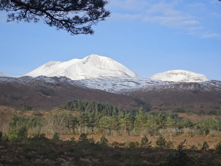
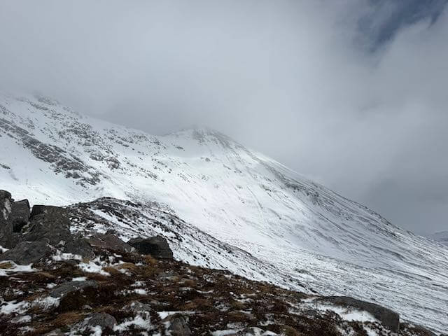
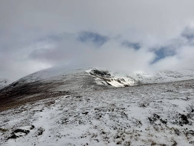
Keep up to date by subscribing to our RSS feed
This report is supported by