Avalanche Report for Creag Meagaidh
Issued
Avalanche Hazard Forecast
FOR PERIOD 18:00 Tue 07/04/2026 TO 18:00 Wed 08/04/2026

Forecast Snow Stability & Avalanche Hazard
Reports for Creag Meagaidh have now finished for the winter
Forecast Weather Influences

Observed Avalanche Hazard -
Observed Weather Influences
Observed Snow Stability and Avalanche Hazard
Reports for Creag Meagaidh have now finished for the winter
Mountain Conditions
Recent Avalanche Activity
Avalanches recorded in this forecast region within 7 days of this report.
10 Avalanches
View details | View on map
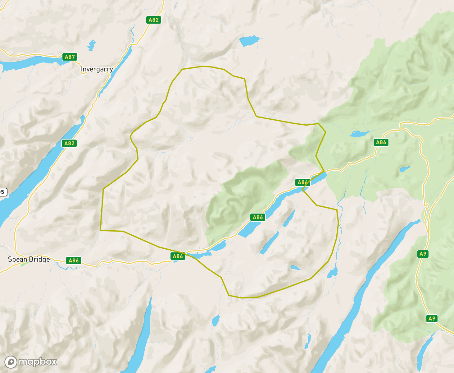
The Creag Meagaidh avalanche forecast Area
When producing daily avalanche forecasts for the Creag Meagaidh region the whole area and summits as indicated on the map are considered by SAIS forecasters when writing their daily reports.
In the Creag Meagaidh region the core forecast area primarily visited are the popular cliffs and summits around Coire Ardair and the Munros and summits to the north west of Loch Laggan. Knowledge from the core area is applied to the more outlying mountains such as Beinn Teallach to the West and Geall Charn in the East, where field observations are carried out in turn as the winter progresses, or specific snowpack assessments are required.
-
Wintry start and finish
A blustery and cold Westerly airflow persisted during the first half of the week. Often new snow overnight and leading to a considerable hazard. Towards the later part of the week a warm front passed over the area bringing a significant thaw and lots of cornice collapse. A plummeting freezing level has now improved stability and the Hazard is Low.
Wet grain snowpack but new snow laterWell bonded wet grain snowpack, getting patchy and limited to places above 800m at the start of the period. Latterly, storm snow and drifting improved coverage as low as 250m for a time. Newly drifted snow poorly bonded for a time and quite deep and extensive but only above 900m. New cornices over most steep lee slopes.
Improving stabilitySerious winter conditions returned at the start of the period. Stormy weather brought new snowfall and a developing windslab and cornice problem. There was considerable hazard on North through East to South-East aspects above 800 meters. As the week progressed temperatures fluctuated and rain created further instabilities in the snowpack. The freeze thaw process and high pressure towards the end of the week led to improving stability and a low hazard.
Winter Returns with Unstable WindslabAfter a threadbare snowpack of old snow remnants winter returns. Windslab will gradually develop becoming deeper and more widespread from Thursday 12th March. Temperatures will be low so instabilities will be present in the new accumulations.
snow pack continues to diminishWet grain, isothermal snow pack steadily diminishing but refreezing at times, then wet and moist at all levels at the end of the period. Effective snow line circa 850m though down to 750m on some favoured NW to NE aspects.
Diminished snow coverA significant thaw over the last few days has significantly reduced snow cover. Snowpack is now soft and deep but stable. Cooling temperatures occurring over the last days of February will limit snow loss. Greatest amounts above 950m on NW through N to E aspects.
Contrasts according to wind exposureDense or crusty snow on windward aspects for most of the period. New windslab quickly morphed into denser layers on lee slopes though with some noticeable buried weak layers later in the week. Avalanche on 18th on a NW aspect at 950m failing on buried weak layer overloaded by persistent drifting.
Firm with isolated fresh depositsThe South-East airflow continued for most of the week, with a change to a North-Easterly flow occurring latterly. There have been periods when the freezing level has been near the summits, allowing consolidation of the older snowpack and resulting in some snow loss on lower slopes. Following this, there was a drop in the freezing level and the snowpack has become firm and icy. There has been a dusting of fresh snow to lower elevations and isolated deposits of windslab have developed.
Good cover, generally stableThe SE airstream has continued with the freezing level fluctuating between about 700m and 1000m. Although consistently cloudy, there has only been small amounts of fresh snowfall. The windslab that was deposited the previous week consolidated through the period. There have been some fresh deposits of windslab, these have generally been shallow. Cover remains good above 800m. The hazard has been moderate or low throughout and no avalanches were recorded in the area during the last seven days.
New snow morphing into well bonded snow.Periods of new snowfall and drifting, with shortlived instability, which consolidated into denser well bonded windslab. Slightly milder conditions followed by cold weather induced a widespread crust which is now buried on lee slopes. Windward slopes distinctly hard or crusty in the latter part of the week.
New Windslab, Fresh snow, Strong WindsWith a freezing level fluctuating around summit levels the snowpack is undergoing a general stabilisation process. A mild period of the last few days has diminished snow cover considerably. New snowfall and a lower freezing level will now present a period of instability with new windslab accumulations developing in the next few days.
Back to a typical Scottish snowpackSnowpack now consists of consolidating snow with at least two buried and decaying melt freeze crusts. Low and midpack generally well bonded with new windslab instability late in the period.
Cold and snowyIt has been a cold snowy period. Unstable windslab was initially deposited mainly on NE-E-S aspects above 950m. Subsequently accumulation became deeper and more widespread with more snowfall at all levels, with N-E-S-SW aspects affected. The last two days were mainly dry with generally light winds, facilitating gradual consolidation of the snowpack.
Rapidly EvolvingA relatively dry, cold and settled period with limited snow amounts for the Christmas period, followed by an abrupt change to a North-Westerly (Arctic Maritime) flow. A period of continual snow showers under strong winds have resulted in windslab accumulation and a return to more wintery conditions.
Early wet snow instabilityThin snowpack was briefly enhanced by a snow and drifting event. Thereafter, a wet grain well bonded snowpack - with an occasional re-freeze - which steadily diminished over the week. Thin and increasingly patchy snow cover mainly above 950m by the end of the period.
Thin snow cover, gradual build up on tops.Mild temperatures have depleted the snowpack considerably. New snow is gradually building more significant accumulations above 900m with unstable windslab and cornices beginning to form.
Very limited snowpack.Just a few old wet snow patches on N to E aspects mainly above 1000m, with bare ground elsewhere.
High PressureSunny, dry and warm weather prevailed throughout the week. The remaining areas of snow high up on North through East to South-East aspects continued to diminish as the week went on. What snow remains is generally stable and presents no hazard with the exception of the small, residual cornices slumping/collapsing.
Scant snow cover.Scant snow cover, comprising of small isolated patches on N to E aspects above 950m. Wet grains throughout. No Hazard category issued for 4 of the 7 day period.
Dry with overnight frostsThe period has been dry with a slow thaw of the recent snow. Overnight frosts and cold summit temperatures have caused the remaining snow patches to be mostly firm, only softening where exposed to the sun. It has now turned milder and the snow is softening and thawing in all areas.
Spring then a return to winterInitially the snow loss continued with the freezing level well above the summits. The temperatures then dropped and what snow remained became firm and stable throughout. The odd wintry shower has given a thin and superficial covering of new snow above 700 metres.
Mild weather and a transition to a wet grain snowpackEarly light snowfall and some thin windslab transitioned to an entirely wet grain snowpack after the onset of sustained mild weather. Significant snow loss at all levels by the end of the period.
Wet and mild then colder and snowyThe period started with a very warm, wet and windy spell and there being a significant thaw at all levels. Colder conditions followed with some fresh snow and build up of unstable windslab on North through East to South East aspects above 950 metres. These are now slowly consolidating.
Cold airmass transitioned to Atlantic weatherA sustained cold airmass induced some near surface facetting near a crust but with little overlying windslab. Rapid change to mild, wet conditions late in the period resulted in limited wet snow instability for a time.
Little changeCold dry conditions prevailed throughout this week. Little change in the snowpack, which was generally stable. Some localised instabilities persisted, mainly on steep N-E aspects above 1000m.
Fluctuating freezing levelAt the start of this week there were areas of windslab mainly on N-E aspects, then the freezing level rose above the summits facilitating stabilisation in the snowpack. Heavy rain at all levels created wet snow instabilities on NW-N-E aspects above 850m. Further rain and then a freezing level dropping below the summits stabilised the snowpack before fresh windslab was deposited on N-E aspects. At the end of the week this was consolidating, with only localised weaknesses remaining
Fluctuating freezing levelAt the start of this week there were areas of windslab mainly on N-E aspects, then the freezing level rose above the summits facilitating stabilisation in the snowpack. Heavy rain at all levels created wet snow instabilities on NW-N-E aspects above 850m. Further rain and then a freezing level dropping below the summits stabilised the snowpack before fresh windslab was deposited on N-E aspects. At the end of the week this was consolidating, with only localised weaknesses remaining
Buried weaknesses dissipating laterCold temperatures induced some buried weaknesses in new and older windslab. In conjunction with this the slab overburden became denser and stronger with time. A brief temp rise followed by colder conditions gave a widespread thin breakable crust. Drifting late in the period produced some minor, softer but more localised windslab and a few small cornices.
Very little snowIt was a period with very little snow. For much of the week the remaining snow patches were melting in the mild conditions, then on Tuesday onwards froze in cooler temperatures. A thin dusting of new snow arrived on Tuesday, with a little more on Thursday.
Diminishing snowpackEarly new drifting with cold-induced facets in mid-pack and lower in the snow pack, then a transition to rounded - later wet grains - with the onset of typical Atlantic weather. Snowpack much diminished and limited to patches around coire rims by the end of the period.
Very cold with a thin cover of soft snowA widespread thin cover of unconsolidated snow at all elevations with some windslab build up around coire fringes. Cold temps have preserved and developed weaknesses. There has been generally lights winds during the last days but recent stronger winds have started to build windslab on a weak snowpack structure in specific locations..
Very patchy wet grain snowpackPersistent thawing conditions further depleted the patchy wet grain snowpack until late in the period. One minor full depth avalanche during this time. A little new windslab later during much colder conditions with one very small dry slab avalanche.
Cycles of snow and thawTwo cycles of fresh windslab being subject to thaw over the course of the week ultimately producing an isothermal snowpack composed of wet grains. One minor dry snow avalanche mid period during heavy drifting. Snow cover much reduced and patchy by the end of the week.
Snow patches to Thin Snow coverA mostly diminished snowpack over the last week after a deep thaw which left only patchy fragments. Today, new snowfall and cold conditions continues the cycles of cold then warm conditions.
Spring snowpack.Increasingly coarse-grained, isothermal snowpack now limted to areas above 800m and a few gullies at lower altitudes. A little snowfall during the week which either melted or decayed into yet more wet grains.
Morphing into a wet grain snowpackGeneral trend was of slow thaw and a developing wet grain snowpack. Some snowfall but with rapid consolidation. Dry and cooler for a time so an incorporated soft crust within the snowpack, too.
RoundingNew snowfall, where it accumulated, rounded out and became quite dense.
Wet grain snowpack contd.Mature if patchy wet grain snowpack, refrozen at times moist at others.
Wet grain snowpack.Wet grain, mature snowpack with occasional top up of thin new snow that consolidated rapidly.
Drifting followed by consolidating trendSome new snow and windslab development preceded heavy drifting. This resulted in some instability and avalanche activity triggered by cornice collapse due to overloading, combined with a slight rise in temperatures. Following this avalanche cycle milder conditions have resulted in a slowly consolidating spring snowpack which is confined to the high coires and major gully lines. The greatest cover lies on North-West through North to East aspects above 900 metres.
Classic Scottish snowpack evolutionClassic Scottish snowpack evolution. A short sequence of drifting, new snow instability, some rounding followed by a melt-freeze cycle then more new snow. Snow cover somewhat limited at the end of the period.
Ablation then a wintry repriseMuch reduced mature wet grain snowpack then new snow and drifting late in the period with a minor avalanche cycle.
Significant snow event, then slow thawEasterly wind and snow showers early in the period eventually eased and veered to the South-West. Strong winds then put fresh windslab deposits onto mainly North to East aspects. Significant drifting occurred, cornices were unstable and many avalanches were recorded on North to East aspects above 1000 meters on Monday and Tuesday. The freezing level then went above the summits and the snow has slowly begun to consolidate.
Hard snow-iceLast week's wet grain snow pack morphed into firm or hard snow-ice. Main old snow accumulations limited to N to SE aspects above 750m. Superficial general dusting of snow late in the period.
Developing wet grain snowpackWet grain snowpack evolving through some melt-freeze cycles. New snow later in the period melted in rain and mild temps.
A Roller Coaster of a WeekDuring the early part of the week fresh snow fall and high winds developed considerable windslab problems on the tops and a moderate hazard down to mid mountain level. Multiple freeze/thaw cycles in the second half of the week has general stabilised and diminished the snowpack.
Late storm snowHard or crusty snowpack with some facetting in the vicinity of a buried crust buried by better bonded new snow. Late storm snow introduced deepening overburden covering the older snowpack. New snow avalanche activity late in the period.
Generally stable snowpackDuring this period the snowpack has been generally stable. Greatest accumulations lie on NW-N-E aspects above 800m. A widespread melt-freeze crust made going hard for the first part of the period, then the snowpack firmed up as cold conditions exerted its influence. The period ended with a firm and generally stable snowpack, with some shallow localised deposits of windslab mainly on NW-NE aspects above 1000m.
A little new snow, then slow thawOccasional periods of light snowfall with a little drifting mainly close to summit areas. Latterly, a slow thaw of all snow giving a moist but reasonably well-bonded snowpack in most places.
Winter ReturnsThe last week has been an unsettled period with some snow and strong winds. A light snowfall on Christmas Day was followed by a dry and bright Boxing Day and then the arrival of Storm Gerrit on 27th. Unstable windslab developed rapidly during the storm on SW, W, NW and N aspects. Generally the snowpack had a consolidating trend during the milder temperatures on the 28th.
Dusting of snowStrong Westerly winds with intermittent light snowfall followed by mild conditions has lead to very little snow cover. No avalanche hazard forecasts have been issued yet.
Winter mid week stingMinimal snow cover before the arrival of a cold snap mid-week. This brought unstable windslab on primarily North Westerly aspects at highest elevations, above 900m. Rapid consolidation then occurred below this elevation, with some further snow showers only at summit levels. Stability is again improving since this mid-week winter sting.
30 March - 6 AprilIsothermal very patchy old snowpack. Snow distribution is limited to hollows on plateau areas and some gullies as low as 750m.
23 March - 29 MarchLimited new snowfall, any new snow consolidating quickly. Older patchy snowpack composed of well-bonded coarse wet grains.
Keynotes: patchy, but new snow laterPatchy, isothermal snowpack mainly North to East aspects above 850m and composed of old coarse wet grains. Some new snow early in the period, and at the end with new snow instability and minor dry slab avalanche activity.
ThawingAfter a period of snowfall, cold temperatures and windslab development, an abrupt change came on Thursday morning. The arrival of mild conditions and rainfall, are stabilising the snowpack. The snowpack is thawing at all levels, with most snow now lying primarily above 800m.
Very cold conditionsFirm and generally stable old snow patches were all that remained at the start of the week. From Sunday onwards a Northerly air mass brought new snow and sub zero temperatures at all levels. Windslab and cold weather weaknesses in the snowpack are present on all aspects, above 900 metres.
Wet grain snowpackThe old patchy snowpack is composed of well-bonded wet grains. Some near-surface rounded grains after a few very modest bouts of snowfall.
Generally stable.A generally mild week with thaw conditions and only a few brief colder spells. The snowpack continued to gradually thaw and diminish through the week and has generally been well bonded, firm and stable. On Wednesday there were instabilities on South-East and South aspects above 950m. These had gone by Thursday. Greatest accumulations remain in gullies and corries with North through East to South-East aspects above 850 metres.
Thawing new snow and more wet grains.Similar cycle to the previous week: wind drifted snow soon thawing on top of a mature wet grain snowpack.
Wet grains predominateFor the most part a wet grain, dense snowpack. New storm snow right at the end of the week.
Developing windslab then thawing.During the first three days of this period there was a generally stable snowpack. Then on Monday new windslab was deposited on N-E-SE aspects above 800m. Deposition of further unstable windslab continued over the next 2 days with avalanches recorded on SE aspects. During Wednesday night the freezing level rose above all summits and Thursday saw persistent rain at all levels. After an overnight period of instability the now moist snowpack thawed and consolidated.
Full cycle snowpackFacets, storm snow and an avalanche cycle at the start of the period immediately followed by wet snow instability and more avalanches. Thenceforth the development of a better bonded wet grain snowpack.
Wintry weekIt has been a cold and wintry week with at least some snowfall most days. The snowpack has become quite complex with various crusts, facet and windslab layers. The hazard has generally been considerable mainly on North through East to South-East aspects. Some significant cornices have formed above these aspects. Some avalanche activity was recorded through the week. However, visibility was generally poor, and it is expected that many avalanches occurred but were not observed.
Fluctuating temperaturesIt has been a changeable week with mostly strong winds. There have been colder periods when windslab developed, mostly on North to East aspects, and short warmer periods that helped consolidate the snowpack. Fragile cornices have developed through the week.
Windslab then consolidationThe week started with cold conditions and snow showers when unstable windslab developed mainly on West through North to East aspects. The temperature rose well above summit level on Tuesday night and Thursday afternoon and this has helped to consolidate the snowpack.
Fluctuating temperaturesDuring the week ending Thursday 29 December the key feature was fluctuating a freezing level, which rose above or near the summits on three occasions before dropping to 700-800m. This resulted in the snowpack becoming moist, then refreezing and stabilising. On colder days, light snowfall deposited windslab in wind sheltered areas, mainly on NW-N-E aspects above 900m. At the end of the period this windslab had stabilised due to the fluctuating temperatures.
Typical Scottish snowpack evolutionSeveral minor snowfall events followed by some thaw and freeze cycles have combined to produce a crusty snowpack. Overall snow cover is patchy and fairly thin and what remains is composed of refrozen wet grains.
CosmeticCold conditions with sporadic snow showers. Accumulations have yet to develop and achieve any significant depth in the Creag Meagaidh range. There exists a general cover at all elevations with snow lying on approach paths, the generally light winds to-date have not resulted in many drifted areas. Some new snow instabilities are now beginning to develop on North through to Easterly aspects above 850 metres
ThawThe period has seen a significant depletion of the remaining snowpack. Expanses of coarse-grained and generally stable old snow now only at highest elevations in coire backwalls, gully tops and in selected plateau areas. A steady thaw continues.
Patchy, mature snowpackPatchy, mature snowpack confined to locations above 850m and also in some gullies as low as 700m. Composed entirely of tightly bonded wet grains that have been through a several melt-freeze evolutions. Pockets of cold, dry, thin new windslab at the close of the period but only above 900m
Spring back into winterThe period started with warm temperatures and the freezing level above the summits. This led to a further diminishing of the snow cover, which is now patchy above 900 metres. Full depth avalanches in this area were recorded. A return to colder conditions at the end of this period has refrozen the saturated snowpack, which is now largely firm and stable throughout. New snowfall has added a cosmetic dusting on higher ground.
Consolidation into a mature spring snowpack.Over the course of the week a transition to a coarse-grained, mature, spring snowpack. Ablation at lower altitudes became more noticeable later in the period.
VariableFluctuating temperatures over the period have brought rain, sleet and snow in limited quantities to all elevations. The consolidated, spring snowpack has seen a re-freeze above 850 metres, at lower elevations the patchy cover is less firm and wet. High pressure to end the period, with clear night skies heralding another re-freeze with expected hard conditions underfoot at higher elevations.
Spring ConditionsSome wet snow instabilities to start the period, with fresh snow and fluctuating temperatures. A similar trend as period ended. Generally stable spring snowpack.
Full cycle snowpackStorm snow early in the period with new snow instability then early rounding. Transitional avalanche activity followed with onset of milder, wetter weather. Finally, a transition to a mature wet grain snowpack with full-depth avalanche activity at the end of the period.
Wind and snowfallA windy wintry week, with mainly Westerly winds. Snowfall was interspersed by 2 brief spells when the freezing level rose to around the summits. This period ended with cold and snowy conditions building unstable windslab in wind-sheltered areas.
Yo-yoNew snow instability followed by transitional instability then consolidation. More new snow instability at the end of the period with the arrival of Storm Dudley.
Winter ReturnsIt has been mostly cold with a brief milder period on Monday. Winds have been strong, predominantly from the South-West. There has been snow most days, resulting in significant deposits of unstable windslab at higher elevations.
Depleted snowpackThaw conditions have dominated the week, with a little new windslab forming over the weekend. After that thawed, snow patches are all that remain on North through East to South-East aspects above 850 metres.
Sparse conditionsThe snowpack has been much diminished with mild conditions which brought periods of thaw to all levels. Fluctuating temperatures resulted in a re-freeze of isolated remaining patches at highest elevations. Cooler with a dusting of snow once again at summit elevations, the pattern of temperature fluctuations continuing at end of the period with rain / snow at summits elevations. Snowpack remains very sparse and generally stable.
Diminishing patchy snowpackSnowpack is now much diminished and patchy. Sustained thaw then colder conditions induced firm and well-bonded snow-ice in the remaining snow patches. Some very thin pockets of windslab late in the period.
ThawA mixture of conditions over this last period with some avalanche activity from new snow instabilities, then transitional wet snow events as the area became affected by a milder, moist airflow and rising Freezing levels. These thaw conditions now prevail with a now much depleted, moist although generally stable patchy snowpack. Any remaining cornices as always are suspect in thawing conditions, as is the possibility of ice and rockfall in crag areas.
New snowVery sparse conditions over much of the past week with many hillsides devoid of cover, whilst others became windscoured. Where patches remained these were, in the main hard and stable. New snow instabilities with fresh windslab developing in high, sheltered lee gully exits and around coire rims at the end of the period
Some new snow then thawEarly snowfall, limited new snow instability then thaw conditions and reversion to an isothermal snowpack. General snow cover much depleted by the end of the week.
Early season variabilityPre-existing well-bonded snowpack to start the season. Some minor new snow instability immediately after snowfall at the start of the week with a few small transitional avalanches with the onset of mild wet weather. A similar cycle of weather and minor avalanche activity followed shortly thereafter. Sustained thaw conditions at the end of the period saw snow recession at all altitudes and a generally moist but well-bonded snowpack. Snow cover now quite patchy.
Winter returnsMature, old re-frozen snowpack with new snow later. Avalanche cycle to conclude the week with transitional avalanches running on N to E aspects.
Spring SnowpackThe sparse spring snowpack has undergone melf/freeze cycles during the period. The now much diminished cover is confined to highest elevations above 850 metres, occasionally down to 700 in selected, mainly N to NE facing gully locations. The snowpack re-frozen and stable at the end of the period; some wintry conditions are forecast at time of reporting.
Moist spring snowpackOverall, a moist spring snowpack. Snow distribution now distinctly patchy. Wet snow instability at the end of the period after snowfall followed by a fast transition to wet, mild conditions. Two recorded transitional avalanches at the end of the week.
Spring ConditionsSnow showers and wintry conditions to start the period brought new snowfall above 450m. After some initial new snow instabilities, with small single point release activity (on mainly sun affected E to SE aspects) accumulations consolidated rapidly. A thaw then prevailed resulting in a much diminished snowpack, which although moist, is generally stable. Cornices have collapsed with debris to coire floors; some large ones still remain. Rock and ice fall below crags an additional objective hazard
Mature spring snowpackMature, coarse grained spring snowpack, though patchy and limited to above 800m in most places. Cold temperatures kept the snow surface hard in the early part of the week. Further freeze thaw cycles made for a bullet hard surface layer. Some limited new snow instability towards the end of the period as windslab built on lee slopes.
Re-freezeDuring the period the snowpack has been subject to sustained thaw conditions and re-freeze. Cover is now much depleted, the remaining accumulations in the main are above 850m, and lie primarily on NW through N to NE aspects. In all locations the snowpack is re-frozen and stable
Wet snow instability and depleting snowpackA few cycles of wet snow instability throughout the week. Snowpack much depleted at lower altitudes. Two avalanche cycles mid week and towards the end of the period when snowfall was immediately followed by rain and milder temperatures. Deposits of older snow now composed of well bonded coarse wet grains.
ThawCold weather to the start of the period maintained weaknesses within the snowpack. A thaw has now affected the area and the stability is much improved with some temperature fluctuations helping to remove the fragile grain structure DNA of these weaknesses within the snowpack. Developing wet snow instabilities are now a feature of the snowpack, with rain affecting all elevations.
Developing weaknessesWindward slope scouring a feature early in the week with new windslab on lee slopes. Sustained cold temperatures encouraged facetting in various layers which became more pronounced later. Size 2 triggered avalanche mid week attributed to buried weak layer being overloaded by recent drifting and two ski tourers. Stronger bridge developed later especially where the snow overburden was deep. Buried weak layers under less deep snow more reactive due to steeper temperature gradient.
New snowCold conditions. A complex snowpack prevails, with residual instabilities (see our 'Blog' public response appendix http://meagaidhblog.sais.gov.uk/2021/02/when-west-isnt-best-at-least-at-creag-meagaidh/ )
Weak layers exist within the snowpack and whilst many slopes are also scoured and with icy patches, pockets of instability are widespread. Storm conditions to end the period with new slab building in high sheltered lee locations; these are primarily on WSW through W to NW aspectsFull cover.Executive summary: full snow cover, new snow instability and diminishing cold induced snowpack weaknesses. Very good snow cover from circa 300m upwards on all aspects. Sustained cold weather produced some facetting in some layers mainly on N to E aspects above 900m. Cycle of avalanche activity, much of it due to collapsing cornices, during the middle part of the period immediately after snowfall and drifting. More new snow instability after persistent snowfall at the time of reporting.
Wintry conditionsIt has in the main been a cold period with regular snow showers above 800 metres. There have been several periods of poorer stability resulting in triggered and natural avalanches - due variously to cold re-distributed snow at high elevations loading onto lee aspects and temperature fluctuations with rain on new snow events. The snowpack has been subjected to re-freeze cycles with new snow and windslab instabilities now developing from Storm Christopher at end of the period
New snowIt has been cold for the most part; a high pressure weather system the major influence. A milder South Westerly airflow on 9th brought stronger winds resulting in a re-distribution of high level cold accumulations. A number of avalanche events were recorded at this time, associated with rapid slab build up, temp rise and cornice collapses. A re-freeze thereafter brought good stability; fresh windslab is once again building in high lee NW through N to NE aspects above 850m
Cold induced weaknessesSnow cover on all aspects down to 300m and persistent cold temperature throughout the period. Some lingering but as yet not very reactive weaknesses in the snowpack above 900m. General consolidation in all snow below 800m.
More WintryFresh falls of snow at the start of the period resulted in a largely cosmetic cover at all elevations. New snow instabilities were noted above 900 metres with slab accumulations developing in steep gully exits on mainly North through to Easterly aspects. Cold Northerly winds have maintained deeper instabilities in the snowpack. New windblow accumulations and instabilities developed mainly on Southerly and South Easterly aspects at the end of the period
Limited snow coverLimited snowfall and snow cover are the keynote characteristics of the week. Thin well bonded snowpack until the end of the week when some cold induced weaknesses were noted above and below a thin crust buried beneath recent but limited windslab. Instability was localised and confined to NE, E, SE, and E facing coire rims and gully tops. Superficial snow cover below 800m in all locations.
Sparse conditionsLight snow showers over the period brought some thin, new humid windslab to summit areas over the period. Accumulations are now much diminished as a thaw and rain has depleted any limited cover. Temperatures at the end of the period above summits.
Windslab, wet snow, windslabThis period started cold with unstable windslab mainly on N-E aspects above 800m. A warm interlude then produced wet snow instabilities and avalanches. Finally with cold conditions, snowfall and strong SW winds unstable windslab was deposited mainly on N-E aspects above 800m, with further avalanches.
Wintry ConditionsVarious weather cycles over the period have resulted in thaw , full depth snow slides and varying degrees of new snow instability events. Fresh slab is once again towards the end of the period building in high sheltered lee locations ....winter trundles on,
Old Skool Scottish snowpackMuch deeper more widespread snowpack after several significant snow events. Avalanche activity during and post snowfall, exclusively new snow instability. Snowpack slowly consolidating later in the period in most locations, with residual instability confined to much higher altitudes and very steep slopes. Cornices, some very large, remained an issue throughout.
WindslabShowery wintry conditions have persisted over the period with accumulations of poorly bonded windslab on variable aspects. Several natural avalanche dry slab events recorded particularly on NE and E aspects (see avalanche map for details) areas with poorly bonded layers also exist in deeper accumulations in other high sheltered lee areas
Storms continueThe stormy wintry weather continues. Windslab has continued to develop in high sheltered areas. Avalanches have occurred during the period most notable on Easterly aspects with a large event 19th in Inner Coire, from Cinderella. Stability is poor with snow showers continuing over high ground combined now a Freezing level rise bringing rain to summits.
StormyIt has been a stormy period with two significant weather influences . Storm Caira brought snow to all levels initially with some deep drifts and weakly bonded slab in high sheltered lee slopes . After some consolidation stability improved followed by wet snow instabilities (from a brief temperature spike) with rain at all levels. A second storm (Storm Dennis) affects the area now in latter period, with new slab again developing on high ground mainly on North and Easterly aspects
Thaw, snow, thaw.Well bonded moist snowpack after a thaw. Short period of new snow instability after snowfall and drifting quickly followed by a consolidating trend then a thaw. Snowpack was generally moist and well bonded at the end of the period.
Thawing snowpackFresh snowfalls to all levels over the period. Now thawing at the end of the cycle with numerous small loose wet snow instabilities. Fluctuating temperatures continue with new, wet snow instabilities from rain on new snow events
ThawAn already very sparse and shallow snowpack has once again been much depleted by thawing conditions . Slightly cooler now at the end of the period which will help consolidate and re-freeze remaining accumulations above 850m
More WintryIt has been a very stormy and much more wintry period than of late. Widespread scouring took place of many slopes on high ground. Temperature fluctuations resulted in thawing conditions at most levels, with wet snow instabilities. A cooling trend has now resulting in a re-freeze of existing accumulations at upper elevations. Wintry and showery conditions prevail....
Modest cover of fresh snow followed the thaw.Sustained thaw conditions removed most older snow patches though some remained above 850m but were sparsely distributed. Very stormy conditions brought more snow but strong counter winds stripped snow from all but the most sheltered lee slopes - mainly above 950m. At the end of the period, localised new snow instability around coire rims and gully heads only. A cover of thin soft fresh snow in all other places above 500m.
Sparse conditionsThaw conditions resulted in a much depleted snowpack; old remaining patches of snow above 800m have been re-frozen and are stable.
Newer light deposits with some localised instabilities developing in the slowly rising tempertures again towards the end of the period.Much diminished snowpackLittle or no new snow; snow cover very limited. Some larger snow patches above 850m and at lower altitudes in some favoured gullies, all of which were moist and stable at the end of the period.
Sparse CoverThaw conditions have almost completely depleted the snow cover in all areas (back to green).
What little remains in the gully exits, on high N to E facing aspects and in a few sheltered plateau areas is hard, frozen and stable.
Temperature inversions conditions to end the period with light valley frosts overnight.Soft wet snowCool to start the period with snow showers to all levels. This was followed by rain at summit levels and some wet snow instabilities. Now widespread soft wet snow with some residual localised instabilities persisting; stability generally improving as snowpack continue to consolidate
New snowEarly season snowpack ; some showery periods and cool temperatures brought drifted accumulations in high sheltered lee locations. Weaknesses have been noted above and below a crust layer mid week, with further windslab and cornices developing above 800m. These on mainly NW to Easterly aspects
StabilisationAt the start of this period windslab was present mainly on S-W-NW aspects above 900m. On 6th the freezing level rose above the summits and the snowpack started to consolidate with only localised instabilities present mainly on S-W aspects. Milder temperatures with melt-freeze cycles then stabilised the snowpack and from 8th April it was basically a stable spring snowpack.
Snowfall eventDiminished and refrozen snowpack comprising mainly of patches in lee areas early in the week. A little additional well bonded new snow then later a sizeable snowfall event with widespread cover and deeper drifted accumulations. Some limited new snow instability at higher elevations during and after the storm but with a consolidating trend in all snow at lower altitudes.
Typically ScottishTypical Scottish Highlands regime of light snowfall, short term wet snow instability after a temperature rise then a consolidating trend as thaw conditions became established. Snowpack was moist and isothermal at all altitudes by the end of the period.
Snowy then mildFrequent periods of snow along with strong Westerly or South-Westerly winds and colder temperatures led to quite an accumulation of snow above 600 metres on Easterly aspects. As a result there was quite a bit of avalanche activity on these aspects. From Monday milder temperatures have led to a slow thaw of the snowpack with many ridges and plateau areas now bare. The thaw has led to cornice collapse and the increased threat of wet snow avalanches on steep North-East to South-East aspects.
Storm GarthFrequent snow showers affected the area courtesy in the main of Storm Garth. Graupel was a feature of the snowpack and avalanche activity resulted on various steep, mostly Easterly aspects. With fluctuating temperatures now towards the end of the period there has been some overall improvement - a showery snow cycle is again developing with new windslab building in high, sheltered ,mostly NE and Easterly aspects
Only a little more wintry.Limited general snow cover. Mainly localised instability throughout. An early minor new snow avalanche cycle at the beginning of the period. New snow build up confined to lee areas above 900m and even here quite limited. Thin and sparse elsewhere.
All changeThe unseasonably mild weather continued to diminish the last of any remaining patches of snow above 800 metres during the period. That just ending now with a return to more 'normal' winter temperatures and fresh snow above 700 metres beginning to affect the range. Any old patches refrozen and stable, new instabilities developing in fresh windblow deposits.
Very MildUnseasonably mild conditions have stripped snow from all but very highest locations. What remains although moist is generally stable. Thaw conditions prevail.....
Early new snow and transitional instabilityEarly part of the week was characterised by a typical Scottish Highlands sequence of instability and avalanches immediately after snowfall, then again following the sudden transition to rain and mild temperatures. The onset of milder, initially wet, weather later in the period initiated the collapse of relatively small cornices. Latterly, sustained mild temperatures brought significant consolidation to the snowpack in all locations, it becoming isothermal from the ground up by the week's end.
CoolerA cooler period with fresh snow at all levels. There was some avalanche activity to start from new snow events just below cornice lines, mainly Easterly & South Easterly aspects. After some fluctuating temps a breakable crust developed with poor bonding noted in layers both above and below. Any additional snow in the immediate expected to further weaken.....
Cold - with slow consolidationMild and wet to start, then cold conditions and fresh snowfall. Little snowpack base - although some persisting instabilities in high shaded locations
Limited snowLimited snowfall gave rise to only localised accumulations of new moderately bonded windslab on N to E aspects above 950m. Cold temperatures maintained limited dry snow instability, though a late consolidating trend in easing temperatures late in the period.
Start of Winter?Mild conditions until mid-week and the arrival of a colder air mass bringing some snow. There was a little drifting at highest elevations, but overall the snowpack is still very limited and largely stable.
Very Limited coverHigh pressure conditions and dry for much of the period. Temperatures have fluctuated above summits. What little snow remains is well bonded and stable
Very limited, sporadic coverVery little snow. What remains of the snowpack was moist and well stabilised early in the period then refroze during colder weather later. Some snow persists high on coire rims, at the top of a few gullies and in one or two favoured hollows on plateaux areas.
Thawing snowpackSome snow fell early in the period, this quickly consolidated as mild conditions prevailed. The snowpack is now much depleted and confined to isolated patches of old snow above 900 metres, mostly around coire rims.
Sparse conditionsStorm snow from 'Deirdre' at the start of the period became much depleted by a subsequent thaw. Some cornice debris noted in high coires brought down during the thaw. Snowpack is now stable and very limited below 900m.
Updated Thursday 20th DecemberUpdated Thursday 20th December
A slow, steady thaw has been taking place over the period. The snowpack although moist is now generally stable. Some localised wet snow instabilities in steepest convex and inclined slopes and benches. Many coire rims remain overhung with large cornice sections, which continue to be suspect during thaw conditions .
Stable snowpack early in the period with some new snow instability with snow showers. Cold temperatures maintained minor near surface weaknesses. Deeper persistent weaknesses present but unreactive. Heavy snowfall later in the week produced some poorly bonded new windslab in deeper deposits. Dry slab avalanche activity at the end of the period after snowfall and drifting. Large cornices again a feature over most steep lee slopes.
Moist snowpack with occasional thin accumulations of new windslab in the early part of the period. More snow and windslab mid period with new snow instability and minor avalanche activity. Consolidating trend followed with only a little new snow. Some minor weaknesses in thin deposits of windslab in heavily shaded areas towards the end. Very large cornices a feature over NE to SE aspects.
High pressure affected the area for much of the period with cold temperatures giving strong snowpack temperature gradients. This gave rise to sporadic instability above 800m with weak layers developing above and below buried crusts. Some transitional avalanche activity resulted on high mainly NW aspects mid-week as these layers became overloaded by the arrival of milder, wetter conditions. The snowpack is now generally well consolidated and stable. A colder showery front to end
Fresh snow resulted in avalanche activity early in the period mainly on North to East aspects, with a persistent weak layer slow to stabilise. The cold period was followed by milder conditions and the cover is now much diminished below 600m. A melt /freeze cycle has largely stabilised the snowpack in all locations, some new snow instabilities are now developing in highest, very sheltered lee locations. A very strong South Easterly airflow has been a major feature of recent days
Cold induced weaknesses became established above and beneath a surface crust of varying thickness above 900m in many locations,. Subsequent snowfall and drifting buried this under deepening, bridging windslab on SW through W to NW aspects. Instability remained here right through to the end of the period. Onset of S to W airflow later with snowfall gave a variable pattern of new instability on N to E aspects as well as persistent instability on SW to NW aspects.
Hard or crusty surface to the snowpack for most of the period. Some limited evidence of near surface facetting appearing later with the onset of light snowfall. Some weaknesses in new snow towards the end but distribution of new slab not widespread.
Windslab instabilities were widespread to start the period and avalanche activity was recorded on North through NE to Easterly aspects. At the start of the week a thaw with overnight rain to all levels resulted in a period of high instability and numerous cornice triggered wet snow events, some of which, particularly on Easterly aspects brought debris down to coire floors. Dry cool conditions now affect the area resulting in a re-frozen and stable snowpack.
Snow showers throughout the period brought quantities of poorly bonded windslab to high sheltered lee areas. A crust from a brief melt/ freeze cycle mid-period became quickly overlaid with further unstable windslab and a period of avalanche activity ensued on mainly North East to Easterly aspects (some at 600m). Wintry conditions persist and stability remains poor with windslab continuing to build in high, sheltered lee locations. Some scouring on exposed slopes and ridges.
A week of occasional generally localised new snow instability interspersed with periods of consolidation at all altitudes. Snow cover on many aspects. A buried crust present later in the period, but little evidence of facetting. Cornices notably large in places.
The week started with a nice bright cold Friday. Then it became warmer on Saturday with rain at all levels, wet snow instabilities noted and an avalanche reported. Subsequent melt-freeze cycles with rain at all levels for periods of varying length started consolidating the snowpack. During Tuesday precipitation turned increasingly to snow above 700m with strong SW winds. Since then it has remained cold with snowfall at all levels and strong Westerly then NW winds.
Cold conditions with new snow and windslab instabilities to start of the period. This was followed by a thaw and significant snow loss, particularly below 700m, A return of cooler weather with light snow showers and localised instabilities with new cornices developing on North to Easterly aspects to end the period.
A cold and shallow snowpack brought localised instabilities to varying aspects at the start of the period. This was following by a consolidating trend before recent storm cycles have developed new windslab instabilities on North through to Easterly aspects. Poor stability above 800m in steep, sheltered locations on these aspects to end the period.
Early avalanche cycle after snowfall and heavy drifting. Cover of snow on most aspects which varies in thickness and surface quality. Facetting a feature of the snowpack in many locations especially where the snow cover is thin. Weakness below deeper snow also persistent. Consolidating trend at lower altitudes with instability only persisting above 900m by the end of the period.
Thin snowpack early in the period. Localised instability after snowfall at New Year with a thin covering a snow on most aspects and altitudes. Minor new snow avalanche cycle late in the period after a little snowfall and drifting, though instability localised and confined to steeper locations above 900m.
A cold period which followed a thaw resulted in a re-frozen and stable snowpack.
Recent snow falling in colder temperatures has yet to bring any significant accumulations.Thaw conditions. The snowpack in the past week has been significantly depleted - remaining accumulations whilst moist are generally stable
The Weekly Snowpack Summary for Creag Meagaidh will be updated on Thursday 21st December 2017
After a cool start with snow showers the period became milder with rain at all levels. During Sunday the freezing level dropped with snow showers. Snow showers continued through Monday and Tuesday which saw much more snowfall to low levels and strong generally WSW winds. This deposited unstable windslab on North through East to SE aspects. Wednesday and Thursday were dry with moderate NE then light SE winds;the snowpack started to slowly consolidate.
Mild with thawing conditions throughout. Some avalanche activity recorded mid-period with wet snow avalanches from steeply inclined ledges and benches (see blog from 10th March) of the Post Face and also in the Inner Coire Ardair. Cooling conditions now towards end of the period with fresh snow and some new windslab slab beginning to develop on high mainly North East and Easterly aspects.
The period started with a covering of snow above around 600 metres with deepest deposits on North to East aspects. Easterly winds then redistributed snow to other aspects. The remainder of the period saw significant further snowfall mainly above 800 metres with greatest accumulations on North to East aspects but also some warmer periods which, after an initial reduction in stability, helped to consolidate the snowpack. Some large fragile cornices are present mainly above North to East aspects.
Much depleted, sparse snowpack. Largely coarse-grained and stable but confined to locations above 800m. Heavy snowfall late in the period saw new snow at all levels with instability in deeper deposits on slopes of most aspects above 850m.
Very strong , cold South Easterly winds in the period brought fresh snow above 500m. Instabilities developed and whilst localised and mainly on North West slopes above 900m the instability was variable through North to North East aspects as a weakness developed deeper in the snowpack. A thaw to end the period was accompanied by rain and the cover is now much depleted. Whilst there are now some wet snow instabilities the snowpack has become well bonded and generally stable
The snowpack at the start of the period was very minimal, confined only to coire backwalls. Lowering temps brought snow to all levels with many areas then scoured by very strong South Easterly winds. Areas of marginally stabilised windslab developed on mainly NW through North to North Easterly aspects above 800m. Cold temps are maintaining instabilities on these apects.
Limited and patchy old snowpack. A period of poor stability after snowfall and drifting but sustained thaw afterwards. Firmer but scant snowpack late in the period as temperatures fell. Largest patches on NW through N to E aspects above 750m.
There has been a limited snowpack for the last week with the largest patches on North-East to South-East aspects above 800 metres. It has been mainly dry with inversion conditions leading to a mainly frozen and stable snowpack.
Wintry showers in the early part of the period resulted in snow to all levels. A steady thaw thereafter resulted in the disappearance of cover in all but highest coire backwalls and a few sheltered hollows. Accumulations whilst moist to start in the thaw became rapidly well bonded and stable and have now become firmer in the recent high pressure, temperature inversion conditions.
Very little snow to start the period, with any accumulations only at highest elevations. A cold North Westerly airflow then brought storm cycle with snow now lying to all elevations, Winds beginning to ease as showers gradually dying out. Soft slab continues to build in sheltered lee locations.
A depleting snowpack. Mainly old snow patches, larger ones above 700m on North to East aspects. Only a little new snow during the period. A few melt-freeze cycles strengthened the increasingly coarse-grained old snow.
The period started with warm weather and only very limited patches of snow. Snow showers started on Tuesday afternoon and have continued since then. Winds have been strong and from between a Southerly and Westerly direction leading to a substantial build up of windslab mainly on North to East aspects.
Only a little new snow during the week which rounded out quickly after initial surface wet snow instability. Regular re-freeze of older snow above 950m induced a crust or firmer surface to the coarse-grained snowpack. Collapsing cornices were an issue for a time with the onset of a milder spell. Well-established spring snowpack by the end of the period.
Spring conditions. The period characterised by occasional snowfall and drifting at higher altitudes followed by milder temperatures and rainfall. Some initial wet snow instability then a rounding trend in newer snow. Older exposed snowpack is now coarse-grained and moist. Glide cracks widening in some locations. Minor full depth avalanches from some steeper crags.
Variable spring snowpack conditions for most of the week. Persistent but localised instability high on some lee slopes in colder, dry snow. Cornice triggered avalanche activity mid-period.
Spring conditions. Coarse grained snowpack slowly thawing at all elevations. Glide cracks widening in deeper old snow deposits on some East aspects. Minor full depth avalanche activity in the middle of the period.
Milder conditions after prolonged cold with a consolidating trend commencing by the middle of the period. Snowpack stability improved later as the snow went isothermal from top to bottom. Moist wet grains predominate by the end of the week.
Residual weaknesses beneath new and older snow for much of the period, often localised. Storm cycle brought new snow instability on NE to SE aspects but then a consolidating trend in all snow below 800m contour. Cold-induced instability lingering through to the end of the period on NE aspects at higher altitudes. Very large cornices feature over steepest lee slopes.
Buried weak layers due to prolonged low temperatures in the first part of the period. Then a 36hr period with 3 quick evolutions in weather and snowpack conditions: rapid thaw with rain to near summits followed by heavy snowfall and new snow instability, and finally bright, sunny conditions but with residual instability at higher altitudes. Respective avalanche activity due to wet snow instability closely followed new snow instability and cornice collapse.
Heavy snowfall with deep windslab on all NE to SE lee slopes inducing a new snow avalanche cycle in the first part of the period. Then very cold for several days with instability slow to improve in the snowpack in most recent deposits of windslab. Instability in the midpack and near-surface layers. Large cornices. Scoured crust on some S and W aspects.
A generally cold week with one mild/wet day (Tuesday). Strong winds of Friday the 12th caused some redistribution of the snowpack, producing some natural avalanche activity. Varying wind directions over the next few days led to windslab on many aspects, and a complex hazard distribution. Tuesday was very wet, with heavy rain/snow on the summits, and a number of natural avalanche releases. It soon cooled down again, but snow showers deposting fresh windslab created a considerable hazard again.
Two avalanche cycles. Weak new windslab on North and East aspects leading to localised instability and a triggered avalanche. Later, rapid loading on East to South aspects resulted in cornice triggered avalanche activity. Cold temperatures maintaining localised instability. Transition to spring noted; more heat from the sun but with cold interludes giving a widespread melt-freeze crust which is now buried under new snow. Snow consolidated in all locations below 700m.
South-West to West winds throughout the period, very strong at times. Significant accumulations of new snow especially on North through East to South-East aspects. Rain to summit level on Sunday night followed by colder temperatures helped to consolidate the snowpack. Temperature now rising giving a period of increased instability, but then due to freeze again tomorrow. Many slopes and ridges exposed to recent winds are bare.
Significant snow loss during the period with the return of wetter & milder conditions. Fluctuating temperatures consolidated existing weakness within the snowpack. Some cover again returning above 750m. Mountain conditions generally poor to end with fluctuating temperatures and mild storm force Westerlies affecting the area.
A week of cold temperatures and little new drifted snow. Facetting identified above and below a buried crust. Instability confined to locations above 900m. Slab overlying the buried weak layers became stronger and more supportive by the end of the week. Milder saw temperature gradients in the snowpack ease but buried facets still responsive to compression test. Much milder by week’s end with more consolidation noted in overlying slab.
Snowpack characterised by being comparatively thin in many locations. Deeper accumulations on NW through N to E aspects above 900m. Very cold temperatures in the second part of the period induced buried weak layers in thin and deeper snow on all aspects above 900m.
The period started cold with South-Westerly winds, some windslab and a frozen older snowpack. The rest of the week saw strong East to South-Easterly winds with snow showers but no large accumulations. Freezing levels varied between 750 and 1000 metres. The fresh snow consolidated fairly quickly in the moderate temperatures.
Fluctuating temperatures over the period bringing the all too familiar cycle of snow /rain. Several cycles with some full depth avalanche activity noted at usual sites (Sron a Ghoire). Snowpack remains very limited with existing patches well consolidated and stable. New snow accumulations are beginning to develop on sheltered North to East aspects with new snow instabilities and windslab developing in steep gully exits of these aspects. Some new cornices forming around core rims.
Wintry conditions returned for a spell with fresh snow down to all levels for a brief period. Some avalanche activity followed with new snow instabilities and numerous mainly wet snow single point release events widespread in subsequent solar warming. Cornice lines came down above NE though to East aspects , although remnants remain along with old creep lines in convex terrain, some at low elevations below 800m. High pressure stable conditions and a generally re-frozen snowpack now above 800.
A week when the snowpack consolidated steadily after initial snowfall. Collapsing cornices triggered a few wet snow avalanches early in the period. Snow grains became coarser and moist as the steady thaw set in. Full depth glide cracks opened on steep East to South East aspects and these continue to widen in the warm conditions. Cornices remain notably large and weak over many lee slopes.
Highly variable spring weather conditions with heavy snowfall at times. Snowpack on NE to SE lee slopes now deep and characterised by old snow base below a significant amount of new snow. Storm new instability commonplace in the latter part of the period. Minor wet surface snow releases during periods of sunshine. Very large cornices above all lee slopes.
Well stabilise re-frozen snowpack for most of the period with some softening on sunnier aspects. New snowfall towards end of period from a wintry blast brought fresh slab deposits, mainly on North West through North to Easterly aspects - rapidly consolidating in fluctuating temps. Diminished snowpack elsewhere, moist but generally stable below 800m.
Fluctuating freezing levels to around summits resulted in a generally well consolidated snowpack in most locations. Some light snowfall gave rise to localised accumulations of moderately bonded windslab start of period, which persisted for much of the time above 900m on NW through to Easterly aspects. Elsewhere most slopes remained hard re-frozen and stable. The snowpack is now beginning to soften in a slow thaw, stability remains generally good.
Several melt freeze cycles stabilised the old snowpack though full depth glide cracks widened on East aspects. Some new windslab accumulated on high lee slopes with wet surface sluffing after temp rise or rain.
A brief mild period at the start of the week before turning much colder with snow to all levels and frequent heavy snow showers on a strong Westerly wind. Areas of deep unstable windslab developed on mainly North-East through to South-East aspects above 700m with large unstable cornices building above these aspects. At the end of the week a slow gradual thaw started in conjunction with strong to gale force force South-Westerly winds and light rain showers.
Storm cycles throughout the period brought snow to all levels and areas of windslab were widespread on mainly North through to Easterly aspects, with large cornices building over mostly North East and East aspects. A freeze thaw cycle towards the end of the period helped consolidate the snowpack in all locations, although new slab is again beginning to build as further snowfall brings fresh accumulations above 600m.
Isothermal snowpack and cool temperatures in the early part of the period maintained good stability, though full depth glide cracks widened on SE aspects at 750m. Large full depth avalanche early on the 15th on a SE aspect after freezing level rose to 800m. Other glide cracks widened. Some new snow instability on N to NE aspects after snowfall and drifting followed by much milder conditions and wet snow instability induced by rain at all levels. Re-freeze brought some initial consolidation later
Little or no snowfall but cold early in the period sustaining localised instability in mature windslab on many aspects. Deeper deposits on some steep East to South aspects had widening full depth glide cracks and conspicuous buckling of slab as temperatures eased. Full depth avalanche activity on South East and East aspects at around 750m in Coire Ardair and Coire Choile Rais on 11th Feb in milder weather. Size 3 avalanche in Coire Ardair.
Three days of snowfall and drifting brought new snow instability and some limited avalanche activity on E to SE aspects. Persistently cold temperatures through the rest of the period preserved instability on most aspects but notably on SE to SW aspects. Less cold conditions later encouraged consolidation in all locations except SE and S where deep snow cover maintained the facetting trend. Glide cracks beginning to appear near the end of the period on some selected SE aspects at around 750m.
Some heavy snowfall at start of period followed by fluctuating temps and wet thawing conditions at the start of the week. Additional snowfall followed with further temp fluctuations, strong winds heavy windward scouring on exposed hillsides and another melt /freeze cycle. Heavier snowfall to end the period with some new snow instabilities and small cornice triggered slides. New slab building mainly Easterly aspects.
Early snowfall and drifting with winds from variable directions brought extensive cover of snow with hard and soft slab persisting on NW through N to SE aspects above 750m. Cold temperatures extended over several days and induced some early facetting notably above a buried crust and in soft surface slab. Instability became localised later with better stability in many places.
Snowfall on the 9th and 10th didn’t accumulate except for localised accumulations with a scoured surface prevalent. More snowfall and fluctuating temperatures followed by heavy snowfall at all levels. Very stormy conditions brought widespread storm snow instability on N to SE aspects above 750m. Overall, fairly typical Scottish snowpack with new snow instability but no lingering weak layers.
After a thaw the snowpack froze in all locations. Run of mainly Westerly winds and some snow showers maintained localised accumulations of cold, multi-layered windslab on NE to SE aspects above 750m. Thaw and light rain brought instability and some avalanche activity on NE aspects on 5th Jan. Colder conditions after the thaw re-stabilised the old snowpack at all altitudes. More snowfall and much colder weather on 6th, 7th and 8th induced new snow instability on NE to SE aspects above 800m.
Very little snowfall during the period but some lingering instability on NE to SE aspects above 800m due to persistent cold temperatures. Minor evidence of facetting noted in the snow profile on 29th producing easy shears but localised in extent. Diminishing instability with onset of milder temperatures and later moist conditions. Onset of very heavy rainfall and mild temperatures induced full depth avalanche activity on some very steep SE aspects 31st/1st. Thawing, wet snowpack elsewhere.
New snow avalanche activity on the 20th on NE to SE aspects. Further avalanche activity on 21st after heavy rain and mild temperatures followed by some snowpack consolidation as temperatures fell. More snowfall with graupel induced new instability on N to E aspects which persisted in cold temperatures on Christmas Day.
Storm snow to start the period resulted in soft weaker layers overlaid by hard more dense deposits. Temperature fluctuations followed mid week with a thaw to all level by end of the week. The depleted snowpack is generally now well consolidated. NB Some cornice collapses mid period with new build up on-going.
A week of persistent thaw with occasional snow showers and cooler interludes. Snow pack now much patchier and what remains characterised by coarse-grained, stable structure. Deep glide cracks and crevasse-like features present as well as partially collapsed old cornice lines.
Slow steady thaw conditions and stable for most of the period with freezing levels above summits occasionally lowering just below. Bright sunshine briefly mid-period with some sun on snow localised instabilities, glide cracks continue to develop with remnants of cornices slumping and collapse prone. Slow thaw persisting to end period.
New snowfall at high levels to start the period were followed by very strong winds with heavy drifting and the rapid slab build up of unstable slab from re-distributed snow. Poor stability with avalanches (class 2 & 3 events)followed these accumulations mid period on NE and E aspects around 900m. Warmer temps and strong sunshine followed with localised wet snow instabilities & cornice debris. A re-freeze now has resulted in much better stability - a few instabilities above 900m from new showers.
More frontal activity coming in from the Atlantic with rain, very strong winds and mild temperatures; colder, wintry towards the end of the week. Snowpack generally moist and stabilising but diminished in thaw. Snow line now 750 to 800m. Most large cornices now down but some remain. Full depth glide cracks in several never seen before locations: all continue to widen. Colder temps encouraging MF crust to form with new windslab developing on N to E aspects above 850m.
Two thaw cycles have affected the snowpack over the period with associated wet snow avalanches and a number of cornice collapses primarily on North West through North to East facing slopes. Between these cycles regular snow showers mostly above 700m brought new snow instabilities with drifted accumulations. Some deep seated weaknesses persist within accumulations above 900m.
Lots of avalanche activity to start the period with numerous large events from a temperature rise accompanied by rain on snow, all mostly below 800m, in some cases these ran to full depth on North through North East and Easterly aspects and involved significant volumes of wet snow. Cooler temps mid week brought some consolidation. New snow showers continuing to build slab again at highest elevations above 900m on same aspects to end period. Good consolidation at lower elevations
Frequent frontal activity brought snow then warm sector conditions throughout the week. Pattern as follows: initial dry snow instability then transitional wet snow instability followed by a period of consolidation. Avalanche activity has been both dry and wet varieties. Some of the massive and commonplace cornices collapsed in the last wet-warm cycle. Large and deep full depth avalanche on 17th-18th at 750m on a ESE aspect of Sron a Ghoire.
Blizzard conditions to start the period gave rise to lots of snow transport at high levels. This was followed by avalanche activity (temp rise)primarily NE & E aspects - inner Coire Ardair , although due to cross-loading on high, sheltered areas some activity also noted on SE aspects. Mid-week strong, mostly SE winds and regular snow showers maintained areas of poorly stabilised slab above 850/900m,a cooler period delivered snow to all levels mid-week. Strong mostly SE/SW winds throughout. Highs
Fresh snowfall followed by some high avalanche activity at the start of the period with several events in Inner coire Ardair NE through E aspects. Further snowfall through the period maintained areas of poorly stabilised slab which became more widespread in variable winds. A feature throughout has been the high level nature of the instabilities and whilst some run out zones affected terrain down to 700m the hazard remained for the most part high on slopes above 900m.
Snow showers above 800m throughout accompanied by mostly SE winds. Good cover in high plateau areas with pockets of harder windslab around coire rims with new cornice development. Snowpack fairly well consolidated at lower elevations. Snow lie towards end of week with fresh showers and new soft slab NW aspects. Cooler FL around 500m
A showery and predominately SW airflow over the period. Very little snow lying below 800m but above this regular showers have added to areas of windslab mainly lying at very highest elevations above 900m on N through to E aspects. FL levels seldom rising above summits or lowering below 400m. Greatest additions of new snow towards end of period with heavy snow showers on tops - but still only bringing a dusting below 800m. Thaw to summit with rain forecast to end week.
Sequence of snow showers throughout with drifting, then colder temperatures. Significant windslab build up followed by milder temperatures and consolidation. Cool temperatures followed with little snowfall continuing the stabilising trend within the snowpack. Snowpack is currently moist and well stabilised in all locations. Large old cornices above some very steep locations.
Periods of snowfall with windslab development, followed by melt/freeze conditions saw snow avalanche activity before and after thaw. Some of the avalanches cornice triggered. One or two small full depth avalanches during thaw on very steep ground. Snowpack currently moist with a surface crust at higher altitudes and humid windslab confined to locations above 1050m on N to E aspects.
Fluctuating temperatures helping to consolidate existing snowpack. Strong South westerly's throughout bringing snow showers to highest elevations only, with any new snow weaknesses and windlslab accumulations confined primarily to NW to E facing gully tops and exits above 850m and around coire rims. Localised Considerable for much of period.
Strong SW throughout with some frequent snowfalls (some very heavy) Temperatures fluctiating althoufh remaing below summit levels. Weakness in windslab accumulations persisting at highest elevations. Deep drifts at lower levels with breakable crust towards end of week below 750m. Little activity in coires - good cover above 750m. Ice forming in usual watercourses. Some cornices beginning to build above Easterly aspects with avalanche activity mostly cornice / some soft slab triggered on E aspect
Patchy snowpack to start then a stormy week with periods of snowfall and drifting particularly near end of period. New snow instability in thinner windslab noted but this improved with milder temps. Deeper windslab later with notable new snow instability due to rapid build up.
Sparse and patchy snowpack with larger patches only above 850m. Some South to South East facing coire rims hold a little more old snow. Thawing at all levels.

Keep up to date by subscribing to our RSS feed
This report is supported by