Avalanche Report for Glencoe
Issued
Avalanche Hazard Forecast
FOR PERIOD 18:00 Tue 07/04/2026 TO 18:00 Wed 08/04/2026

Forecast Snow Stability & Avalanche Hazard
Reports for Glencoe have now finished for the winter
Forecast Weather Influences

Observed Avalanche Hazard -
Observed Weather Influences
Observed Snow Stability and Avalanche Hazard
Reports for Glencoe have now finished for the winter
Mountain Conditions
Recent Avalanche Activity
Avalanches recorded in this forecast region within 7 days of this report.
1 Avalanche
View details | View on map
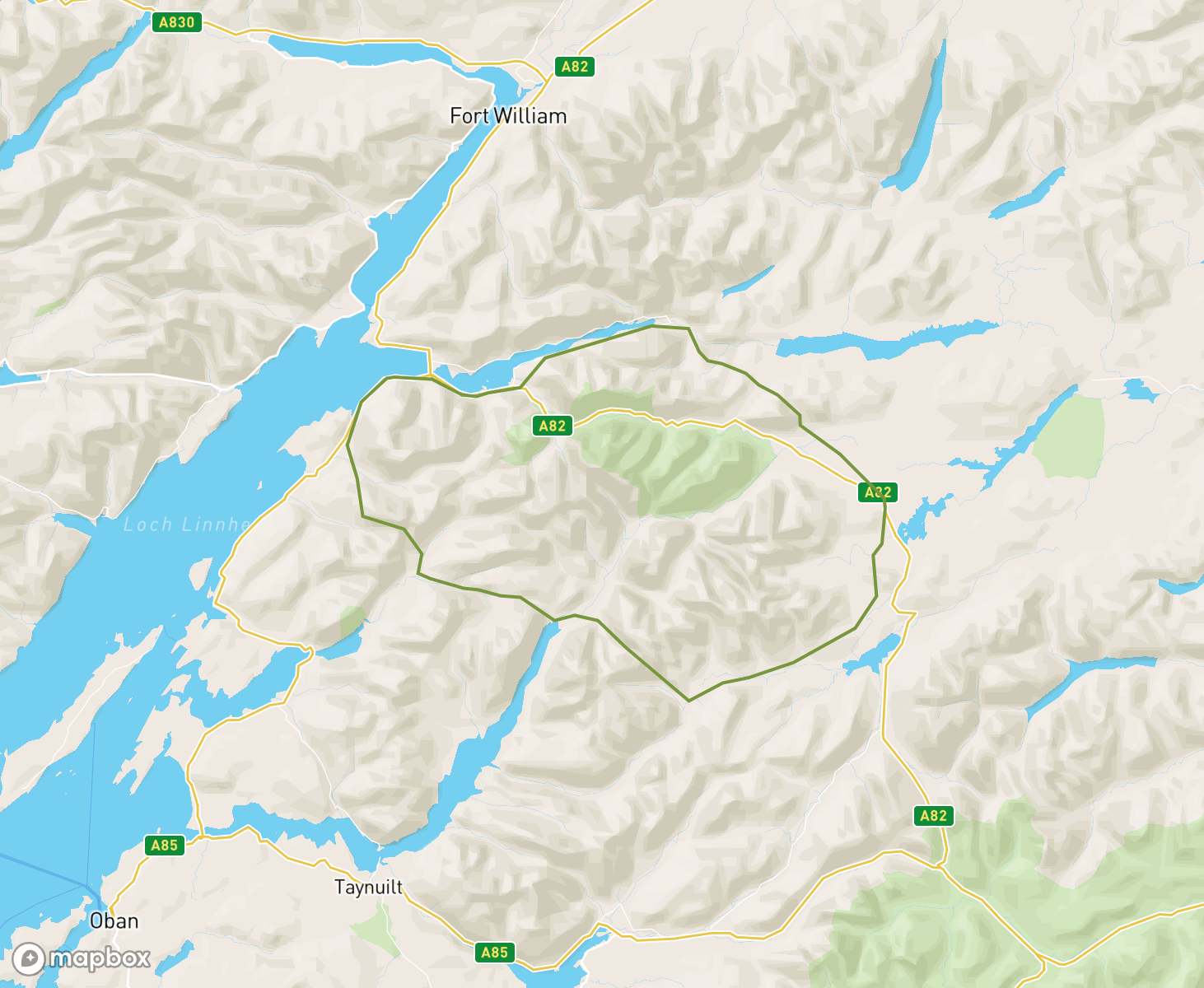
The Glencoe avalanche forecast region
When producing daily avalanche forecasts for the Glencoe region the whole area and summits as indicated on the map are considered by SAIS forecasters when writing their daily reports..
In the Glencoe region the “core” forecast area primarily visited are the mountains to the south of Ballachilish and Glen Coe from Bidean Nam Bian to Buachaille Etive Mor to the Meall a Bhuirid range. In the north, the Aonach Eagach summits . Knowledge from the core area is applied to the more outlying mountains such as the Glen Etive range to the west and the hills bordering Rannoch moor to the east where field observations are carried out in turn as the winter progresses, or specific snowpack assessments are required.
-
Becoming stormy over the weekend
Changeable conditions through the week gave a couple of windslab formation events followed by thaws to all levels. The overall effect has been a reduction of snow cover which is very noticeable at lower levels. Reasonable cover exists above 850-900 metres in the high Northerly and Easterly corries. We finish the period 2/4/26 with the snowpack re frozen and generally stable. Outlook is for new snow overnight but thawing briefly then becoming cold again through Friday with wind and snow showers.
Winter returns with the lambing snows.At the start of this period we had a stable and often icy spring snowpack. Over the weekend thaw freeze cycle occurred through till Monday all days with a Low hazard. Heavy snow showers falling on Tuesday which continuing through Wednesday on very strong South-Westerly winds. Unstable windslab rapidly formed in many wind sheltered locations along with fragile cornices mainly on and above N, NE, E & SE aspects with Moderate hazard which increased to Considerable for Wednesday and Thursday.
Fluctuating conditions...New snow fell to lower levels at the start of this period with fluctuating temperatures on strong SW winds leading to accumulations of new snow and windslab on N to SE aspects mainly above 800 metres including new cornice development. Heavy rain and warm temperatures on Monday and Tuesday produced a heavy thaw depleting and saturating much of the new and existing older snowpack. Dry, cooler condition now prevail which have consolidated the remaining snowpack leaving it firm, icy and stable.
Winter returns?A fairly limited snow cover at the start of the period was restricted mainly to the higher corries and gullies. Snow forecast for tonight 12/3/26 and tomorrow will give a more wintry feel to the area. Areas of unstable windslab will form in wind sheltered gullies and steep NW-N-E slopes mainly above 800 metres. The existing moist snowpack will re-freeze becoming firm and icy in places.
Snowpack stability generally good.This period has been dominated with several thaw freeze cycles which has maintained snowpack stability. Very little or no new snow has fallen during this period. The snowpack surface has often been very hard and icy. The last two days mild conditions have prevailed but the snowpack remains firm and well bonded on all aspects and elevations. A dusting of new snow is forecast to arrive today mainly above 900 metres. Dimishing cover at lower elevations in the spring like conditions.
Mild and wetThe start of the period had some fine weather with a widespread cover of snow and rime which led to some avalanche activity brought on by strong SE winds. New snow and SW winds resulted in more avalanche activity as snow turned to rain. The last few days of the period has been mild and wet, reducing cover particularly at lower levels. The remaining snowpack is soft and wet at all levels. Reasonable accumulations of wet snow remain in the higher NW-N-E corries above 850m. Cooler tomorrow.
Windslab avalanche activityCold snow cover above 600m though this period. On the 12/13th Feb the snowpack was generally frozen with some overlying shallow pockets of Windslab mainly on SW-NW aspects with alot of rime ice formations. Snow and very strong winds started on the 14th with new Windslab forming on NW-E aspects. Then the weather was mainly dry and bright but the snowpack remained cold with Windslab weaknesses persisting mainly on NW-NE aspects. Avalanche activity 18th Feb on NE slopes. Mild weather now forecast.
Milder Becoming Cold AgainEasterly winds have influenced the weather beginning with slightly milder conditions and higher freezing levels becoming colder towards the end of the week. The snowpack has become generally wetter and more stable with only summits getting any new snow, lower elevations thawing and diminishing. The week has ended with a few days of colder temperatures and stronger winds, refreezing the snowpack generally and fresh unstable accumulations on Westerly aspects. Calm and cold into the new period.
Wintery South-Easterly Winds ContinueThe week has continued to be dominated by a cold South-Easterly airstream bringing generally wintery conditions on the hills and mountains. Windslab on Westerly aspects at the start of the period has slowly consolidated with fluctuating freezing levels and scouring improving stability. The week has ended with a refrozen and firm snowpack at all elevations which is stable.
Wintery from the South-EastThe week has been wintery with a cold South-Easterly airstream. There has been snowfall throughout the period, initially to lower levels, and then above around 700 metres. Strong and Storm Chandra force winds have affected much of the snowpack, which has ended the period generally firm and scoured with only localised areas of reasonably bonded windslab at higher elevations. The wintery conditions continue.
WindslabA South-Eastlerly airstream was maintained throughout the period. Windslab present on start of the period gradually consolidated. A significant thaw on night of Wednesday 21st January consolidated the snowpack at all levels, leaving diminished cover at lower elevations. New windslab has started to develop this is forecast to become more widespread with significant snow forecast overnight Thursday into Friday 23rd January.
A Wintery WeekThe week has been generally wintery with additional snowfall but also some periods of thaw. Starting dry and cold, snowfall overnight on the 9th was immediately followed by rising temperatures, rain and instability. Thereafter, it has continued to snow at varying levels, increasing cover and depth especially at higher altitudes. The last few days affected by stronger winds depositing unstable windslab at higher elevations and an increased hazard.
A cold week.It has remain cold through this period with moderate winds. New snow fell to lower levels on the 2nd Jan and cold showery Northerlies continued for next few days. The old patchy snowpack, which existed on N to E aspects above 950m has remained frozen. New snow accumulations fell mostly onto bare ground but some deeper drifted snow formed above 850m. with unstable windslab in wind sheltered locations mostly on E to S aspects above 900m. Fragile cornice also exist on similar aspects and altitudes.
More wintry now....Over the past 7 days the weather has been cold and settled. The patchy snowpack, which existed mainly on N to E aspects above 950m, has been hard, icy, and stable. Last night and today (New Year’s Day), new snow fell to lower levels. New snow accumulations are generally not deep and mostly fell onto bare ground. However, where deeper deposits exist on top of the old hard, icy snowpack such as at the tops of gullies and corrie rims they are poorly bonded. New fragile cornices are developing.
Patchy snow cover.Last Friday and through the weekend some summit snow fell followed by milder conditions and rain which left a much diminished snowpack. Now the remaining snow cover is very patchy and shallow in extent, it is well bonded, firm and often icy. Largest areas remain on North to East aspects mainly above 950 metres, with the greatest areas lying mostly in wind sheltered gullies and hollows and steep coire rims. Some gully lines are only just complete. The current avalanche hazard in Low.
Fluctuating snow amountsThe season started 11th December with very limited snow cover with no avalanche hazard being observed and this continued until Tuesday 15th when new snow arrived above 750 metres. The snowpack has generally been limited in depth and extent and the fluctuating freezing levels and temperatures have quickly had a diminishing affect. The last 3 days the avalanche hazard has been low and the area has retained snow mainly in wind sheltered locations on North to East aspects mainly above 950 metres.
Thawing snowpackThe snowpack has slowly thawed and receded over the last week. Any initial instabilities soon consolidated. There are currently only limited small patches remaining, mainly in hollows and gullies on North to East aspects above 1000 metres.
Low to No HazardThe forecast week began unsettled with snow showers, at times falling above around 600 metres and strong South-Westerly winds. By the end of the weekend, with fluctuating freezing levels, further rain and then drier, the snow pack was consolidating and generally stable. The new week started damp, cloudy and mild and by Tuesday onwards high pressure has brought dry, sunny and mild conditions that continue. The thawing and diminishing patchy snow returning to 'No' hazard on Thursday.
Patches of Snow....Patches of snow exist in sheltered hollows and gullies mainly above 850 metres on Northerly aspects, today 27th March persistent rain fell saturating and further depleting these remaining, isolated patches. No avalanche hazard has been issued for the last 6 days. Tomorrow 28th March new snow accumulations are forecast, these are not expected to be significant they will generally fall onto bare ground. Deposits will be greatest on North to Easterly aspects above 900 metres.
Clear and sunny with overnight frost at most levels.The snow cover mainly consists of patches in the higher North and East facing corries and gullies. Overnight freezing for much of the period rendered the snow with a firm and icy surface. Solar warming through the day softened and moistened sun affected slopes. Snow stability is generally very good. Milder conditions are now affecting the area The snow will thaw and soften at all levels.
Unseasonably warm weather....This past week, Glencoe has been predominately dry and mild this has followed a trend of the spring like conditions of the previous week. It has got slightly colder with a slight dusting of new snow on Tuesday night, the freezing level has remain around 600 metres but mostly dry conditions have prevailed. The spring snowpack is now very patchy, refrozen, firm and often icy and is stable. The avalanche hazard has been Low throughout this last period. A new dusting of snow is expected tonight.
Diminishing snow coverMild conditions with persistent rain at all levels over the last few days have reduced the snow cover down to mainly large patches in the higher Northerly and Easterly corries and gullies. The remaining snow is soft moist and generally stable. Cooler conditions tomorrow morning may firm up the highest exposed slopes.
Challenging snow amounts..The early part of this week was mild, very wet, rain at all levels and very windy which exacerbated the situation and a lot of snow cover quickly thawed. Mid week new snow arrived and snow accumulations develop with snow lying mainly above 600m. Localised windslab deposits and cornices formed, initially NW through to E aspects above 850m.These have now started to consolidate but some snowpack instabilities persist mainly on N to E aspects above 930m. Weak cornices still exist above same aspects.
Cold Turning MildThe snowpack has been shallow and generally stable for most of the period. Dry, cold conditions with South-Easterly winds until 17th February. Localised pockets of windslab then formed with North-West to North-East aspects most affected. These deposits consolidated quickly. Mild, wet and windy conditions have now returned and the snowpack is thawing and diminishing. Stability is currently good with greatest accumulations in North and North-East facing cories and gullies.
Cold and DryThe weather has been cold and dry over the last week, with winds mainly from the South-East. The avalanche hazard has remained low with isolated areas of windslab on North to East aspects slowly consolidating and snowpack stability is now good. The snow is cover is generally shallow with greatest accumulations on North to East aspects above 800 metres. Variable snow surface, breakable crust in some locations, firm in others and water ice on many paths and in stream beds.
Fluctuating conditions.At the start of this period it was mostly cold with snow that came on very strong winds from the various storms of the week before. Then came a mild spell with rain at most levels and the snow cover depleted and snowpack thawed. Mid week a return to cool settled conditions with some fresh snow. No significant avalanche activity was recorded, the avalanche hazard was mostly low, becoming briefly moderate and now back to Low. Dry settled conditions are expected for the next few days.
Consolidating snowpackThe period started with storm Eowyn on Friday 24th bringing significant amounts of new snow on strong winds, stormy conditions and new snow continued until Sunday 26th. Windslab developed through this period mainly on North-West through North to East aspects. Since Sunday 26th the snowpack has gradually consolidated. The snowpack stability is now good, the snowpack is relatively soft with a thin crust in many places.
Dynamic Change....Past week no real avalanche hazard existed, remaining small snow patches are firm and well bonded, found mainly on N through E aspects above 900m. Now, Thursday afternoon 23rd Jan. Storm Ewoyn is approaching fast and new snow started to fall today above 400m, accumulations are currently not deep but are coming more widespread with windslab developing in wind sheltered locations mostly on NW to NE aspects above 850m. Tomorrow, blizzard conditions, new snow, unstable windslab developing rapidly.
Significant ThawThe period started as the cold conditions began to change, becoming mild with a South-Westerly air stream. The mainly shallow light soft snowpack quickly thawed with only slightly deeper accumulations initially persisting. Remaining mild, most snow patches completely melted to bare ground, only very isolated insignificant patches on the highest summits remain. There is currently insufficient snow for an avalanche hazard.
Cold with snow showers.Cold conditions and snow showers have affected the area. Soft generally stable snow exists on most aspects above 400 metres. Isolated pockets of windslab exist in wind sheltered gully exits and corrie rims with a mainly North East to South-Easterly aspect above 900 metres. These areas are localised and generally avoidable. Further development of localised windslab on Westerly aspects may occur on Friday as the winds become more Easterly. Small fragile cornices may exist in these areas.
Light cover of new snowIntense thaw conditions previously had reduced the snow cover to isolated patches. New snow on New Years eve gave a light general cover above 300 metres, strong variable Northerly winds formed isolated pockets of windslab in wind sheltered hollows. Colder conditions have formed ice on rocks paths and watercourses, exposed ground is generally scoured and is icy in places, some more snow is forecast overnight2/2/25 but quantities are uncertain. Localised windslab may form on NE-E-SE above 1000m.
Thaw conditionsThaw conditions have predominated for the majority of the period. There was a brief spell of colder weather from overnight on the 21st December till warmer conditions returned on the 23rd December. Temperatures have been particularly mild since combined with heavy rain. Now, only patchy snow cover remains in Glencoe. Largest areas of snow remain on North-East and East aspects above 900 metres in gullies and around coire rims.
Colder now with new snow...This past week has been very mild with rain and strong winds, this combination practically depleted all the snow cover leaving only isolated patches of thawing snow in very high sheltered locations. Then, late yesterday afternoon 17th December the freezing levels lowered and fell to around 450 metres, the rain turned to snow showers at higher elevations. New snow accumulations at present are generally quite shallow and fell to around 360 metres particularly at the more easterly end of Glencoe.
Storm Darragh then cold conditionsGenerally the snow cover and snowpack are quite shallow, often deeper accumulations are to be found around 700 metres. A settled high pressure system with a strong temperature inversion has affected the area for the last 6 days maintaining a stable snowpack but this has led to icy paths and frost covered rocks affecting approach paths. Milder conditions are due to come into play in the next few days.
Last summery for 2023/24New snow has arrived on several occasions during this past week but it has quickly diminished with fluctuating freezing levels and periods of heavy rain. The existing snowpack is now moist at all elevations and generally well bonded in all locations. The remaining snow cover is becoming limited in extent in the current mild conditions, some cornices still remain mainly above North to Easterly aspects. Greatest snow amounts can be above 850 metres on North to Easterly aspects. Hazard is now Low.
Settled conditionsMainly Easterly winds throughout the period. Mostly dry with some light snow showers on the summits. Any fresh snow accumulations consolidated quickly in the settled conditions. There is currently snow cover on all aspects above 850 metres with deeper accumulations mainly on North to East aspects.
A Wintry week, Spring being made to wait.The week started with Westerly snow showers giving a Considerable Hazard on mainly Easterly slopes above 800 metres. Following that it was largely dry with freezing levels below the summits. The snowpack consolidated, and by mid week, winds had shifted to a mainly Easterly direction. There was some fresh snow deposition on Westerly slopes in the later part of the week. Freezing levels rose to summit levels by the end of the week with consolidating snow and Low hazard level.
Changable but Generally MildThe week started with several days of fluctuating temperatures, with some limited new snow and consolidation. Wetter and mild thereafter the snowpack has been predominantly soft and wet, generally diminishing. The end of the week has seen a return to winter with new snow and unstable windslab forming which is expected to continue into the start of the next week.
Stable Snowpack.This past week its been predominantly dry, freezing levels hovering at around 800 metres. Snowpack has been quite moist but generally stable in most locations, new snow amounts have not been deep or extensive. Tuesday 12th March during the night the freezing level rose well above the summits and rain saturated the snowpack and depleted snow cover at lower elevations. Recent cooler conditions have consolidated the snowpack which is now stable, greatest amounts remain on N to E aspects above 850m.
Starting to feel Spring LikeIt has started to feel a bit more Spring like in the past week. There was some snow over the first few days, with one avalanche being recorded just to the South-West of the area. However, through the latter part of the period the weather was settled with the freezing level fluctuating around or a bit below the summits, during which time the snowpack slowly consolidated. Little snow remains below about 700 metres.
Mostly WinteryMainly dry, the colder conditions continued into the start of the period with accumulations of redistributed unstable windslab persisting. Turning milder and wetter later in the week, with freezing levels at times rising above the summits, the still limited snow pack has consolidated at most levels. The last few days have seen fresh snow above 500 metres and very strong winds building accumulations of new unstable windslab at higher elevations.
All ChangeFor the majority of the week the freezing level has been above the summits with rain at all levels. Any periods of colder temperatures and snow have been very brief. Thaw conditions have dominated and the older snowpack is very much diminished. Temperatures have now fallen and the older snowpack is frozen and stable. New accumulations of unstable windslab have developed on North to East aspects above 800 metres. It is forecast to remain cold with further windslab developing in these locations.
Stabilising cycle.A week ago the snowpack was limited in extent and stable. Snowfall since then has generally increased on a daily basis and unstable windslab continued to developed mainly above 850 metres mostly on North to Easterly aspects. Avalanches occurred during this period. During the last 2 days the snowpack has started to consolidate as mild conditions have affected the area. Currently, isolated wet snow instabilities exist in deeper accumulations mainly on North to Easterly aspects above 900 metres.
Continuing UnsettledThis period began with further fluctuating freezing levels and temperatures. Monday was significantly wet and mild with notable snow thaw and loss of cover. It then turner colder and drier for the remainder of the period with some light snow fall. The snowpack is currently frozen and hard with isolated soft snow accumulations.
Fluctuating freezing levels and temperatures....This past week has generally been very unsettled, fluctuating freezing levels and very strong South-Westerly airflows. Mostly rain has fallen, any new snow amounts have been light and often blown away in the gale force South-Westerly winds or thawed, this combination has limited deep snow deposits from forming. Lower slopes below 650m are generally devoid of snow, above 800m there is a spring snowpack. The past six days including today the avalanche hazard has been Low. Mild for next few days.
Turning milder.A stormy unsettled week with a general trend towards milder conditions. There was a fair bit of fresh snow during this transitional period, but also rapid consolidation of the snowpack as it went through a number of thaw freeze cycles. A number of avalanches, some quite considerable in size and both natural and human triggered were recorded. Toward the end of the period, the snowpack was wet at all levels and stability generally good.
Cold snowpack instabilitiesCold temperatures and Northerly winds this past week have maintained snowpack weaknesses for a few days. Weakly bonded windslab in lying on an old icy refrozen crust layer and deposits are reactive.Accumulations are generally shallow in localised wind sheltered locations above 850m. In the next few days a change in strength and wind direction accompanied by further snowfall will redistribute and form further snowpack instabilities mainly on NW to E aspects above 850m. Cornices are also unstable.
Cold with good stabilityIt has been cold throughout the period and the snowpack has become firm and stable. There is a very thin layer of soft snow above 950 metres.
Windslab now consolidatingFor several days up to 2nd January winds varied repeteadly between East-South-East and South-Westerly, producing windslab accumulations on West through North to East aspects above 850 metres. More recently a gradual thaw and consolidation has taken place. Temperatures are due to drop slightly and consolidation will continue giving a generally stable snowpack.
New snow instabilities....This last period was dominated by strong winds and unsettled conditions and limited snow cover. Light snow falls in the early part but accompanied by widespread thaws, then storm Gerrit arrived on Wednesday 27th which gave snow to lower levels and the start snowpack weaknesses at higher elevations. Snowpack instabilities are now present mainly above 900m on N to E aspects particularly in steep sheltered locations like coire rims and sheltered gullies. Fragile cornices exist above similar aspects
Dustings of snow coverSince mid December the Glencoe mountains have had several very light snow falls these have then been affected by a few cold then thaw cycles. Also, very strong winds have been a major feature during this period these have blown any new snow falls to lower levels which then thawed. Currently a very limited snow cover exists at any elevation this amounts to a dusting over the highest tops with no deep or extensive snow accumulations present. No avalanche hazards have been issued.
Lambing snows.The period started with settled Spring weather and a fairly limited snow cover mainly in the higher North and East facing corries. A dump of snow on Wednesday with further showers overnight has given deposits of windslab on North-West to East aspects above 850 metres. Triggered cornice collapse recorded on a Northerly aspect at 850 metres 13/4/23 Further snow showers are expected on Friday further windslab development initially but fluctuating temperatures will aid the consolidation process.
Much reduced and diminishing snowpackThe remaining snowpack is generally stable throughout, some area are firm particularly on higher exposed slopes elsewhere moist, soft snow exists. Greatest accumulations of snow remain in the high Northerly and Easterly corries. Tomorrow, Good Friday the snow surface will be firm and icy after an overnight refreeze then softening where exposed to direct sunlight during the day. Greatest snow amounts remain above 900 metres in gullies, around some corrie headwalls. Avalanche hazard Low.
Diminishing moist snowpackSome new snow fell through the week giving minor surface instabilities but the general trend has been for an overall reduction in snow cover with rising temperatures and some fairly persistent rain at times. The current snowpack is moist and is generally stable throughout, some firm areas of older snow exist particularly on higher exposed slopes. Greatest accumulations of snow remain in the high Northerly and Easterly corries. Outlook is mild and moist at times then cooler on Sunday.
A wee bit more wintery on the higher slopes.The first half of the period mild and wet at all levels, over the last couple of days there has been some new snow on the higher slopes. Outlook is for more snow on the higher slopes mainly above 900 metres. Unstable windslab will exist in sheltered locations and the old snowpack where exposed will be firm and icy at higher elevations. At least it looks more wintery on the higher tops than it did this time last week!
ChangeableThe period started cold, dry and settled. Milder from Sunday and for a few days, increased precipitation and variable winds bringing rain and snow, and forming variable windslab instabilities. The period ended with snow down to sea level. Then on Thursday the freezing level rose above the summits leading to a thawing snowpack at all elevations with wet snow instabilities on steep ground. This is expected to continue until cooler conditions arrive on Saturday night.
ColdIt has been a cold, settled period with light winds and a little light snowfall. The older snowpack has been firm and stable. Fresh snow amounts have not been significant.
Stable snowpackHigh pressure has brought a week of dry, settled conditions. The snowpack has been well bonded and stable, mostly very firm with some softening in the sun. Greatest snow amounts are in high North and East facing corries.
Snow cover remains limited.Greatest amounts of snow remain in the higher Northerly and Easterly corries. On Thursday stability is generally good with the odd shallow surface instability on the very steepest slopes and gullies. Outlook is milder with light drizzle/ sleet overnight becoming colder and dry on Friday. Isolated generally avoidable surface wet snow instabilities may initially exist in gully exits and on scarp slopes, cooler and drier conditions later will refreeze the snowpack improving overall stability.
Limited stable snowpack.Greatest amounts of snow remain in the higher Northerly and Easterly corries. On Thursday stability is generally good with isolated areas of shallow surface instability on the very steepest slopes and gullies. Outlook is mild and wet overnight becoming cooler on Friday with light snow showers which will form isolated generally avoidable areas of windslab in gully exits and on Easterly scarp slopes, elsewhere with cooler and drier conditions the old snowpack is expected to be stable.
Stable diminishing snowpackThe snowpack has remained stable for the period. There have been cycles of thaw and refreeze and the remaining snowpack is firm and stable. The snowpack has gradually diminished with greatest accumulations remaining in North and East facing corries and gullies. Shallow windslab that has developed overnight and today will consolidate tomorrow (Friday) as thaw conditions return again giving a return to a stable snowpack by the end of the day.
All changeCold conditions at the start of the period with widespread firm snow were followed by new snow and strong Westerly winds at higher levels, thaw conditions overnight (1/2/23)with heavy rain have reduced much of the superficial cover with the main accumulations of remaining snow now in the higher Northerly and Easterly corries and gullies, less damp conditions are expected for Friday which will aid the consolidation process.
Consolidation...This period started with cold conditions with unstable windslab present mainly on North through East to South aspects above 850 metres, some avalanche activity was recorded during the first part of this period. On Monday 22nd a thaw started affecting all levels followed by a gradual consolidation of the snowpack which is now depleted but well bonded and a Low hazard level. Currently the main snow cover is mostly above 750 metres on North to Easterly aspects which is refrozen, icy and stable.
In depth weaknessesNew snow at the start of the period formed areas of unstable windslab in gullies and slopes with a mainly Northerly and Easterly aspect, during this time several avalanches were recorded on the higher slopes. Cold conditions through the week maintained in-depth weaknesses within this windslab. Southerly aspects were affected but to a lesser extent later in the period as new snow arrived on strong North-Westerly winds. Windward and exposed slopes are generally stable becoming icy in many places.
Poorly bonded snowpack.Fluctuating temperatures through the past 7 days and varying amounts of new snow and strong winds have resulted in a poorly bonded snowpack particularly in steep wind sheltered locations. During the 7th to 12th January windslab has continued to accumulate, mainly on North to East aspects above 850 metres, this has remained generally unstable, NW and SE aspects are also affected due to cross loading winds. Also, fragile and unstable cornices exist above many of these aspects.
Mild and wet.New snow at the start of the period and some fine weather gave the glen a very wintery feel. The second half of the period has been mild and wet, reducing cover particularly at lower levels. The remaining snowpack is soft and wet at all levels. Greatest accumulations remain in the higher Northern and Easterly corries above 900m. Colder tonight the older snowpack will refreeze, some new snow is forecast but amounts are uncertain unstable windslab will form in sheltered gullies and N-E-SE aspects.
Fluctuating temperaturesThe period started cold with fresh snow, a heavier fall of snow affected the area on the 27th followed by a thaw at all levels, new snow today has formed areas of unstable windslab in sheltered gullies and slopes with a North to Easterly aspect mainly above 850 metres. Outlook is for more snow with freezing level rising briefly above the summits. Unstable windslab will exist in sheltered locations and the old snowpack where exposed will be firm and icy at higher elevations.
Getting colderThe period started out cold with some heavy snow showers falling initially giving a reasonable cover and a generally wintery feel to the area. A period of thaw on Monday reduced much of the cover which is now mainly in the higher Northern and Easterly corries and gullies. Colder conditions overnight developed a breakable crust in many areas. Old exposed snow is firm and icy in places with verglas forming on exposed rocks above 100 metres. Outlook for Friday is dry, cold with strong East winds.
Cold Clear and CalmOvernight, there was a smattering of light new snow. It has been cold and clear for the last week and these conditions continued through today. It has been dry and calm any winds were very light generally N-Easterly. Tomorrow new snow, accumulations of new unstable windslab will develop on steep sheltered North-West to North-Easterly aspects, especially around the tops of gullies and coire rims, mainly above 800 metres. On West and East aspects some localised deposits may also develop above 800m
Diminishing moist snowpack...The final summary of the season: The week started with shallow localised windslab forming mainly on NE to SE aspects above 900m. Over the weekend the freezing level rose above the summits and since then the snowpack has continued to slowly thaw and diminish at all levels, but it has remained generally stable. Some localised surface instabilities will still exist in steep summit gully exits and around steep corrie rims mainly on N to E aspects above 1000m. Remaining cornices are unstable.
Colder than average...This past week was unsettled with some very light snowfalls but mainly freeze thaw cycles and a thawing snowpack. Then, last 2 days artic maritime conditions brought colder temperatures and some light snowfall falling to lower elevations but with fluctuating temperatures yesterday. The snowpack froze last night then new accumulations of windslab have formed in wind sheltered locations mainly on N through E to S aspects above 900m. Other aspects currently have a cosmetic dusting of new snow.
Stable snowpackPast week was very settled with no precipitation and plenty of sunshine. First few days were generally warm and sunny, the freezing level then dropped, it has been much colder the last two days. The snowpack was generally moist and soft when it was warm, then more recently it turned very hard and icy as the temperatures dropped. Snowpack stability was generally good with the avalanche hazard being Low throughout. The snowpack is hard and icy giving serious consequences in the event of a slip.
Warm and SettledIt has been a warm and dry week with plenty of pleasant spring sunshine. The freezing level has been above the summits throughout. The spring snowpack has generally been stable and the avalanche hazard low. Some cornices remain at higher levels, and these have been slumping and prone to collapse in the warm conditions.
Stable start followed by some fresh snowThe period started with a stable snowpack with only shallow deposits of fresh snow. From Wednesday windslab developed on North to East aspects above 900 metres. This will to gradually consolidate with fluctuating temperatures, however instabilities are currently present on North to East aspects above 1000 metres.
A stable start and end to the weekThe period started with a stable snowpack which was mostly frozen and firm. During the middle of the week some fresh snow and fluctuating temperatures gave windslab and wet snow instabilities mainly on higher North-West through North to East aspects. The snowpack has now consolidated again, is stable in most locations and continues to gradually thaw.
Spring snowGenerally the snowpack has consolidated during this past week particularly in the latter half of the period. The snowpack is now generally stable throughout, it is generally firmer at higher elevations. Most snow exists on North through East to South-East aspects above 650 metres below this elevation the snowpack is patchy and diminishing. Tonight the snowpack is expected to re-freeze becoming icy in many places. Approach paths and rocks will also have verglas in some places.
Temperature cycles then colder weather.The period began with strong Westerly winds and heavy snow showers. There were three temperature cycles during the latter half of the period, to around summit level. Finally, it turned colder with snow to all levels. The temperature cycles consolidated the older snowpack, but the recent snow on Strong, mainly Westerly winds have deposited fresh unstable windslab on North-East to South-East aspects in wind sheltered locations. Unstable cornices have also formed on these aspects.
A windy end to the weekWet and milder for the first half of the week becoming cold with strong winds and new snow. Many windward slopes have been scoured with drifting onto Easterly aspects. This has formed unstable windslab in sheltered gullies and on slopes with a mainly North through East to South East aspect. Unstable cornices have formed above many of these aspects. Outlook is remaining cold with light snow showers overnight and on Friday,
Generally coldIt was generally cold with frequent snowfall and winds were mostly strong and from a South-West to Westerly direction. This has led to windslab being present on North through East to South-East aspects for most of the period. The exception was Monday when the freezing level was well above the summits and heavy rain caused a significant thaw.
Wintry conditions return.Until today, the period has chiefly been warm with a stable snowpack that was much diminished. Fluctuating temperatures re-froze the isolated snow patches at higher elevations, new snow fell on two occasions but thawed. Last night, new snow mainly above 300 metres accompanied by very strong Westerly winds. Snow showers continued today with drifting at higher elevations. Windslab is developing on N to SE aspects which is currently localised but it is expected to become deeper and more extensive.
Mild and wet but getting colder.Some new snow affected the area during the first half of the period then a return to very mild and wet conditions through the second half has reduced snow cover at all levels. Greatest deposits now exist in the higher North and East facing corries and gullies. Much colder conditions over Thursday night and through Friday will give frequent snow showers with a strong Westerly airflow. Unstable areas of windslab will form in sheltered gullies and on N-E SE aspects mainly above 850 metres.
Patchy but stable snowpackFluctuating temperatures gave dustings of fresh snow at times but the colder periods were generally fairly dry with the heavier precipitation falling as rain in the warmer conditions. This has lead to an overall loss of snow through the period. Greatest snow cover is to be found in gullies and hollows on North to East aspects above 900 metres. The snowpack has remained well bonded and stable throughout the period.
Limited but well bonded snowpackA fairly mild start to the period was followed. by colder but mainly dry conditions. The limited snowpack mainly exists in the higher Northerly and Easterly corries, it is firm icy and generally well bonded. Milder conditions expected on Friday, snowpack will remain stable and icy in places.
Diminishing snow coverThe period started with fresh snow and instabilities in windslab on North-West through North to East aspects above 800 metres. On Monday there was increased instability in these areas as the freezing level rose and precipitation turned to rain. The mild and wet weather has continued since and the snowpack has gradually consolidated and diminished through the week. The snow cover is now becoming increasingly patchy with greatest amounts remaining on high North to East facing slopes.
More wintery than of late.Initially mild, wet and windy conditions with a limited patchy snow cover mainly restricted to the higher N and E corries and gullies. Colder and more wintery conditions over the last few days have affected the area giving a generally light cover of new snow at most levels. Rain, sleet and snow today (6th Jan) along with strong Southerly winds are forming unstable windslab in summit gullies and higher slopes. More snow forecast will develop further instabilities on slopes above 800 m.
Depleted snow pack...During the past 7 days fairly cold temperatures at first, with some light snow showers, this gave a shallow blanket covering of snow, mainly above 650 metres. Several days of temperature inversions often colder in the valleys than at altitude maintained the shallow snow cover. Mild conditions started to affect the area on the 29th December. A big thaw on the evening of 29th and morning of the 30th with heavy rain and strong SW winds and high temperatures rapidly depleted the snowpack.
Snow cover still limitedDry conditions have affected the area with a strong persistent temperature inversion. The limited snowpack is very firm and icy and is mainly in the higher Northerly and Easterly corries and gullies above 850 metres. Precipitation is forecast with rain, freezing rain sleet or snow likely.
Mild with limited snow coverA reasonable cover of snow at the start of the week this has largely disappeared from lower levels, greatest snow accumulations which are quite patchy now remain in the higher Northerly and Easterly corries and gullies mainly above 900 metres. Remaining areas are soft and moist but stability is generally good. Avalanche Hazard is currently Low.
Good snow coverOver the last week, periods of snowfall followed by some milder episodes but snow cover remained good above 350 metres. Snowpack stability, was generally good but moderate for periods after any new snow fall. Snow cover was shallow at lower elevations with some deep drifts above 850 metres. Currently ,deposits of unstable windslab are present at the tops of slopes and in sheltered gullies mostly on North to Easterly aspects above 950 meters. These areas are generally localised and avoidable.
Spring SnowpackThe snowpack has gone though several freeze thaw cycles and is now generally well bonded and stable in most locations.This 'spring snowpack' firms up overnight and then surface layers soften during the day, particularly on sun exposed slopes at all altitudes, shaded areas a firm, icy snowpack persist. In the afternoons, steep North to South-Easterly aspects are currently affected with surface instabilities above 850m.On sun exposed slopes, glide cracks will become wider in the coming days ahead.
Artic Northerly air streamsAt the start of this period the snowpack was wet and much depleted, then a return to much colder conditions with artic air flows the snowpack refroze became stable, firm and icy. Light accumulations of new snows arrived over 3 days forming shallow windslab on E to SW aspects, but the older refrozen snowpack remain predominate. Last night mild conditions affected the snowpack. Today, after rain, new snow instabilities above 800m forming moderately bonded windslab on N to SE aspects above 800m.
Mainly mild and wet through the week, cooler and drier outlook.Very mild and wet conditions through much the week have affected the area, this has reduced snow cover at all levels. Greatest deposits now exist in the higher North and East facing corries and gullies. Cooler conditions expected over the next few days will firm up remaining deposits of snow giving potentially icy surfaces in shaded areas such as summit gullies and recesses. General stability is good but any remaining cornices will be prone to collapse with rising daytime temperatures.
A period of reasonable stabilityAt the start of the period the snowpack was generally stable, consolidating with melt freeze cycles due to solar radiation during the day and cold over night temperatures. Greatest snow cover remains on North to East aspects above 850 metres with more patchy cover at lower elevations. The last two days, more unsettled wintry weather, new snow with lower temperatures and strong South-Westerly winds have resulted in new windslab instabilities mainly on NW to E aspects above 800 metres..
Wintery start to the week milder now.The period started out very Wintery with new snow and cold conditions. This gave rise to some avalanches and cornice collapses. Since then a change to settled mild and occasionally sunny weather has stabilised and reduced the snowpack at lower levels Greatest accumulations now mainly exist in the higher Northerly and Easterly corries and gullies. General snow stability is good on all but the steepest slopes where surface instabilities are a possibility. Cornices collapse and rockfall a hazard.
Becoming more WinteryThe older snowpack has re-frozen and is mainly stable after a general thaw during the earlier part of the report period. Blustery snow showers have formed localised areas of windslab in sheltered gullies and on North to Easterly aspects mainly at higher levels. Further development of these windslab areas expected with snow showers heavy at times and strong West-South-West winds forecast for Friday.
Well consolidated snowpack.The last 7 days have been dry and settled, cold nights, winds, mainly light Easterly. At the beginning of this period some residual accumulations of moderately bonded windslab persisted on N to SE aspects above 950m. With a rise in temperature these accumulations consolidated, after this gentle thaw colder conditions stabilised all the snowpack in all locations. The snowpack has been generally firm and stable for the last 4 days, often icy in places. Sun exposed slopes softening after mid day.
Fluctuating temperaturesSignificant loss of snow at lower elevations. At higher elevations, several periods with instabilities in fresh windslab were fairly short lived with rain and rapid warming causing a few avalanches but melt/freeze cycles then causing the snowpack to stabilise fairly quickly.
Persistent instabilities.From 11th to 13th Feb. Considerable hazard, cold conditions maintained deep instabilities in the snowpack. Instabilities were hard packed windslab mostly on W to N aspects above 800m, SW and NE aspects affected to a lesser extent. Afternoon 14th mild conditions affected the area but deep instabilities persisted. A thaw at all levels then a slight freeze took place on 16th also new snow that day on frozen snowpack with further light snow on 17th and 18th = Moderate hazard. 19th mild in all places
Cold with Easterly windsIt was cold throughout the period. Strong Easterly winds and snow showers at the start of the period were followed by dry, sunny weather and moderate East-South-Easterly winds. Unstable windslab accumulated in wind shetered areas with weakness persisting in the cold temperatures. Windward slopes have been generally scoured and stable.
Weakly bonded snowpack.This period has been dominated by a cold Easterly airstream, very strong winds and new snow above 150 metres. Snow cover is extensive lying mostly above 250 metres, deepest accumulations on SW to N aspects, progress on foot difficult at times. The snowpack consists of multi layering, weakly bonded on sheltered aspects above 700 metres. The avalanche hazard as been considerable throughout this period. Areas of widespread windslab are currently present on SW to N aspects and avalanches are likely.
Good snow cover on higher slopesSnow of varying quantities has affected the area over the period with some of the falls affecting all levels. A cornice triggered avalanche was recorded during a brief overnight thaw period on 26th-27th. Currently there is a good cover above 700 metres with new snow affecting the area today and tomorrow Unstable windslab exists in many sheltered areas but with current Easterly winds particularly SW-W-N aspects but also in sheltered gullies. Cornices are weakly bonded.
Unstable windslabThis period has mostly been cold, one thaw freeze cycle on the 16th Jan. Snow cover is generally good. Accumulations of windslab have persisted and continued to develop mainly on NW through to SE aspects above 800m. Snowpack instabilities on NW to NE aspects have now partially consolidated due cold, calm conditions. New snow on 21st Jan and strong WNW winds have deposited unstable windslab mainly on steep NE to SE aspects where avalanches are likely. Snowy conditions to continue for a few days.
Variable conditionsThe period started with very cold and dry conditions and a reasonable snow cover. There was then a significant thaw and heavy rain at all levels. The freezing level then dropped to low levels, generally consolidating the snowpack throughout. Subsequent snowfalls have given windslab accumulations in various steep aspects at higher elevations with fresh snow to low levels again today.
Cold conditionsLight new snow arrived at the very start of this period falling above 200 metres. This added to a good distribution already existing on all aspects, albeit a fairly shallow snowpack. Windslab instabilities persisted in steep locations above 900m particularly steep gullies and exits largely on N to E aspects. Persistent cold conditions maintained instabilities in the snowpack to date. New snow on 7th January formed shallow instabilities mainly on SE to SW aspects more expected to form on 8th Jan.
Winter snows arrive....On Friday 25th Dec freezing levels rose above the summits this was followed by much colder conditions the snowpack re-froze then new deposits of snow fell to 100m giving blanket snow cover. Unstable windslab developed mainly on North to East aspects above 900 metres, then wind directions varied for 3 days forming new localised windslab on all other aspects. Snowpack is still generally shallow particularly at lower levels. Above 840m the snowpack is currently moderately bonded to NW to E aspects
Localised hazard developingThe first half of the period saw the limited snowpack continue to consolidate. Snow showers then gave localised windslab deposits mainly on high N to East aspects with a little wind redistribution to South-East and South aspects at the end of the period.
Generally MildWinds from between South-East and South-West have led to a mild week. The freezing level has generally been close to summit level and while there has been some snow at higher levels there has also been rain and overall there has been a reduction in snow cover. Stability is generally good as fresh snow has consolidated quickly in the mild conditions.
Limited snow cover.A snowy and cold start to this week - it looked like winter had arrived albeit a thin cover! Localised areas of shallow windslab instabilities developed on some higher slopes mainly on North-West through to South-East aspects. These windslab instabilities have now consolidated as milder conditions affected the area. Freezing levels have remain quite high for the last few days and the shallow snowpack continues to consolidate and slowly thaw at most levels.
Becoming more settled than of lateSnow cover has been generally building at higher levels through the week with one or two thaw periods giving rise to periods of higher instability triggering wet snow events. At present (19/3/20)the older snow is firm and icy where exposed with areas of deep weakly bonded windslab in sheltered gullies and on N-E-S slopes mainly above 800 metres. Cornice collapse noted today with rising temperatures. Outlook more settled which will aid stabilisation but deep windslab will remain weakly bonded.
Very Wintery, weaknesses will persist in deep windslab.A major thaw at the start of the period saw numerous wet snow avalanches occur. Since then stormy, windy conditions and frequent snow showers have led to several avalanches some corniced triggered. Most recently a heavy fall of snow overnight and today has built up some deep accumulations of windslab in sheltered gullies and on North to South-Easterly aspects, outlook for Friday dry settled and sunny but weaknesses will persist in areas where deeper windslab exists.
Avalanche ActivityDuring the first part of this period significant snow fell above 300m accompanied by strong winds forming unstable windslab mainly on North-Westerly through to South-Easterly aspects above 700m. Other aspects have large amounts of moderately bonded snow on steeper slopes. Numerous avalanches have been reported and logged in this area. Last 3 days, generally dry and cold so instabilities have persisted in the snowpack and avalanche activity continues to date. Large unstable cornices also exist.
Complex pictureThe period started with freezing levels rising and some lingering instabilities. An icy surface crust formed on wind scoured terrain features. By mid week we have had variable winds with significant amounts of new snow and strong winds building unstable wind slab on to wind sheltered terrain. The freezing level has been low and now rising to around 400 metres. Also some weaknesses remain within snow pack, cross loading is evident and cornices are fragile. The hazard is Considerable.
A stormy week.....WindslabThe main theme strong WSW winds. Storm Dennis, exceptional winds with mild conditions.Then, frequent wintry showers most days interspersed with short mild spells leading to melt freeze cycles. Windslab has formed mainly on NW to SE aspects, consolidating at times, new areas have continued to form over the last 4 days. Tomorrow, rising freezing levels and temperatures along with significant rainfall leading to wet snow avalanches that are likely on N to SE aspects above 800m leaving wet snowpack.
Stormy week with a brief respite on ThursdayStormy conditions with snow, strong winds have affected the area. Deep moderately bonded windslab exists in sheltered gullies and on Northern and Easterly aspects above 850 metres. Very strong South to South-Westerlies have rendered many windward slopes scoured or with just a superficial covering of snow. Exposed old snow is very firm and icy. A stormy outlook for the next few days will increase the hazard as a brief mild wet spell affects the area on Friday, beyond that Storm Dennis the Menace
Stable snowpack.During this period significant thaws took place at most levels but also light snow showers fell to low levels leading to a temporary increase hazard. Snowfalls have generally been light in volume but windslab formations developed at higher elevations in localised pockets mainly on North to East aspects. The hazard level was generally Low except on the 3rd Feb. Most snow remains above 800 metres on North to East aspects above 800 metres. Snowpack stability is now generally good in all locations.
The period ended very wet and mildMild conditions at the start of the period, snow cover was generally spartan. More Wintery conditions arrived on 26th January. The snow cover started to build over the next few days when at times it was down to sea level but all change today (Thursday) as a return to mild and very wet conditions this has reduced cover particularly at lower levels. The remaining snowpack is soft and wet at all levels. Greatest accumulations are to be found in the higher Northern and Easterly corries above 900m.
Started Wintry now Mild conditions.A week ago localised areas of windslab existed and continued to develop on North to South-East aspects mainly above 850 metres, these conditions existed for four days. Mild conditions started affecting the area on Monday 21st, since then the snowpack has thawed, consolidated and diminished. Now, most snow exists on steep coire head walls, in sheltered gullies and ridge flanks on North to East aspects mainly above 850 metres. Mild, changeable conditions forecast for next 2 days then more wintry.
Stormy conditions have affected the area for much of the week.Stormy conditions with much rain and wind have affected the area, a return to more Wintery conditions over the last few days has increased the snow cover but its still mainly to be found in the higher Northern and Easterly corries and gullies. Very strong South to South-Westerlies have rendered many windward slopes bare and scoured. Outlook is colder with snow showers, the older snowpack surface will start to re freeze with areas of unstable windslab in sheltered locations .
Limited moist snowpack.The snowpack was thawing and was very much depleted during most of this period. Recently, (last 2 days) drier, colder conditions refroze the moist patchy snowpack remains and light new snow arrived mainly above 500 metres on strong South-Westerly winds. Currently, localised areas of shallow windslab are present mostly on North to Easterly aspects above 900metres. Tomorrow evening (Friday 10th) mild conditions with heavy rain will again reduce the snowpack.
Mostly mildThe period started with warm and windy conditions and a thawing but generally stable snowpack. There were colder conditions on Monday and Tuesday when the snowpack froze hard. Warm, wet and windy conditions to end the period leaving a patchy but generally stable snowpack with greatest amounts to be found in gullies and hollows, at tops of scarp slopes and around corrie rims on North to East aspects above 900 metres.
Generally stableFollowing a thaw on the 19th December the snowpack gradually consolidated. Localised windslab has been present on North to East aspects above 950 metres since the 23rd December. Elsewhere the snowpack has remained well bonded and generally stable.
Mild conditions.This past week we had a blanket of snow cover above 300m. Drifting took place above 800m giving unstable windslab deposits on NW through to E aspects. Avalanche activity took place on 14th December on Northerly aspects. Last night mild conditions affected the area, freezing level rose above the summits with periods of rain and avalanches reported on Northerly aspects. The snowpack is thawing with instabilities persisting on steep NW through to East aspect above 850m. Cornices remain unstable.
SAIS - Glen Coe forecasting begins againSnow cover is present mainly above 450m although snow fell down to 300 metres. Some drifting above 850m giving deeper soft accumulations in sheltered locations. Localised windslab deposits present mainly on North-West through to Easterly aspects. Greatest accumulations are in steep sheltered locations mostly above 880m, with corrie rims, gully exits and steep convexities particularly affected. Cold, showery conditions will persist for the next few days leading to further windslab development.
Slow gradual thawThe period started out quite stormy with new snow on higher slopes. Since then a change to settled mild and sunny weather has stabilised and reduced the snowpack. Greatest accumulations now mainly exists in the higher Northerly and Easterly corries and gullies. Frosty conditions overnight are firming up the snow surface with a slow gentle thaw softening sun exposed areas. In shaded recessed gullies and hollows the surface of the snowpack is generally quite firm.
Spring changeable conditions but a tad wintryAt the beginning of this period we had a spring like snowpack which was stable, then milder conditions began, the snowpack thawed. Recently, colder conditions re-stabilised the older snowpack. This was followed new snowfall and strong variable winds forming moderately bonded windslab on different aspects. Currently, windslab is mainly localised but affects South through West to North aspects above 900m. Ridges and wind exposed locations have areas of wind scoured snow ice which is often icy.
Mild and dampMild and damp conditions through the week have affected the snowpack reducing cover particularly at lower levels. Greatest deposits exist in the higher North and East facing corries and gullies. The snowpack is soft and moist with generally good stability. Colder conditions are expected to return on Friday night with possibility of snow.
Snow then ThawAt the start of this period snow amounts and conditions were almost the norm for a mid March winter. Strong winds formed unstable windslab in many sheltered locations during Friday through to Sunday mainly on NW through to SE aspects. Numerous avalanches were recorded during the week-end, after which thaw conditions have affected the area which increasingly depleted the snowpack. Currently a moist snowpack exists which hopefully is set to re-freeze and with a forecast of new snow fall.
Snowiest week so far.This week has been by far the snowiest week of the winter so far. At higher levels snow fell daily with winds from between the South and the West. The amount of snow at higher levels is now approaching more normal value for the time of year. The observed hazard has been considerable for most of the week, dropping to moderate today (Thursday) due to consolidating overnight thaw/freeze cycle. A number of natural avalanches were recorded over the weekend and then again on Wednesday.
A bit more like winterThe weather has gradually become colder in the last week although still very changeable with the freezing level fluctuating quite a bit. This has helped stabilise the recent snow which has consistently fallen since the 2nd March. Due to the fresh to strong winds there has been some deep accumulations mainly on North to East aspects above 850 metres. However recent Northerly winds have also affected South facing slopes with some build up of localised deposits on these aspects.
Mild and spring like.Mild conditions have affected the area through the period with the freezing level well above the summits. The snowpack is patchy and mainly exists in the higher North and East facing corries and gullies above 900 metres. Stability has been generally good.
Generally MildIt has been mild with a generally stable and diminishing spring snowpack. There was some fresh snow at higher levels on Monday and Tuesday. However, this soon consolidated in mild and wet conditions on Wednesday. Overall there is little snow on the hills for the time of year.
Now very mild.Good weather and nice cold conditions with a good snow cover on Sunday 10th and Monday the 11th. This was followed by mild, wet conditions with the freezing level well above the summits. The snowpack has been slowly thawing and consolidating for the last three days at all levels, however stability is generally good but with some localised wet snow instabilities on steeper North-West through North to Easterly aspects.
A bit more Wintery but we still need more!The period started out with a Wintery appearance but much of the snow cover was light powder and fairly superficial. A couple of brief thaws followed removing lower snow and leaving a widespread breakable crust above 700 metres. New snow and mainly South-Westerly winds have formed areas of poor bonded windslab in sheltered gullies and North to Easterly aspects mainly above 900 metres. Milder conditions on Friday with sleet will see wet snow instabilities develop in areas where windslab exists.
Slow return to winterThe period started off with wet and mild conditions which stripped back much of the snow cover. This was followed by a reasonable fall of snow which came in on a strong Northerly wind, further falls of new snow have given the Glen a very seasonal feel but much of the cover is soft and unconsolidated with no underlying base. Deepest accumulations are on the higher Northern and Easterly aspects and in the deeper sheltered gullies where instabilities exist, cornices are weak. Cold and dry outlook.
New Snow then change.A very shallow snowpack existed until Sunday 20th then more snow arrived with much lower temperatures, snow cover was still generally shallow and limit but existed at all levels on all aspects. Localised and isolated pockets of deeper cold snow was present mainly on North-West through to South Easterly aspects where marginally bonded windslab persisted mostly above 850 metres. Tonight, milder conditions. Tomorrow (Friday 25th) thaw conditions will prevail.
Change in the weatherMost of the last seven days have been quite mild with the hills remaining almost snow free. There was a change in the weather on Wednesday the 16th, with colder conditions arriving from the West. Heavy snow showers were blown on by strong West winds on Wednesday, it was then cold and clear on Thursday. The actually amount of snow on the hills remains limited, and the avalanche hazard low, but they at least now look white.
Generally MildMild conditions have generally prevailed for most the period. A dusting of new snow graced the Glen Coe summits in the middle of the period but this was short lived and only a brief encounter as mild conditions have returned! The remaining snowpack has diminished to such an extent that many hillsides and summits are completely free of snow. Patches of snow still exist in sheltered hollows mainly above 900 metres these are well bonded and stable.
Diminishing snowpackDue to mild conditions earlier in the week the snowpack has diminished to a great extent with many hillsides completely free of snow. There are patches mainly above 900 metres which, with recent colder temperatures are now frozen, well consolidated and stable.
Consolidation and slow thawSome fresh snow arrived at the start of the week, this forming pockets of windslab on steep Northerly slopes. This consolidated fairly quickly and by Christmas day a mild Southerly airflow brought an increase in temperatures and a slow thaw to the snowpack. The mild temperatures have continued, occasionally accompanied by periods of rain. As a result the snowpack has slowly diminished in size becoming patchy with the main deposits above 850 metres and generally good stability throughout.
soft windslabModerate accumulations of new snow arrived during last weekend, this was followed by a heavy, rapid thaw which depleted the snowpack considerably. Thursday 20th December, new snow mainly above 750 metres with windslab forming in sheltered locations primarily on NW to NE aspects deposits are generally shallow but moderately bonded and developing.
Updated Thursday 20th DecemberUpdated Thursday 20th December
Snowfall last Friday then a rise freezing levels led to unstable windslab mostly on NW to E aspects. Slowly the snowpack has been thawing and consolidating at all levels. Now, localised wet snow instabilities have existed for the past few days, mainly on NW to E aspects above 900m, with several surface wet snow avalanches recorded. Unstable cornices still remain, mainly above NW to E aspects and cornices collapses have been noted on a daily basis. Spring snow cover diminishing.
Cold conditions have generally affected the area with snowfall to lower elevations. Today, there is a good cover of snow on all aspects above 300 metres. Snowpack stability has generally been good for the first half of the period and more recently poorly bonded windslab has trended on to most slopes aspects above 800 metres. Large cornices are still present above many cories. No avalanche activity has been noted in Glen Coe this period. Mild conditions forecast 6/4/18 leading to a moist snowpack
There is a good general snow cover above around 600 metres. The older snowpack has been through several melt/freeze cycles and is generally stable. Snow showers gave periods of unstable windslab mainly on North to East aspects at he start of the week. On Tuesday the freezing level rose above the summits which helped stabilise the windslab. Further windslab then developed mainly on North to East aspects again. Large cornices are present mainly above North to East aspects.
It was a cold and wintry start to the period with some fresh snow depositing area of windslab. However, these areas were generally not that extensive. The rest of the snowpack was very firm and icy. The middle of the period was cold, settled and sunny. However, it was not too last with mild and damp conditions prevailing for the final two days. This softened the snowpack, and increase the possibility of cornice collapse. However, no avalanches were recorded during the period.
On the 9th and 10th March unstable windslab formed on North to East aspects above 900 metres then the snowpack consolidated in dry settled conditions leaving only localised instabilities. Recently milder weather and rain have affected the snowpack at all levels. The snowpack will currently refreeze at all levels. New pockets of unstable windslab will start to build in any sheltered locations but mainly on West through North to North-East aspects above 800 metres. The avalanche hazard is Moderate
The first part of this period there was a sustained cold period, freezing to lower levels with mainly light snow showers with East or South-Easterly winds which were strong at times. Localised areas of unstable windslab was present on South-West through to Northerly aspects and mostly above 900 metres. On Thursday the winds were Southerly with deposition onto Northerly aspects. Recent snowfall gave instability on North to East aspects.
It has been a cool and dry week with East or South East winds. The snowpack remain refrozen and stable throughout the week, and the avalanche hazard has generally been low. On Thursday the 1st snow showers deposited some limited areas of windslab, particularly on the hills at the top (East) end of the glen. This increased the hazard to Moderate. There has been plenty of water ice forming in watercourse and seepage lines through the week.
At the start of this period heavy snow showers fell to all levels on very strong winds this led to substantial windslab accumulations on many aspects above 700 metres particularly on NW to E aspects. This was followed by a significant thaw to all levels, which created a period of high instability. The freezing level then dropped to lower levels and the moist snowpack refroze at all levels. The snowpack is now refrozen, firm, icy and stable. Many cornices are still present and some very large.
A generally cold and wintry week with lots of fresh snow and strong winds depositing large areas of windslab and maintaining a Considerable avalanche hazard. There were a couple of settled days (Friday and Tuesday) with reasonable visibility when avalanches were recorded including few size one ski cut avalanches and a large natural avalanche on Stob na Doie. There was likely other natural avalanche activity not recorded on other days due to the poor visibility. Some large cornices exist.
N-W winds and snow at the start of the period gave way to a mainly cold, dry and settled few days with light snow showers. During this period much of the older snowpack became very stable with a very firm and icy surface, windslab in sheltered locations started the consolidation process. New snow on Tue and Wed with variable W winds and cold conditions started to form windslab and fragile cornices. Milder conditions on Wed night were followed by more snow and SW winds Outlook cold and snowy.
Stormy conditions for much of the week have brought several melt freeze cycles rendering much of the older snowpack firm and icy. New snow on mainly strong North-Westerly winds in the last couple of days have formed unstable areas of windslab in sheltered gullies, hollows and on slopes with a mainly North through East to South-Easterly aspect above 800 metres, many of these aspects have fragile cornices.
Cold conditions with significant new snow during the early part of this period led to accumulations of unstable windslab on NW through N to SE aspects this has generally remained in evidence to date. On Sunday afternoon the freezing level rose towards the summits giving a period of thaw conditions mainly at lower to mid-levels. On Wednesday and Thursday there was new snowfall with strong SW winds forming new accumulations of windslab. In this period some avalanche activity was noted and recorded
Perfect alpine conditions at the start of the period saw some surface hoar develop, this was followed by some grey, mainly dry and settled conditions allowing the snowpack to start the consolidation process. A return to snow showers on Monday started the build up of windslab in sheltered areas. This has been the theme until now with some fairly heavy falls of fresh snow on mainly Westerly winds, cornices are are fragile and deeper accumulations of windslab are weakly bonded. Exposed slopes icy.
Snow on most aspects mainly above 600 metres which varies in depth.The weather has been dominated by periods of strong East or South-Easterly winds and relatively cold temperatures and lately cold, calm conditions . Snowpack stability gradually improving, helped by a brief rise in the freezing levels. Instabilities are now generally localised.
Over the week we have seen a gradual increase in both the distribution and depth of the new snow as well as an increase in the degree of instability. From being limited in terms of depth and distribution, we now have a situation where fairly significant amounts of unstable snow are present, on a relatively wide range of aspects. Cold temperatures will prolong this situation.
Thaw conditions prevailed up to and including the 24th December then a colder period started around Christmas day which has resulted in a re-frozen and stable snowpack albeit sparse. Over the last 3 days very light new snow fell down to 350 metres with much colder temperatures, accumulations as yet are not significant.
As SAIS forecasting started on 15/12/17 this coincided with a rapid rise in temperatures it went very mild, accompanied by periods of heavy rain at all levels, the snowpack started to thaw. The current situation is thaw conditions. The snowpack in the past week has been significantly depleted and whilst the remaining accumulations are limited and wet they are generally stable.
The Weekly Snowpack Summary for Glencoe will be updated on Thursday 21st December 2017
There has been a spell of great settled weather for much of the period with rain and much milder conditions arriving over the last couple of days. The snowpack initially was quite extensive albeit fairly thin and superficial at lower levels, with the thaw conditions affecting the area now much has gone leaving a generally soft moist but stable cover in the higher Northern and Eastern facing corries. Outlook remains mild and wet at times. Cornices will remain prone to collapse.
The period started off with some persistent snowfall on Friday followed by mild and wet conditions which depleted the cover somewhat. Snow showers over the next couple of days gave a more wintry appearance to the hills with a fairly decent dump of new snow with strong South-Westerly winds arriving on Tuesday, since then conditions have been settled and dry. Greatest accumulations of snow are to be found in the higher North and East facing worries and gullies.
During the last 7 days the snowpack has consolidated and stabilised, localised Moderate or Low hazard has been forecasted. The freezing level has been at or above the summits with the snowpack diminishing at lower levels. Thursday (today) saw the return to cooler conditions this has started to refreeze the moist snowpack and new snow has started to arrive above 700 metres. More new snow is expected on strong Westerly winds in the next 24hrs.
The period started off cold and dry giving some good blue sky mountain conditions. The snow cover has mainly been restricted to the higher slopes and corries with limited cover lower down the mountain, over the last couple of days much of the lower snow has disappeared but a good cover still exists high up mainly above 950 metres with the North and East facing corries having the greatest accumulations. Outlook is fairly mild and dry for the next day or so.
It has been one of the more wintery weeks of the winter. Despite this there is significantly less than average snow for the time of year. It was a damp weekend with heavy rainfall at all levels on the Saturday, and wet snow at higher levels on the Sunday. Since then the freezing level has generally been around 600 metres with soft snow lying about 500 metres. Variable winds have blown the snow around a bit, but the greatest hazard tends to have been on North to East aspects.
The period started with sustained thaw conditions with milder temperatures and rain at all levels. This diminished the snowpack considerably. It became colder towards the end of the period with increasing snowfall starting to produce some windslab which was most unstable where it fell on the old snowpack on North to East aspects. There was a significant snowfall at the end of the period which generalised the Moderate avalanche hazard.
Generally the snow cover was above 500 metres with some deeper deposits above 850 metres. Areas of moderately bonded windslab existed mainly on N-W to N-E aspects above 800m. It was generally cold and dry until Sunday with a temperature gradient leading to some faceting in the snowpack below a hard slab surface layer. Monday to Wednesday saw a very slow warming leading to some consolidation in the snowpack. Today was mild with rain at all levels diminishing the snow cover, now Av hazard is Low.
There was some fresh snow in the first half of the period which formed unstable windslab and increased the avalanche hazard. Generally drier later however, strong South-Easterly winds have continued to redistribute the snowpack forming further deposits of unstable windslab. The snow level is around 500 metres and greatest fresh snow accumulations are on West through North to North-East aspects. The general cover is relatively light with with only localised drifting.
There was snowfall at the weekend down to 500 metres. The snow deposited gave a Moderate hazard, and it was redistributed by a change of wind direction and subsequently represented the possibility of wet snow instabilities as the temperature rose again. The snowpack then slowly consolidated in the thaw conditions with Low hazard until the end of the period. The snowpack is limited to mainly North to East aspects above 850 metres.
The period has been characterised by lack of precipitation. Apart from a dusting of snow overnight on two occasions, the week has remained dry - the amounts of fresh snow were insignificant and soon thawed away. The snowpack is limited to patches, mainly on North to East aspects above 800 metres, and has remained well bonded and stable with the avalanche hazard remaining Low throughout the period.
The period has been characterised by the progressive stabilisation and diminution of the snowpack. Initially, snow showers formed localised unstable windslab on East to South-Easterly aspects, however these stabilised in the settled conditions of gradual thaw which followed, becoming Low hazard towards the end of the period. The limited snowpack became moist at all depths but is now starting to become firmer and drier as the temperature has fallen and become sub-zero at summit level.
Early in the period it was mild and damp, with little in the way of a snow pack and a low avalanche hazard. On 11th and 12th conditions changed with strong West or North Westerly winds bringing much colder conditions and snow showers. Although many areas were scoured, and there does not look like much fresh snow from road level, some deep areas of windslab were deposited. Although not extensive these tended to be poorly bonded.
The snowpack has remained limited over the period consisting mainly of patches on North to East aspects above 800 metres. The period has been characterised by lack of precipitation leading to little change in the snowpack, which has remained generally consolidated and stable. Colder overnight temperatures towards the end of the period produced a very firm surface layer on the snowpack.
Its been a roller coaster week with wild weather bringing snow during Thursday/Friday forming unstable windslab on NE to SE aspects. During the Christmas period fluctuating freezing levels, gale force SW winds and rain have drastically effected snow cover. The last two days freezing levels have been above the summits the diminished snow cover is generally stable on all aspects & elevations but cornices remain fragile. Heavy rain is forecast for all levels Thursday/ Friday new snow on Saturday.
22/12/2016
Warm conditions prevailed for the start of the forecast season and continued through Tuesday 21/12/16. Cold, showery and generally windy conditions became established there after. New snow accumulations above 300 metres with the greatest windslab instabilities on North through to South-East aspects above 900 metres. Cornices have developed rapidly in the strong WSW winds. The general snow cover is fairly thin and will be affected by thaw conditions tomorrow.New snow has generally been light through this period and mostly a dusting over the summits, only one deeper accumulation fell which led to surface sloughs on steeper slopes these were recurrent for a few days. Most days gave warm spring conditions and cold nights, this helped transform and stabilised any new accumulations. Latterly, drier conditions and the cold night time temperatures have produced a stable snowpack. Cornices have and still are a hazard. New snow will arrive tomorrow.
The period has been characterised by mainly light showers, falling as snow at higher levels. Winds have been variable, often within each 24 hour period, so the resulting light accumulations of windslab have been distributed quite broadly, the common focus being the North to East aspects, where the greatest accumulations of the winters snowpack reside. The snowpack has become more moist at lower levels and has been generally diminished by the rising temperatures.
The period started with a stable spring snowpack. Over the next few days there was a little snow at higher levels, but these quantities were not large. Later in the period conditions turned a lot more spring like with mild temperature and strong sunshine having a significant affect on the snowpack on Southerly aspects. One avalanche and one significant cornice collapse occurred during this period.
The early part of this period high pressure conditions dominated the area with warm daytime temperatures, it was sunny and dry with a stable, spring snowpack. Yesterday, new snow arrived on South-Westerly winds above 700m with an increased hazard. Today, mild conditions prevailed with rain at summit level. New snow and unsettled conditions are forecast for the next 3 days with strong South-Westerly airflows this will likely lead to new windslab deposits above 800m over the Easter week-end.
The period began with milder temperatures, and precipitation as rain, moistening and destabilising the snowpack. Drier, more settled conditions followed and this led to a reduction in the avalanche hazard with the major consideration becoming wet snow instabilities due to solar warming and the increased likelihood of cornice collapse. Fine, dry settled conditions prevail at the end of the period with the Avalanche Hazard being Low.
Precipitation has fallen as snow above 600m with very light accumulations on the 4th & 6th then more snow on the 8th & 9th of March. The winds have generally been light to fresh and from most directions during the last 7 days. Temperatures have mainly been cold with overnight frosts and summit temperatures below freezing. Above 800 metres snowpack instabilities have remained during this period with NW through to SE aspects mostly affected. Mild conditions are about to take effect for next 3 days
The period began with continuing settled cold, dry conditions however after two days the wind became Southerly and the temperature rose with rain at all levels. This caused widespread wet snow instabilities. The following fall in temperature refroze the snowpack giving a stable base. Further light snow showers and shifting winds have lead to the existing distribution of localised unstable windslab deposits.
A significant thaw/freeze cycle at the weekend with heavy snowfall and strong Westerly winds resulted in large accumulations of unstable deep wind slab on many slopes, particularly N, NE, E, SE and S aspects. Since the start of this week it has been generally cold and settled which has allowed the snowpack to slowly consolidate, windslab instabilities are still present mostly on steep NE to SE slopes. Large unstable cornices still remain which are fragile.
Initially East winds deposited windslab on Westerly aspects. In the middle of the week, the wind went through a changeable spell and there was a brief spike in temperature giving wet snow instabilities. Thereafter the wind became generally South-West with snow showers building windslab on North to East aspects. The freezing level has been generally below 500 metres so snow cover has accumulated over the week leading to recent avalanche activity.
Unstable windslab has been present within the snowpack for the past week. Instabilities were on North-West through to South-East aspects above 800 metres, the avalanche category was Considerable for most days. Recently (today) the snowpack has consolidate slightly and moderately bonded windslab persists on North to South-East aspects. In the coming week ahead a drier, settled, colder spell is forecast and this will help further consolidation of the snowpack but some instabilities will exist.
Initially, heavy thaw stripped back the snowpack significantly. Two further cycles of heavy thaw and then fresh accumulations of windslab on, generally, North to East aspects followed. These fluctuations in conditions have meant the extent of snow cover has changed rapidly with little chance of overall building of the snowpack. The condition and appearance of the hills has been extremely varied, almost on a daily basis. The period is ending with a return to more wintry conditions.
Thaw conditions affected this area for the first 5 days of this period with mostly rain and strong South-Westerly winds, localised instabilities were mainly on North to East aspects. New snow arrived (Wednesday 27th & Thursday 28th) with windslab developing and present on North to East aspects above 750 metres. Fluctuating freezing levels will bring a period of significant instability with avalanche activity likely for the next 2 days then returning to colder conditions with snow.
A period again characterised by a South-Easterly airflow. Steady precipitation of snow showers mainly on West to North aspects but rising temperatures have seen the snow-line ease up. Deep snowdrifts still exist in sheltered areas in the bases of corries. The period is ending with serious thaw conditions due to heavy rain at all levels.
A period of snow showers most days and varying wind directions with falling freezing levels have added to both the depth and extent of the snow cover which now extends down to road level. In sheltered areas on many aspects there are some deep accumulations of unconsolidated snow giving the potential for the formation of further windslab deposits by wind redistribution with the next higher winds.
Unusually, the weeks weather has been dominated by a strong Easterly airflow with relatively small quantities of precipitation, falling as snow on the upper areas of the hills. The freezing level has varied between 500 - 1000 metres with no major periods of thaw. Only at the end of the period has the wind briefly turned Westerly however it is forecast to return to the East. There has been a gradual increase in the snow cover above around 750 metres but it remains generally sparce.
Roller coaster week. Christmas day recent snow on higher slopes, was followed by some moderate accumulations of new snow with drifting in the strong winds resulting in some sluffing on North-Easterly aspects, at this point general snow cover was looking quite good on higher slopes, then all change, 28th mild, 29th mild and wet, 30th very mild, very wet (storm Frank) After this event snow cover patchy in high corries and gullies, since then cold again with some new snow, windslab is developing.
24/12/15. The week started with very limited snow cover mainly restricted to the highest gullies and hollows, heavy rain and stormy conditions followed for a couple of days further depleting the cover. Some new snow fell on the 21st but was promptly striped the following day with another heavy thaw. The last couple of days have seen a return to more Wintery conditions and the outlook remains similar. There are localised instabilities where deeper windslab exists but general cover is still thin.
A period of snowfall started last Thursday night (10th December) this continued into Friday this was followed by a dry cold weekend and freezing at all levels. As the week progressed a sharp and sustained increase in temperatures and heavy rainfall quickly affected and depleted the snowpack. The snowpack has continued to thaw at all levels and is now very patchy but generally stable.
Last weekend new snow and wintry conditions arrived down to 400m, new windslab development took place and the avalanche hazard increased. A heavy thaw on Tuesday, where rain saturated the snowpack at all elevations this consolidated most instabilities in the snowpack. Colder temperatures returned on Wednesday stabilising the moist snowpack at all elevations. Now, warmer conditions have softened the snowpack surface at most levels. Snowpack stability is generally good with settled conditions .
It has been a settled week, no precipitation only the odd spit of rain and the freezing level has remained above the summits through this period. The snowpack is now spring snow which is generally stable. Due to high temperatures and the amount of solar radiation, localised wet snow instabilities exist on steep North-East through to East-South aspects. All cornices have become unstable and prone to collapse. The avalanche hazard has been Moderate through the period and often a localised hazard.
Winter returned at the start of the week with a fair bit of snow at higher levels but the rain wasn't far behind as it came on heavy by the start of the weekend. This was then followed by several days of fairly heavy fresh snow and stormy conditions culminating in today which has been calm dry and clear for much of the day. There now exist a fairly extensive snow cover on many of the hills in the Glencoe area. Much of the snow is bone hard and is very unforgiving in the event of a simple slip
It was mostly another dry and settled week with some pleasant spring sunshine at times. The freezing level has been fluctuating, and generally the snowpack has been quite stable. There was a little fresh snow on Monday night but the quantities were not large. A significant change in the weather occurred on Thursday with significant fresh snow at high levels. This fresh windslab was poorly bonded, and natural avalanche may well have occurred, but poor visibility prevented any being observed.
The past week has generally been dry, no new snow has materialised and the snowpack has generally been well bonded and in a consolidated state. The Avalanche hazard has been 'Localised Moderate' or 'Moderate' whenever new snow was forecast. Some localised instabilities still exist on North through East to South-East aspects mainly above 900 metres. No significant snowfall is forecast.
In generally it has been a very stormy week. The start of the week was also very very wet. Cornice collapse and wet snow avalanche activity was recorded in Coire an Lochan on both Friday and Saturday. There was some fresh snow on Sunday and Monday, but quantities were not extensive, and these deposits soon consolidated in the fluctuating temperatures. Despite the rain and mild conditions there is still good snow-cover at higher levels.
The period commenced with snow showers on South-West and Westerly winds down to around 400 metres. On Sunday night more persistent snow and strong Westerly winds affected all levels, with similar conditions on Monday/Tuesday. This storm snow resulted in deep drifts forming in many sheltered areas even down to lower levels with scouring on the windward slopes. Wednesday turned out dry calm and settled with a return to mild moist and windy conditions today.
The period has seen the progressive build up over six days of windslab accumulations on North-West through North-East to South-East aspects. There was evidence during this time of natural slab avalanches on Easterly aspects above 900 metres. This was followed by an abrupt overnight thaw after which debris from a number of wet slab releases was observed. The period ended with a return to cold weather, which has refrozen the snowpack, and the accumulation of some fresh windslab deposits.
The period began with a continuation of the relatively settled weather - generally dry with the snowpack gradually consolidating and becoming more stable. The second half of the period was characterised by more unsettled weather with considerable accumulations of fresh unstable windslab forming. This was followed by thaw conditions which moistened and softened the snowpack occasioning some cornice collapse but no major slab releases. Falling temperatures are now stabilising the snowpack.
12/02/2015
The week has been dry apart from the odd snow flurry and some drizzle. Freezing levels have been complex with temperature inversions for much of the time where general freezing levels were above the summits with a fluctuating sub zero band lying below. This has given some great atmospheric hill days where visibility existed mainly on the hills at the Eastern end of the glen. The snowpack today is firm and icy. There not been a significant reduction in snow cover throughout the period.The period has been characterised by Northerly winds and low temperatures, with the freezing level mainly between 200 - 300 metres. This has resulted in windslab accumulations mainly on North-East through South to South-West aspects and other slopes being mainly scoured and stable. There was some redistribution of the snowpack by changes in the wind direction but accumulations were generally light. The period has ended with a rise in the temperature which will start to consolidate the snowpack.
Fluctuating conditions with three significant thaw periods have caused the snowpack to go through a series of melt/freeze cycles resulting in a diminished and stable snowpack towards the end of the period. Further snowfall at all levels has produced fresh windslab on this firm base.
The area had significant snow fall at the early part of this period, the Avalanche hazard then increase to High. The snowpack settled slightly but areas of weakly bonded windslab remained on North to South-East aspects. Colder, clear conditions with light winds then prevailed, during the last 3 days, winds have shifted to South-Easterly but it has remained dry, some light redistribution has taken place. The avalanche hazard has been Considerable from the 16th January to date.
The period started with a thaw which diminished the snow pack and produced wet snow instabilities. The subsequent fall in temperature consolidated the snowpack and this thaw/ freeze cycle was repeated. It then became considerably colder and the end of the period has been characterised by heavier snowfall accompanied by hail which has lead to widespread unstable conditions higher up, and snow at road level.
The weather during the last seven days has been dominated by a couple of large thaws with cooler but drier periods in-between. The snowpack is not extensive,with the main accumulations being on North to East aspects above 800 metres. The amounts of snow which has arrived between the thaws has been been quite small, and these deposits have tended to consolidate quite rapidly in variable weather. No avalanches were recorded in the area during the week.
The period started with cold conditions with some fresh snow and wind redistribution of the snowpack creating windslab on mainly Eastern aspects. As the temperature started to rise and it became increasingly rainy, wet snow instabilities were produced in the existing deposits of windslab as the snowpack became increasingly moist and soft. The temperature at the end of the period is starting to fall and the snowpack will be consolidating.
After some fresh snow last Friday and Saturday, there was a major thaw on Sunday. Heavy rain and summit temperature of plus five degrees had a significant affect on the snowpack. From Monday it slowly turned colder, the existing snowpack froze, and there were further windslab deposits. The majority of the snowpack lies on North through East to South-East aspects above 700metres. The avalanche hazard category was considerable for most of the time. No avalanches were recorded during the period.
The first week of the season has been mostly been cold with snow showers. There was a brief thaw on Saturday night and then a more significant one through Wednesday and Thursday. Winds have been consistantly from between the South-West and North-West, and so windward aspects hold little snow, particularly after the thaw. Significant deposits, which have now generally stabilised, exist on lee ascents. A couple of relatively small avalanches were reported, one triggered and the other natural.
The snowpack has been mainly isothermic and moist at most levels for the past week and is generally well bonded and stable. We have encountered South, South-West and Westesterly weather influences with the freezing level generally above the summits. The avalanche hazard has been Low for 6 of the days with one day with a localised Moderate hazard. The day Moderate (localised) was forecast did not materialize because new snow amounts were not significant. This is the last summary of the 2013/2014
The snowpack has been isothermic and moist at most levels for the past week and is generally well bonded and stable. We have encountered Easterly weather influences with the freezing level generally above the summits. The avalanche hazard has been Low for 6 of the days with one day with a localised Moderate hazard.
Wintery conditions returned last Friday 21 March with a fair amount of new snow over the next two days mainly above 800 metres. Victim triggered avalanches were recorded on Sunday. Windy conditions followed with strong to gale South-Easterlies affecting the area. Natural avalanches were recorded on East and North West slopes. On Tuesday a return to milder conditions saw rain affecting all levels. Wednesday was dry and mild and Thursday colder with snow showers and Easterly winds.
Its been a stormy week with unsettled mild weather on most days. Rain has fallen at all levels until today when snow fell above 700m. During the week the snowpack has been moist with wet snow instabilities on steep slopes, no avalanche have been recorded. At present, the new accumulations of snow and windslab are not to depth and mostly on North to East aspect and give a localised Considereable hazard. More snow is forecast for the next few days with the freezing level around 600-800 metres.
The period started with mild weather leading to wet snow instabilities. As temperatures fell stability of the snowpack generally improved. Levels of precipitation were low and there was some fine sunny weather which produced some instabilities on South facing slopes. The temperature rising with some rain increased the avalanche risk at the end of the period. Cornice collapse remained a serious issue throughout the period.
The week has been challenging for snowpack stability there have been many avalanches this week at least 12 recorded. The avalanche category was generally Considerable with avalanches are likely and the last 2 days have had a High category and again avalanches did happen. The snow was generally dry for the first part of the week but now it is moist especially at lower levels.
Another stormy week with a fair amount of new snow on the higher slopes on most days apart from 23rd which was wet at all levels. Snow quantities in the Glencoe area remain exceptionally high on the upper slopes. Winds have mainly been from a South-East through South to Westerly direction.
The stormy conditions have continued. Winds have been strong with snowfall occurring most days which has continued to build up large areas of windslab and bury huts and lifts in the ski area. There has been some avalanche activity recorded, most notably a large natural avalanche out of Great Gully on Buachaille Etive Mor on Sunday night. It is likely there has been a lot of avalanches which have not been recorded due to the poor visibility.
There has been extensive and deep snow cover above 600m all week. Strong SE winds during the first part of this period continued to deposit unstable windslab on SW through W and N to NE aspects mainly above 700m, with natural and triggered avalanches recorded on Thursday and Sunday. From Sunday onwards mainly strong winds varied between SE and SW depositing windslab mainly on W through N to E aspects above 750m.
There is an extensive and very deep cover of snow above 700 metres with strangely very little, if any accumulations in the glens. Over the last week winds have been predominantly from the South, then South East, very strong at times. This has lead to a significant build up of windslab in many sheltered gullies and South West through North to North East aspects. With continuing colder temperatures, many of these areas remain unstable.
Temperature fluctuations at the start of this period consolidated the existing snowpack. Fresh windslab was then deposited mainly on W to N to NE aspects above 800m, with winds that varied between SE and SW. Over Wednesday night and during Thursday there was significant snowfall with strong SSW to WNW winds which deposited deep accumulations of fresh unstable windslab, mainly on NW through N and E to SE aspects above 750m.
At first winds were mainly South-Westerly and windslab formed primarily on North to East aspects above 800m. Then from Sunday winds became Southerly or South-Easterly and windslab was present on West through North to East aspects above 800m. During Wednesday the freezing level rose above the summits and in the late afternoon and early evening heavy rain fell at all levels. On Thursday the freezing level dropped to around 900m and the snowpack started to refreeze and consolidate.
Above 800 metres there is an extensive cover of snow on North-Westerly through North to South-Easterly aspects. A recent melt -freeze cycle has rendered much of the older snowpack firm and stable. Some areas of fresh windslab are forming in sheltered locations such as gully exits and steep Northerly and Easterly aspects. Below 700 metres the snow cover is much depleted due to milder conditions and rain.
Significant accumulations of snow are still present on most aspects especially above 650 metres. The snowpack stability has varied during the past 7 days it started off being very unstable and has now become almost isothermic. Changeable unsettled weather is forecast for the next few days with more snowfall which will produce more instabilities. The greatest accumulations are mainly on W to N to SE aspects above 750m.
Stormy conditions over the last few days added a deep cover of snow on North-West through North to Easterly aspects initially down to lower levels. Many windward slopes are fairly clear of any significant cover. Outlook is milder on Friday then frequent snow showers on Saturday.
Significant accumulations of snow compared to last week. Winter snowpack developing on mainly NW to N to SE aspects above 750m. Immediate concerns (Thursday 19 Dec) are rising temperatures in the forecast period combined with new snow instability on above noted aspects and elevations.
Limited snowpack with patches mainly on North through East to South-East aspects above 850m.

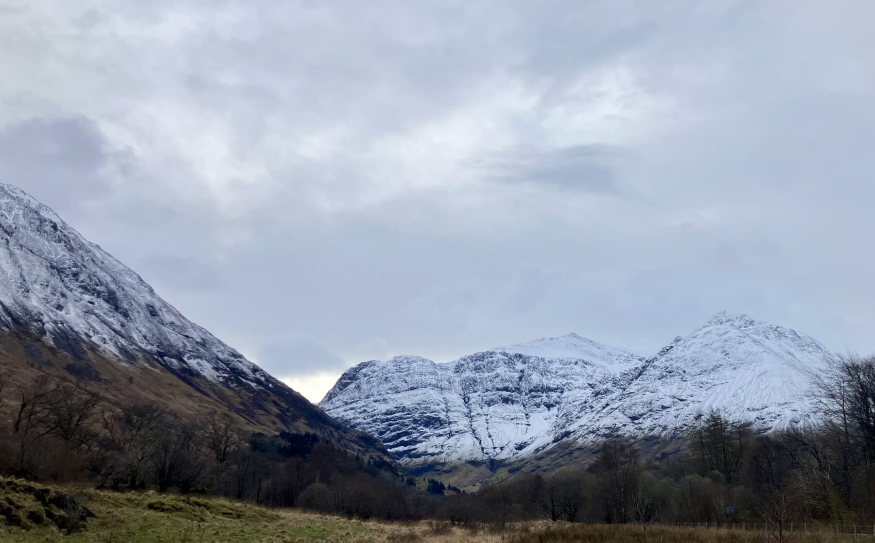
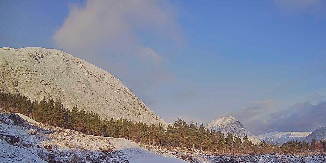
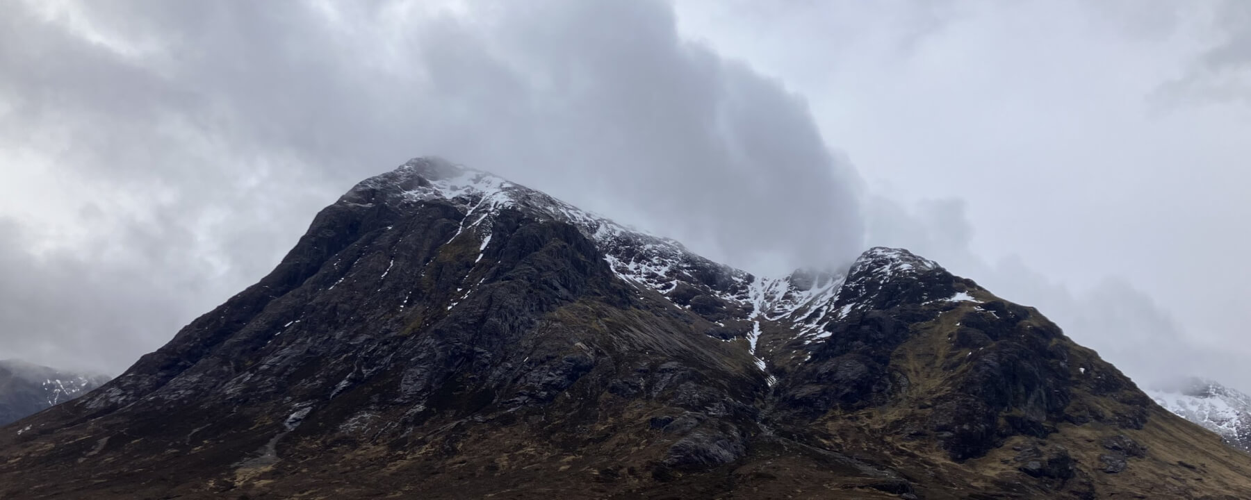
Keep up to date by subscribing to our RSS feed
This report is supported by