Avalanche Report for Southern Cairngorms
Issued
Avalanche Hazard Forecast
FOR PERIOD 18:00 Fri 27/03/2026 TO 18:00 Sat 28/03/2026

Avalanche Problems
Click on a problem icon below for more detail about that problem (guide to problems)
PROBLEM TYPE

Weaknesses developing in the snowpack due to wind transportation of snow and the formation of windslab.
ASPECT / ELEVATION
Aspect and elevation above which this avalanche problem exists.
TREND

Increasing
Development of windslab from early morning
Likely Places
 Gully Tops
 Gullies
 Coire Rims
PROBLEM TYPE
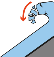
Cornices that may present a hazard due to collapse and/or providing an avalanche trigger.
ASPECT / ELEVATION
Aspect and elevation above which this avalanche problem exists.
TREND
Increasing
Developing in the early morning
Likely Places
- Gully Tops
- Gullies
- Coire Rims
Forecast Snow Stability & Avalanche Hazard
New fresh unstable windslab will develop mainly on North-East to South-East aspects above 800 metres. Minor amounts may also be encountered on both North and South aspect due to cross loading. Wind sheltered locations such as coire rims and gully tops will be most affected, particularly where accumulations develop over old snow. New unstable cornices will form. Old snow will become very firm and icy. The avalanche hazard will be Moderate
Forecast Weather Influences
Snowfall at all levels overnight with the freezing level rising to around 650 metres during the day. Strong winds West-South-West overnight, veering to West-North-West during the day.
Comments
Due to be very windy on Saturday. Old snow-ice will be firm and often icy.

Observed Avalanche Hazard -
Observed Weather Influences
Mild overnight, becoming cooler around dawn, 0 or plus 1 degrees at 900 metres during the day. Occasional squally showers otherwise dry. Fresh Westerly winds throughout.
Observed Snow Stability and Avalanche Hazard
The fluctuating temperatures have helped consolidate recent deposits but instabilities still persist within deeper accumulations. These localised areas are on steep terrain above 1000 metres, mainly gully tops and corrie rims on North-East to South-East aspects. Older snow is firm and well bonded. The avalanche hazard is Low.
Mountain Conditions
Firm snow - ice on most aspects. Good visibility. Winds 30 -40 mph, progress difficult and tiring.
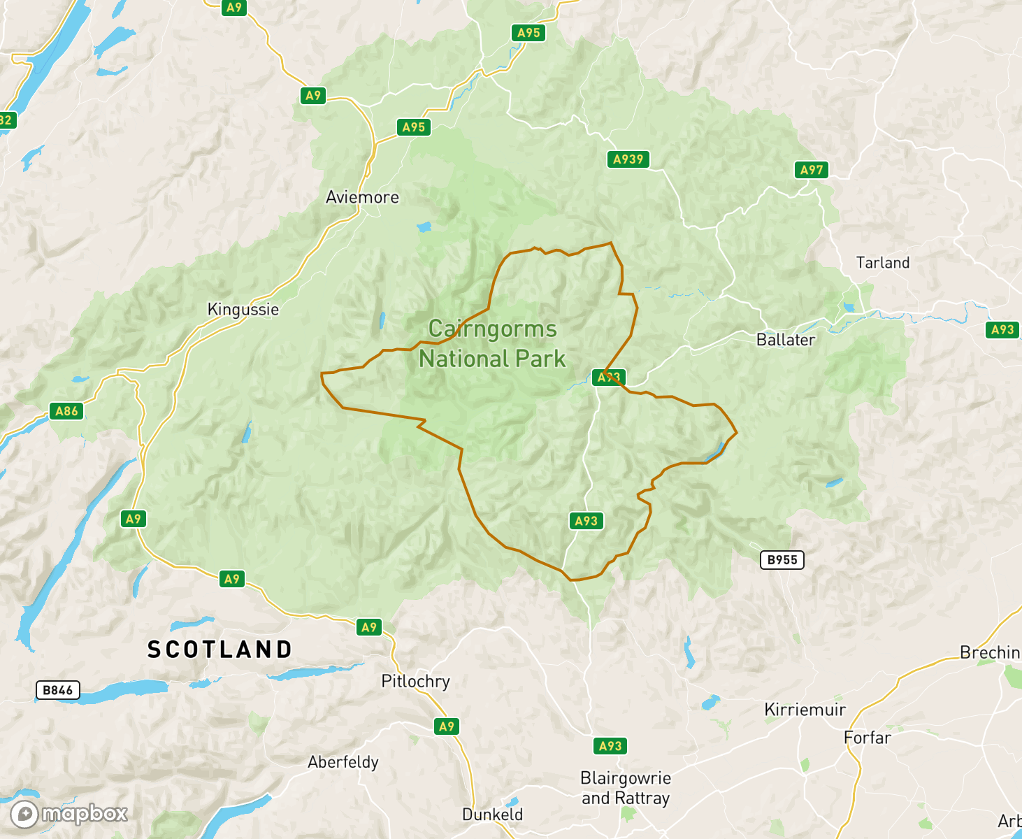
The Southern Cairngorms avalanche forecast Area
When producing daily avalanche forecasts for the Southern Cairngorms region the whole area and summits as indicated on the map are considered by SAIS forecasters when writing their daily reports.
In the Southern Cairngorms region the “core” forecast area primarily visited are from the Lochnagar mountains in the north-east to the Cairnwell and Glas Maol ranges and the Spittal of Glenshee hills in the south. Knowledge from this core area is applied to the more outlying mountains such as Cairntoul and Ben Macdui to Ben a Bhuird and Ben Avon, where field observations are carried out in turn as the winter progresses, or specific snowpack assessments are required.
-
Return to Winter.
A mild spring like start to this period with a largely diminishing but stable snow cover. It became cooler on the 24th with snowfall down to the glens on the 25th. New unstable windslab formed in wind sheltered features mainly NE,E,SE and S aspects above 850 metres. Elsewhere was a light covering of new snow which was largely gone at lower levels by the 26th. Now very much like Winter around the tops.
Good stabilityFresh snow accompanied by gale force winds resulted in an unstable snowpack for the first part of the timescale. This all changed on the evening on the 16th with summit rain and the start of a thaw. This mild airflow has continued which has helped to consolidate the existing snowpack. A general trend of the snowpack refreezing overnight before softening during the day. Snowpack stability is generally good with residual cornices remaining a hazard during the day.
A varied week.A cold start to this period with new snowfall which was wind transported around differing aspects on Wednesday/Thursday before being distributed onto N to E aspects where new unstable accumulations of windslab formed. On Saturday there was a human triggered avalanche on a North-East aspect above 950 metres. Sunday onwards saw a return to more mild conditions. On Thursday limited amount of new snow were noted around the higher summits with the freezing level dropping further in the afternoon.
Generally a mild period.Another week of mostly mild temps with little precipitation. Occasionally it has been cold, surface layers have been icy, only softening where exposed to the sun. Glide cracks and historical avalanches were noted during the week when there was great visibility. The snowpack was generally firm and well bonded during this period.
Thaw conditions.This period has been dominated by thaw conditions with the freezing levels well above the summits and rain (although not heavy) at all levels. A number of avalanches have been reported, the biggest on Westerly aspects. The biggest cornices were also on these aspects, many of which are now gone. Currently, The snow cover is patchy, more extensive areas are above 800 metres with Westerly aspects holding most cover. Friday becoming cooler with the thaw rate expected to ease.
A very changeable week!The start of this period saw a welcome change to the entrenched SE airflow. Avalanches were noted in the good visibility, most extensive on West aspects. Becoming much colder with the majority of the snowpack becoming very firm and icy. There was snowfall Monday with storm force winds redistributing dry cold snow onto the Southerly quadrants. Tuesday saw 3 human triggered avalanches noted. These aspects were stripped on Wednesday. Thaw conditions will arrive on Friday PM.
A mixed week.The SE airflow continued. More snowfall at the start of this period with deep accumulations in sheltered terrain on SW to N aspects above 600 metres. Milder temps with rain up around the tops followed from Sunday on. This helped with consolidation over most of the South Cairngorms. It then started to cool with the freezing level dropping and reasonable snowfall above 800 metres on Tuesday eve/Wednesday. Thursday 12th was a clear day with multiple recent avalanches reported.
More of the same.The East/South-East airflow continues with snowfall, strong winds and little visibility. An exception was Sunday afternoon when winds eased and cloud lifted above some of the summits. There has also been some fluctuation in the freezing level which has helped the overall stability of recent deposits. However, with new snowfall and drifting new windslab is developing in lee locations. Like the start of this period, overall cover is good, but wind exposed locations are icy.
Theme for the week......Theme for the week has been; snowfall, pretty well persistently most days, freezing level fluctuating around 500 to 900 metres and no visibility. Some noteable points of the week, snow accumulations are significant in any lee location with 3 to 5 metres in some locations. A large avalanche, class 3.5 to 4, was reported (a number of times) on Monday afternoon when the constant SE hill cloud cleared for a while. On Monday Storm Chandra did deliver an afternoon of multiple 100mph gusts.
Severe weather finish to the week.We started this period with cooler temperatures and some sunny spells. End of last week saw a rise in the freezing levels, sticking around the 900-1000 metre range but it was very much still winter above these levels. Thursday saw a weather warning for rain arriving on a South-Easterly system. Rain turned to snow above 500 metres, deep drifts and drifting above 850 metres or so. The South-Easterly continues, this week will finish with further heavy snowfall.
A wild week.It has been quite a challenging week. Deep snow on the hill with snowshoes and ski's been utilised. On Sunday a High hazard forecast was issued as thaw conditions moved into the area. In the last days areas of windslab have formed in sheltered Northerly aspects otherwise most of the snowpack has refrozen. Currently there is broken cover on most aspects above 600 metres with snow below this level thawing.
Widespread cover.It's been a cold week with snowfall most days. Initially a strong North-Easterly wind at the start of the week with heavy snowfall, mainly the main Cairngorms and in the East. As the weather patterns became increasing complex, winds changed direction, moving snow around the hills. Currently there is a good covering of snow on many aspects down to the glens with deep drifts in any sheltered area. Not many people have ventured into the hills, one full depth avalanche has been reported
Return to Winter.The week has been dominated by high pressure with classic inversion conditions. At the end of this week the winds turned North-East and significantly strengthened bringing snow showers into the area. BY Thursday the hill landscape is wind blasted and icy in all exposed locations, new softer deposits are found in lee locations above 700 metres. Moderately bonded accumulations are found in gully tops and corrie rims daily on North-East and Easterly aspects above 900m. Limited amounts elsewhere.
Turned mild again.Earlier this week there was a brief return to Winter with snowfall above 700 metres and deeper accumulations forming mainly on North to East aspects above 900 metres. New snow was subject to thaw condition and quickly stabilised. Currently snow is mainly restricted to corrie rims and gullies mainly on North to East aspects above 950 metres.
A cold end to the week.Becoming cooler in the last half of this week with a couple of cosmetic dustings of snow above 800 metres. Otherwise the area has little snow, patchy firm and well bonded snow is restricted to gullies and corrie rims above 950 metres in North to East facing corries. A return to more wintery weather is expected on Thursday evening.
A wet start.With recent heavy rain and freezing levels above the summits, it is mostly a snowless landscape with only isolated patches in North to East facing corries above 950 metres. These are wet, soft but well bonded.
Definitely spring...The period started with a low pressure area brining some unsettled weather and a dusting of snow on the higher mountains. High pressure returned bringing warm and sunny conditions with cold overnight temperatures refreezing the remaining snow cover, which softened and thawed during the daytime. The patchy snow cover persisted mostly on North-West to East facing coires and gullies above 1000 metres, on the higher mountains along the Northern boundary of the forecast area.
Spring LikeHigh pressure dominant through the forecast period, giving mild temperatures with no significant precipitation. Snow cover reduced becoming patchy and confined to North-West to North-East facing, shady coires above 900 meters. Towards the end of the forecast week an area of low pressure brought rainfall at all levels further reducing the thawing snow patches.
High pressure influenceThe early part of the period remained cold under the influence of Northerly winds. Hard snow ice was present on Northerly slopes above 900 metres and limited accumulations of windslab were present on southerly aspects above around 800 metres. High pressure slowly started to influence the conditions from around Monday with a steady consolidation of the recent windslab accumulations due to softening during the day and refreezing at night.
Winter returnsVery mild conditions and diminishing snow patches at the start of the week. A Northerly airflow arrived lowering temperatures considerably and bringing daily light snowfall. The hills now have a shallow covering of fresh snow, the old snow patches have become firm and icy and limited accumulations of unstable windslab are forming.
Firm and coldAfter a period of mild and stormy weather with extensive snow loss, colder conditions gradually resumed. As the freezing level lowered a some light show showers occurred over a short period, giving a welcome return to winter. Redistribution of snow in the cold temperatures has resulted in some minor windslab accumulations around coire rims and in sheltered gully lines. The regional picture, is however one of stability with a spring snowpack in many locations.
Diminishing snow coverAfter a cold period today 20 Feb there has been a shift to mild temperatures and storm force winds. After a short period of instability the snowpack has diminished in extent and is generally moist but stable in all areas.
Unstable snowpack on N and NW aspectsA week of relatively benign weather conditions as high pressure remained. Generally cold, fresh summit winds and lots of cloud but very little snowfall. However, multiple snow flurries merged to produce more snow than expected and a windslab and cornice problem developed at the start of the week. These have persisted through the week and although consolidating, moderately bonded windslab remains. At the end of the week, weaknesses deep within the snowpack were identified and remain.
Freeze-Thaw-freeze.At the start of this period, it was cold with good snow cover across most of the area. However, a return to a South-Westerly airflow with freezing levels above the summits started thawing the snow at all levels leaving a patchy cover. There has been a return to cooler conditions with the hills looking Wintery again. Currently, shallow softer deposits are on N to SE aspects above 900m with older snow very hard and icy.
A Wintery WeekIt's been a challenging week that started with the record breaking Storm Eowyn. Further multi directional strong winds followed with snow showers throughout the week. There is very much full cover over the hills with snow on every aspect above 600 metres or so. Generally, windslab is currently found around steep wind sheltered locations around 900 metres.
A benign week.The weather has been benign over this last week, many days have felt like Spring, with the hills mostly devoid of snow. Isolated patches exist mainly SE to SW aspects, largest areas around the Corries of Beinn a Bhuird. With Storm Eowyn due to arrive over the area on Friday 24th, conditions will be very different in coming days.
Big change.This week has seen some very obvious changes! Over the weekend a much milder system moved over Scotland, by Monday there was only patches left. With the freezing level remaining above the summits the snow has continued to thaw all week. Largest areas of snow are found in sheltered areas on SE to SW aspects above 900 metres in the main Cairngorms.
Localised windslab.A week of snow showers, very cold temperatures and strong winds. Deep areas of cold, dry, multi layered snow have developed on Southerly aspects above 800 metres. Although these areas have become more widespread, they are generally restricted to corrie rims, gully tops and other very wind sheltered locations. Otherwise a covering of unconsolidated snow from the glens with wind exposed areas scoured and deep drifts in any lee location.
Wintery.A mild start to this period but currently it's now very much full Winter on the hills. There is snow cover from the glens, deepest deposits are found mainly around wind sheltered terrain on South and South-East aspects above 900 metres. Here, stability is poor. Elsewhere, mostly shallow cover with occasional deeper drifts in lee locations. Exposed terrain is scoured. Old snow is very firm. A lot of ice has started developing, both underfoot and around burns, making crossings tricky.
A mild week.There was new snowfall, heavy at times, to start this period. Accompanying winds were very strong, resulting in local snow gates being closed for 24 hours. Deep drifts had developed in many lee locations but unfortunately Tuesday saw the freezing level shoot up above the summits where it has remained since. The thaw has resulted in significant snow loss across the area. There is little snow left, particularly around the Lochnagar to Glenshee hills.
Little snow on The White Mouth.A mild and windy week that seen substantial snow loss. The Glas Maol to Lochnagar hills now have little cover, mostly it is old hard patches in sheltered locations. North of the Dee the main Cairngorms have a little more snow cover particularly on the Eastern aspects. Forecasts are showing some fluctuation in freezing levels with a mix of snow and rain. Coming days looks very windy.
Light cover on most aspects.Currently there is well bonded snow in varying depths on most aspects from lower levels. The last two days have been very mild around the summits with the snow cover starting to diminish. Buttresses have become black and cover in gullies generally poor. Limited areas of hard snow and ice will be encountered in some locations.
A mixed week.In general it's been a very mixed week for weather. Most of the days have been wintery, often with snowfall above 800 metres, however fluctuations in the freezing level and rainfall helped stabilise new accumulations. Another thaw cycle beginning Wednesday afternoon and continuing today has led to significant snow loss. Greatest amounts of snow are currently found in the corries and on the higher main Cairngorm hills.
Winter continues.Another Wintery week. With the freezing level fluctuating there was new snowfall down to lower levels gaining depth above 800 metres. In the latter half of the week there was little visibility. Deeper new unstable accumulations were mostly on South-West to North-West aspects above 900 metres with a shallower cover on most other aspects. There has been some consolidation of recent deposits with older snow becoming very firm and icy. Further snow is expected followed by a thaw later Friday (5th).
A snowy week.A cold week with an East to South-East airflow and snowfall down to the glens. Visibility has been poor over the last days. Unstable accumulations have been building steadily on South to West to North-West aspects, mainly above 900 metres. Today, (Thursday) has been much milder with rain noted above 1000 metres. Overall snow stability has been improving but moderately bonded accumulations will persist above 1000 metres.
Fluctuating freezing levels.There has been some snowfall throughout this week but due to fluctuation in the freezing level, any new snow wasn't around for long. Notably, there was some minor activity overnight on 16th/17th March with yesterday's (20th) covering on all aspects above 900 metres already melted. Older snow, mostly found on sheltered West through North to East aspects above 900 metres, is soft but well bounded.
An icy week.Full Winter conditions prevailed throughout the week above 800 metres with the snow cover diminishing below this level. Underfoot conditions became very icy, with walking difficult in some locations without crampons or microspikes. The last days of this period saw thaw conditions with a number of small wet snow avalanches noted. High North to East corries are still holding greatest cover with the snow generally well bonded.
Consolidating.Recently we've seen a return to Winter above 800 metres. Snow showers falling in strong South to East winds have seen deeper accumulations develop on West to North aspects. New unstable accumulations were generally restricted to around corrie rims and gully tops. By Wednesday/Thursday the freezing level had lifted slightly helping consolidate recent accumulations. With cooler temperature on the way all snow is expected to now refreeze.
A mixed week.This period saw a mix of conditions, some cold clear days, brief milder periods and some snowfall. Ice was readily forming on crags but was lost when milder conditions moved over the area. Most of the snowpack is currently firm and icy with softer unstable snow generally restricted to corrie rims. The majority of the snow cover is to be found on higher North to East facing aspects and high plateau areas.
Return to winter...The week was dominated by mild temperatures, with the freezing level above the highest summits. The snow cover diminished rapidly in the thaw conditions. Rainfall at all levels on Wednesday turned to snow as the freezing level finally dropped below the summits. The colder temperatures have refrozen the older melt-freeze snow patches and fresh, shallow windslab with limited distribution has developed on coire rim and gully tops.
Snow then thawA cold and snowy start to the week, finishing with a rapid thaw at all levels. New snow came first on Easterly winds before the winds veered to the South West leading to significant redistribution of the snow and further windslab development in gully tops and coire rims on North-West through North to South-East aspects. A rapid thaw with rainfall at the end of the week has lead to consolidation of the existing snowpack and significant loss of the snow cover on all aspects.
A cold end to the week.A cold start to this week but became it turned mild with rain at all levels. Rivers were high with noticeable snow loss in all locations. The last days has seen a return to dry, cooler conditions with remaining snow refreezing becoming hard and icy. Best snow cover is found above 900 metres in North to East corries and on some higher plateau locations. Snowfall is expected to arrive in the area Thursday overnight.
Diminishing snow cover.There has been continued thaw freeze cycles during the last week. On Sunday 27th strong Southerly winds and a high freezing level led to significant snow loss throughout the area. One avalanche was reported on this day. Snow cover is still reasonable in North to East facing corries and on the higher plateau areas, patchy elsewhere.
A stormy week.This period started with significant hazard and some reported avalanches. The area was affected by Storm Isha and Storm Jocelyn with very strong winds at times, the strongest was recorded by the Cairnwell Weather Station (933 metres) at 124mph. With fluctuating freezing levels and rain at all levels, the snowpack diminished in extent, particularly below 900 metres. Cover still remains good on North through East to South-East aspects and on higher plateau areas.
A cold week.There was a mix of rain and snow at the start of this period leading to some minor avalanches mostly on Westerly aspects. Generally dry since last weekend snowpack stability improved in fluctuating freezing levels. Areas of soft snow persists in wind sheltered locations, mostly on SW to NW aspects above 800 metres. Although these areas are isolated and shallow they demonstrate poor stability.
A mild week.Generally, the freezing level has been around the high summits for most of this period with the snowpack slowly diminishing in extent. Although thawing, snow cover is still found on most aspects with deepest accumulations on West to North aspects. the snow is expected to become firmer in the following days.
Full Winter conditions.There was little snow throughout the area until the arrival of Storm Gerrit. Significant snowfall, initially at all levels was subject to brief thaw freeze cycles and variable wind directions. Most aspects now hold broken cover from around 500 metres or so. Exposed areas are generally firm, particularly above 900 metres with soft deeper deposits found in wind sheltered locations. Poorest stability is found around gully tops.
Snow loss.This period started with shallow snow cover from around 600 metres but this was subject to thaw conditions for the last few days with significant snow loss across the area. Remaining snow is patchy and now mainly found in sheltered gullies on North to East facing corries with bare ground elsewhere.
A return to Winter.We started this period with little snow. That changed on Tuesday evening with the arrival of heavy snowfall from the South. Accompanied by strong winds new accumulations rapidly developed in sheltered locations on NE to NW above 900m. This was followed by further snowfall with fragile cornices forming. Fluctuation in the freezing level has helped consolidate deposits with avalanche activity on NW/N aspects around 1000m noted on 14th April.
Well consolidated.This week has seen a variety of weather conditions with the freezing level lifting above the summits most days. The remaining patchy snow cover continues to thaw but remains well bonded throughout.
Patchy thawing snow.A cooler week with occasional light snowfall. Milder conditions arrived overnight on the 27th with the freezing level remaining above the summits for the end of this period. Snow is thawing and generally restricted to higher North to East facing corries and the main Cairngorms.
Patchy snow cover.The snow cover is patchy and has remained well bonded through this week. Temperatures have fluctuated but mostly the freezing levels have gone over summit level by the end of the day. Greatest amounts of snow is to be found around the tops of the Cairngorms.
Thawing.Mostly, it's been a cold week with snowfall down to the glens, the heaviest snowfall was on Wednesday overnight. Thaw conditions arrived on Thursday morning, 0 degrees, 8am at 900 metres recorded. With poor visibility little avalanche activity was noted. The snowpack was diminishing in extent, particularly below 850 metres.
Unconsolidated snow cover.It's been a chilly week with an unconsolidated covering of snow from around 700 metres, new snow depths vary greatly. Greatest instabilities were noted where new deposits developed over the older snow ice, mainly on wind sheltered N,S to SW aspects. Weaknesses within the snowpack are continuing to develop.
Cold and cloudy.We've seen little of the sun this week, it's generally been cold, particularly when engulfed within the cloud. Occasional snowfall at times, accumulations have been slowly building throughout the week but deposits remain shallow. Last days have seen ice developing on tracks and footpath, often covered by light snow.
Diminishing snow cover.The remaining snow cover has continued to diminish despite the occasional colder temperatures during the week. Currently greatest amounts are found on North to East facing corries, this is mostly old hard snow with only isolated pockets of newer snow elsewhere.
A mild week.Generally, a mild week with the freezing level often above the summits. There were a couple of cooler days with widespread frost and light snowfall but this made little difference to the patchy snow cover which has remained well bonded throughout this period. Greatest cover is currently in North to East facing corries above 900 metres.
Firm and well bonded.The patchy snow cover has mostly been thawing but has remained well bonded throughout this week. Any new snow has been minimal and hasn't lasted long in the fluctuating freezing levels. Greatest amounts of snow is in North to East corries above 900 metres.
Consolidating snowpack.The first half of this week was fairly settled with snow cover generally well bonded. Reasonable amounts of snowfall falling in strong winds midweek led to localised unstable accumulations building on North through East to South aspects. Another thaw cycle started on Wednesday with Thursday recording a temperature of +4 degrees at 930 metres. Remaining snow continues to slowly thaw and consolidate. There are some cornices left which will be prone to collapse spontaneously.
All change.There was a Wintery start to this period with good snow cover and deep unstable windslab in many locations. This was to change with much milder air arriving over last weekend. A number of avalanches occurred during this thaw cycle and there was consolidation of the snowpack. Currently cover is broken but generally improves with height and is very firm, often icy in all locations.
A Wintry week.It has been a cold week with snowfall and mainly moderate to fresh winds throughout. There is a covering of dry light snow in any lee location which is mostly baseless but becoming better above 850 metres or so. Unstable windslab has been slowly developing in depth and becoming more widespread, wind sheltered slopes on East to South aspects currently hold deepest amounts with localised windslab elsewhere. Old snow is very firm and icy. Avalanches have been recorded this week.
A changeable week.A mixed week for weather which started with a thaw and a loss of snow cover. Since then, rain, snow showers, strong winds and fluctuating freezing levels have led to a largely firm, icy and stable snowpack. Localised windslab started to rebuild over the last days, currently mostly around corrie rims and gully exits on the Northerly quadrants above 900 metres.
Improving stabilityIt was an unsettled start to the week with heavy snowfall and strong winds resulting in some avalanches over Friday/Saturday. Generally since then the overall stability has improved with fluctuation in the freezing level and rainfall helping consolidate the snowpack. Currently there is still good cover above 900 metres.
A changeable week.This week has seen fluctuating freezing levels, changeable winds and some snowfall. This has resulted in new localised unstable accumulations developing above 900 metres, particularly around Corrie rims. Away from these areas much of the hill has become very firm and icy. Potentially heavy snowfall will arrive on Friday with deeper unstable windslab becoming a bit more widespread.
Patchy.The start of this period saw a general covering of dry light snow. At the weekend there was a significant change in the weather bringing much milder conditions which led to a widespread thaw. By 22nd there was only a patchy snow cover left, greatest amounts around corrie rims with lesser amounts on open hillsides. Remaining snow has refrozen becoming icy at higher elevations.
A Wintry landscape.Currently, there is covering of dry light snow at all levels. Strong overnight winds on Wednesday 14th redistributed existing snow onto mainly Southerly aspects with one avalanche noted at 900 metres. Elsewhere isolated deeper pockets of snow are to be found in lee locations with exposed ridges mostly bare. Freezing levels are expected to rise this coming weekend.
Diminishing snow cover.We started this period with typical April weather, warm sunshine at times, Wintry showers on the hill and cold temperatures overnight. Some new accumulations initially developing but as the freezing level started to rise throughout the week, recent accumulations consolidated and started to melt. Snow cover is now patchy with greatest amounts found around the highest Cairngorm summits. No new snowfall is currently forecast.
An unsettled week.A cold start to this period but snow showers didn't really amount to any significant new accumulations. A milder period mid-week soften the old snow but this remained well stabilised throughout. With a return to a more Northerly airflow old snow has become very firm and icy. Thursday 7th has seen the most amount of snow falling, coupled with very strong winds. New localised areas of windslab has currently developed SE to SW aspects above 900 metres. Old snow remains very firm.
Winter returns.Initially settled with snow cover slowly thawing in the milder temperatures throughout the area. However cooler temperatures and snow showers at all levels moved down from the North mid week. This has left most of the hills in this area looking white with unstable accumulations developing, mainly on the higher peaks towards the Northern boundary of our area. Currently deepest accumulations are found on SW to SE aspects above 950 metres.
A Spring snowpack.Generally, this week has seen bright sunny days and freezing levels above the summits. The snow has been thawing at all levels and has started to soften in most locations, particularly where exposed to the strong sun, leaving a wet but stable Spring snowpack. Glide cracks have been noted around corrie rims and on covex slopes. Greatest amounts of snow are on higher plateau areas and in N to E facing corries.
Diminishing snowpack.The Spring like snowpack has been in retreat for most of this period but has mainly been well bonded throughout. There is still snow on most aspects above 900 metres but cover is best on North-West through North-East to South-East aspects.
Localised InstabilityFresh snowfall in the previous week led to localised accumulations of mostly shallow windslab mainly at higher elevations; initially on Southerly aspects. Cold conditions maintained the instability and when the winds picked up significantly during the week, this windslab was redistributed forming fresh unstable accumulations on Northerly aspects. Milder conditions produced some avalanche activity in steeper locations but then started to stabilise the snowpack at the end of the week.
StabilisingWe started the week with snow showers to glen level and deep windslab in wind sheltered locations. Gradually through the week we had periods of fluctuating temperatures and the snow started to consolidate. Cooler temperatures led to firm and well bonded snow throughout. The end of the week saw slightly milder conditions with a thaw occurring and limited snow below 800 metres. Good cover remaining above this altitude, with cooler conditions forecast.
A wild week.It has been a generally stormy week with heavy snowfall at all levels and very strong but variable winds. The overall snow cover has improved but deep windslab developed on many different aspects over this period due to the changeable winds with poor stability at times. Avalanches were recorded during this week. As we move into this next period, unstable windslab with fragile cornices is present, mainly on NE to SE aspects above 900 metres.
Winter ReturnsThe week started with localised accumulations of windslab. Due to the strong winds experienced, these accumulations only formed in the most wind sheltered locations - steep, sharply defined gullies etc. Fluctuating temperatures mid-week reduced the cover and consolidated the remaining snowpack. Recent precipitation and cooler temperatures have greatly improved the snow cover and left us with deep drifts of unstable windslab in wind sheltered locations. Fragile cornices have also formed.
Snow showers...Stable and very patchy snow at the start of the week with greatest amounts present in the high North and East facing corries. Very windy and unsettled conditions for the rest of the week with some snow showers, a brief thaw and finally a 48 hour period of showery weather. Precipitation falling as snow above glen level. Accumulations are localised, restricted to the most wind sheltered of locations but are starting to acquire depth at the point of writing (mid afternoon 10th February).
Fluctuating TemperaturesThere has been very little change to the snowpack this week despite the passage of Storm Malik and Storm Corrie. With fluctuating temperatures and little precipitation there has been a slow reduction in snow cover, remaining patches are well bonded and stable. Largest areas are present above 900 metres on the North to East aspects, particularly in the high coires.
Little ChangeThere has been very little change this week with fluctuating temperatures and very little precipitation. Overall there has been a slight reduction in snow cover but what remains is well bonded and stable and has mostly possessed very firm surface layers. Largest areas are present above 900 metres on the North to East aspects of the high mountains situated to the North of the River Dee.
Stable conditionsThere has been very little change to conditions during the past week. There has been a gradual thaw of the lower lying snow. At the higher altitudes the snowpack has been well bonded and stable throughout. Surface layers have been mostly very firm.
Mild end to the week.This period started with classic January weather, cold, changeable strong winds and snowfall.This started to fill in many sheltered features and left a shallow covering of unconsolidated snow on most aspects. However, by the 10th January light rain and rising temperatures started to thaw the snow. By 13th Jan there had been significant snow loss and a much changed landscape. Currently there are patches on most aspects with greatest amounts found in North to East facing corries above 900 metres
Winter's return.After a mild period there was a return to Wintery conditions with cooler temps on 2nd Jan and snowfall overnight into 3rd January. The 4th, 5th and 6th January were stormy with further snowfall and changing winds. By 6th most aspects had unstable windslab in any sheltered locations with greatest amounts developing on North through East to South aspects above 800 metres. Deep drifts will be encountered from low levels with any wind exposed terrain scoured.
A changing week.Most of this week has been cold with a snow covering on most aspects from low levels. Some strong winds at times moving the snow around with any exposed slopes firm and icy. Thaw conditions started on Wednesday 29th, the snowpack softening and diminishing at all levels. Currently the remaining snow is patchy and mostly above 900 metres. Forecast to remain mild. During this period 2 avalanches were noted.
A settled week.It has been settled week with inversion conditions most days. It has been very cold at night in the Glens with a jump up in temperatures on the hill. The range has been as large as -3.5 celsius to 14 degrees celsius. Three full depth avalanches have been reported in this period. All were on sun affected slopes and are likely to have happened earlier on in the week. Currently there has been a return to Wintery conditions with windslab starting to develop, mostly on SW to NW aspects.
Patchy snow.The snowpack has been subject to mild temperatures and rainfall these last days. There is very patchy snow left on most aspects from around 700 metres with greatest amounts now in North to East facing corries above 900 metres. Remaining snow is moist, soft and stable throughout.
High PressureA cold start to the week with some light snow showers forming isolated, shallow accumulations but the snow was mainly firm, well bonded and stable. High pressure built mid-week, bringing dry and settled weather. Cold nights with icy paths and tracks, then sunny days with some single point activity, roller balling and small sections of cornice collapse in the strong sunlight. The week finishes with high pressure still in place giving a clear night and firm snow conditions mostly above 1000m.
Still WinterStable conditions at the start of the week with a patchy snow cover. One Spring like day and then a return to bitterly cold Northerly winds and snow showers down to glen level. Localised accumulations of moderately bonded snow at higher elevations built in the middle of the week. Fluctuating freezing levels helped stabilise conditions at the end of the week leaving a generally firm well bonded snowpack.
A return to Winter.Most of this period has been dominated by a cold Northerly front with snow showers, heavy at times, very strong winds and a very high wind chill on the hill. New very localised accumulations developed around wind sheltered Corrie rims with older snow refreezing becoming very icy and hard. Today (Thursday) has seen the freezing level rise to around the summits, helping stabilise recent deposits but it's expected there will be a return of the cold Northerly airflow thereafter.
Thawing snow cover.This period started with localised moderately bonded deposits on North to South-East aspects until mild temperatures and rain moved over the area. The patchy snow cover softened and thawed at all levels but it has remained generally well bonded and stable.
Firm and stable.This week the snow cover is generally patchy, well bonded and stable. There is snow on most aspects above 800 metres with best coverage on North to East aspects above 900 metres. Up until today, Thursday 25th, any new snow has been insufficient in depth and distribution to alter these current conditions. Friday 26th is forecast to be a bit more Wintry than recent days.
Thawing snow cover.We started this period with generally shallow areas of unstable windslab. These were limited to wind sheltered locations. Fluctuation in the freezing levels helped consolidate these deposits with older snow remaining firm and icy. The weather has generally been bright and sunny throughout the week but often very windy. The last two days have seen the freezing levels remain above the summits with the patchy snow thawing and diminishing at all levels.
Patchy snow cover.The snow cover is patchy, coverage generally improving with altitude. Remaining older snow has had a number of thaw/freeze cycles and is currently firm and well bonded. There has been little new snow with only isolated pockets forming around the higher tops.
Settled conditions.A largely dry and settled period due to high pressure and temperature inversions. Many days were often very cold at lower levels, particularly if cloudy but regularly warm and sunny at higher levels. The majority of snow was very firm and icy. Snow cover remains patchy, greatest coverage above 900 metres.
A patchier landscape.A week of heavy rain and mild temperatures has led to significant snow loss. Initially heavy rain triggered some avalanche activity on steep terrain before remaining snow started to stabilise throughout. The landscape is now much patchier with largest areas around the higher tops.
ChangesWe started this week with dry light snow underfoot and bitterly cold temperatures before a more mild Southerly based wind flow became established. A number of avalanches occurred over the week, biggest on Westerly aspects, one crossing the main A93 and another over a currently closed ski run. Despite the fluctuating freezing levels and a mix of snow and rain it is very much still Winter on the hill with deep accumulations and hard, icy surface layers in many locations.
A wild week.A significant week, with record amounts of snowfall and very low temperatures. Persistent snowfall in a strong mostly Easterly airflow resulted in a 'High' avalanche hazard and an active period on the hill with sizeable avalanches found in the latter half of the week. Winds varied slightly at times resulting in significant drifting and further deposits but there was some improvement in stability on exposed terrain. Weak layers are still present at depth and have been found in many locations.
Deep windslab.The last half of this week has seen heavy and persistent snowfall down to low levels with significant drifting in strong Easterly winds. Overall stability of the snowpack has deteriorated with widespread deep unstable windslab developing, mainly on South-West to North-West aspects. Large unstable cornices have also developed over these aspects. On Fri 5th debris was noted on a West/South-West aspect with a starting zone around 680m. Also deep seated weaknesses persist in many locations.
Windslab developing.Stability of this weeks snowpack has generally improved, particularly on aspects exposed to the sun or latterly strong winds. On Wednesday there was a blanket of soft but stable snow over most aspects. On Thursday 28th snowfall throughout the day with winds has led to localised unstable windslab building, mainly on West to North-West aspects. Stronger winds from the East to NNE will help unstable windslab become more widespread. Expect to find deposits on South through East to North aspects.
Storm Christoph.A generally calm week with snowpack stability improving. However this has now changed with the arrival of Storm Christoph. Although snowfall was only moderate, winds were severe, a gust of 93mph was recorded at 933 metres on Thursday morning. Significant redistribution has occurred with unstable deposits forming on East through South to South-West aspects above 500 metres. Cornices are now starting to build above these aspects.
Variable ConditionsThe first half of the week was very cold with consolidation only occurring at a slow rate. The deposits remained light, cold and dry and were readily available for redistribution when the winds increased and changed direction. Overall cover improved and deep windslab rapidly formed on fresh aspects creating a complicated stability map. In the middle of the week a thaw occurred at all levels but a return to colder conditions refroze the remaining snow hard. Fresh snowfall to glen level today.
A cold week.It has been a cold week with only a little new snow. The predominately Northerly winds were not strong and there has been little drifting during the week. There is a general good covering of soft unconsolidated snow on most aspects above 600 metres with deep drifts in any lee location. Unstable windslab has been present mostly on East through South to South-West aspects above 900 metres during this period. Cooler temperatures are maintaining these weaknesses within the snowpack.
A wintery week.Overall this week has seen an improvement in the snow cover. Up to 30th December there was a shallow covering of snow on most aspects with wind exposed snow very firm and icy. Towards the latter half of the week the winds became more Northerly and there has been some redistribution of deposits. Hogmanay saw the highest snowfall of the season with deep drifts and accumulations above 600 metres. Unstable windslab is currently deepest on East through South to South-East aspects above 900 metres.
A colder period.Initially it was mild on the hill with only patches left. On the 20th it became cooler with the arrival of a strong Northerly airflow and the hills returned to Winter conditions. New snowfall was generally light with slightly heavier snowfall to all levels overnight on the 23rd. New accumulations were often building over bare ground in sheltered locations with exposed areas wind blasted and icy. Currently Wintry at all levels but expected to become milder on 25th.
A mild week.It has been a mainly mild week with strong winds from the Southerly quadrants and rain showers. The snow cover has continued to diminish throughout the week and has become very patchy with greatest amounts found on West to North aspects above 900 metres.
A wet snowpack.Currently, there is a general patchy covering of snow on most aspects above 600 metres with greatest accumulations found above 900 metres on West to North aspects. With the freezing levels around the highest Cairngorm summits, recent precipitation has fallen as rain elsewhere. Freezing levels are expected to fluctuate in coming days.
Improving stability.Stability was poor at the start of this period with a number of avalanches recorded. However, fluctuating freezing levels helped overall stability with snow cover diminishing at lower levels. Currently, the majority of the snowpack is generally well bonded, often icy but with some isolated shallow softer deposits present, mainly around corrie rims. Coverage best on North-East to South-East aspects.
Still Winter.Initially, there was a good coverage of snow overall but the arrival of mild temps and rain on Friday evening/Saturday led to significant snow loss. Post thaw, South to West aspects, which only had thin cover, are currently very patchy with nothing more than a dusting of new snow. North to South-East aspects still hold good amounts of snow with new windslab building in wind sheltered locations. Colder temperatures, -5 degrees C at 930 metres have left older snow very firm, icy and stable
Improved coverage.A brief thaw last week was followed by new windslab developing on NE to SE aspects down to the glens. A change in wind direction and snowfall helped improve overall snow coverage, this was mostly shallow, often baseless but demonstrated reasonable stability. The 25th was a sunny and calm day with the 26th/27th becoming increasingly windy, redistributing existing deposits. Windslab is currently developing mainly on NE to SE aspects. A number of cornice collapses have occurred these last days.
A stormy week.Strong winds with snowfall, generated by Storm Dennis has led to continued improvement in the snow cover with deep accumulations developing in many lee locations. A brief mild period on Wednesday night has helped consolidate accumulations with newer deposits developing around corrie rims in Thursdays strong winds. Exposed plateau areas and ridges have become very icy. A mix of weather over the next couple of days is likely to see changes on the hill.
A stormy week.We started the week with a limited patchy snow cover that was well bonded and stable. Storm Ciara arrived bringing heavy snowfall and persistent drifting creating a combination of deep drifts and wind scoured slopes. Deposits were poorly bonded and unstable for a 48 hour period and are now slowly starting to consolidate. However strong winds and further snowfall are due tomorrow, with fresh unstable deposits forming.
Mild again.During the the first part of the week there was some snowfall and strong winds from variable directions which helped the snow cover become more widespread, giving the hills a Wintry appearance. However generally there was little depth and with a return to milder temperatures over the last two days there has been significant snow loss at all levels. Greatest amounts of snow are again mostly restricted to higher North to East facing Corries.
Mild again.During the the first part of the week there was some snowfall and strong winds from variable directions which helped the snow cover become more widespread, giving the hills a Wintry appearance. However generally there was little depth and with a return to milder temperatures over the last two days there has been significant snow loss at all levels. The snow has consolidated and is stable throughout. Greatest amounts of snow are again mostly restricted to higher North to East facing Corries.
Cold start, mild end.Most of the week was cold, a shallow unstable snowpack had started to develop. In deeper accumulations above 900 metres, a strong temperature gradient was present. However, there was a return to milder conditions on Wednesday night with freezing levels lifting above the summits and rain at all levels. By Thursday there has been significant snow loss with greatest amounts found around corrie rims and in gully exits on North to East aspects above 900 metres.
Thaw ConditionsIt has been a dry week with no new snow. Initially the snow was firm and icy but by the end of the week thaw conditions have become well established and surface layers are now soft and wet. All superficial cover has disappeared with most plateau areas devoid of snow or holding small amounts in wind sheltered locations. Largest areas of snow now remain on North to East aspects above 900 metres.
A wild week.Initially there was little snow cover throughout the area however, the arrival of Storm Brendon, storm force winds and snowfall above 600 metres led to rapidly forming deep windslab developing mainly on very wind sheltered locations on North to East aspects above 800 metres. Windward slopes were mostly scoured. Mild conditions, Thursday 16th are helping consolidate weaker layers with improved stability in all locations.
Good stability all week.A mild week with some very strong winds at times. Gusts of 109 mph were recorded on Tuesday. Calmer days on Wednesday and Thursday with a return to colder conditions. Overall there has been no change to the remaining snow which is very firm, icy and stable throughout.
Patchy and well bonded.Stability has been good throughout this week. Initially the patchy snow cover continued to thaw but as freezing levels dropped briefly on 30th Dec remaining snow became very firm and icy. Largest areas of snow are mostly found above 900 metres around Corrie rims on North to East facing aspects.
Wet but stable.At the start of this period, milder conditions helped stabilise the snowpack. It has generally been calm with any new snowfall light, leaving thin cover on most aspects. Currently, greatest amounts of snow are on North-West through North to East aspects. Remaining snow cover will be subject to a significant thaw over the next few days.
Changes.For the last few days we've had a reasonable cover of generally soft and unconsolidated snow above 600 metres. Deepest accumulations were generally restricted to around corrie rims. Cornice collapses and size 1 avalanches were reported in Lochnagar. A strong temperature gradient was noted with facets starting to form and weaken the snowpack. It has now become very mild, conditions significantly depleting the snow cover below 800 metres. Above this remaining snow is patchy, wet and soft.
Slowly developing.There is snow cover from low levels with deep drifts in many lee locations above 600 metres. Deepest amounts are currently found around defined corrie rims and steep sheltered features on NW through N to E aspects above 800 metres. Windslab is only moderately bonded in these locations and stability of newly formed cornices are poor. Elsewhere, cover is soft and shallow in any exposed location.
Spring snow cover.We started this period with complete snow cover above 650 metres. Throughout the Southern Cairngorms new snow cover was light with the main Cairngorms holding much deeper amounts. There was a return to milder temps with rain late on Friday 5th April. By the end of the weekend most of the superficial snow had gone, leaving only older deeper snow patches on various aspects. Over the last three days the snow cover has been subject to typical Spring weather and is now firm, well bonded and stable.
Winters Return.Last week there was a definite feel of 'Spring conditions'. However, there was a change in the weather pattern with cooler air and precipitation moving over us from the NE and E. Snow started falling on the 1st April, with the heaviest snowfall occurring to low levels on the 3rd of April. The winds were very strong from the N then NE during this period but have since moderated and veered to the East. Currently deepest amounts are on S through W to N aspects. Forecast to become warmer tomorrow.
A mild week.It has been a mild and mostly dry week with the snow cover thawing and diminishing at all levels. The well consolidated snow cover is very patchy, deepest areas are to be found in gullies and around corrie rims mainly on North-East to South-East aspects above 950 metres.
Wintry start/mild end.A Wintry start to the week with snowfall, strong winds and some avalanche activity. By Tuesday 19th there was a return to milder temperatures and a gentle thaw has been in progress since then. Surface layers became wet but drier snow with moderately bonded layers was to be found in deep accumulations at higher elevations. Large unstable cornices developed around parts of Lochnagar providing a significant hazard. Currently greatest accumulations are found on NE to SE aspects, patchy elsewhere.
A stormy week.There has been snowfall most days this week which generally has been accompanied by very strong winds. Wind directions were variable, as a result the snowpack distribution improved with deepest accumulations in wind sheltered features but generally remaining shallow in many locations. The snowline currently starts around 700 metres with overall stability improving in fluctuating freezing levels.
Winters return.There was a return to Wintry conditions last Sunday with some snowfall on most days leaving a thin cover from around 800 metres. Wednesday saw the heaviest showers, with greatest amounts forecast for the Northern side of our boundary. Strong winds from various directions has redistributed deposits into wind sheltered locations on many aspects. Fluctuating freezing levels have helped consolidate accumulations but there is now little snow below 800 metres.
Spring conditions.Generally, it has been a very warm and sunny week. The patchy snow cover continues to to thaw but is well consolidated and stable throughout. There is little snow left, greatest amounts are mainly restricted to gullies and around corrie rims in high North to East facing Corries.
Thawing snow.It has been a mild week with the freezing level above the summits and occasional rain. Remaining snow continues to thaw but is well consolidated. Greatest amounts are to be found in higher corries where some easier gullies are just about complete but elsewhere is mainly snow free.
A week of change.We started this week with full Winter conditions, although the snow was generally not deep. With the freezing level well above the summits and heavy rain at times, it has not taken long for snow cover to become patchy. Currently, most aspects above 950 metres still hold soft but stable snow in sheltered areas with most other areas becoming snow free.
Thin cover with localised weakness.It was a very cold and calm start to this period. This was followed by strong winds from various directions and occasional snowfall. Overall stability was improved by melt-freeze conditions in the last couple of days. Most of the snow cover is bridged by an icy layer but weaker layers are still to be found in some locations. These areas are very localised. Generally cover remain thin, currently thawing under 800 metres.
Mild start/cold finish.After a mild start to this period, Sunday 27th Jan saw a return to wintry conditions with snowfall and strong Northerly winds leaving new accumulations only in the most sheltered of locations and deeper deposits in sheltered glens and forests. Limited snowfall and redistribution of existing snow has left a thin covering of unconsolidated snow on most aspects and isolated areas of windslab above 800 metres, mainly E to S aspects.It has remained cold, weaknesses are persisting within the windslab.
A cold week.It has been a cold week, mostly dry but occasional strong winds led to some drifting and redistribution of existing deposits. There is a light covering of snow from low levels with only a few deeper areas in sheltered locations. Areas of unstable windslab developed, mainly in N to E facing corries above 900 metres. These areas were very localised and generally avoidable.
Wintry conditions.A generally mild week with some precipitation and freezing level fluctuations giving a dusting of snow at times. On the 16th there was a return to cooler conditions with moderate snow fall at all levels helping the overall wintry appearance of the hills. At higher elevations strong winds and subsequent drifting has led to deep pockets forming in sheltered locations on South-East and South aspects. Snow cover is very shallow elsewhere.
Snow patches.Over the last week, fluctuations in the freezing levels and a dusting of snow have made little difference to the current conditions. The slowly diminishing patchy snow cover remains well bonded and is generally restricted to features such as gully lines, around corrie rims and sheltered hollows above 950 metres.
Patchy firm snow.The start of this period was mild and often wet leaving a much depleted and patchy snow cover. The New Year saw a return to much cooler conditions with remaining snow becoming very firm and often icy. Snow is generally restricted to West through North to North-East aspects above 950 metres.
Very patchy.At the start of this period we had good snow cover although often shallow on plateau and exposed areas. It became much milder on Christmas Eve with the freezing levels lifting way above the summits. The snow cover has continued to thaw since then becoming well bonded but very patchy and mostly restricted to West through North to North-East aspects above 900 metres. Many areas are snow free and bare.
Patchy snow cover.It has been a mixed week for weather. There was significant new snowfall down to low levels leaving a general covering and deep accumulations in many sheltered locations. However Storm Deirdre followed with a savage thaw but the cooler temperatures after this have helped stabilise remaining snow. Many gullies are still incomplete but most Corries hold snow and there are significant patches on higher plateau areas.
Updated Thursday 20th DecemberUpdated Thursday 20th December
This period started with avalanches noted in rising temperatures on the 6th April on SW and S aspects. On the 7th, as the mild conditions took hold, further slab avalanches were noted on multiple aspects, mainly all failing on a weak layer that was first recorded on the 30th March. The snowpack continues to thaw and stabilise with the odd cornice collapse occurring. Currently the snow cover is good above 900 metres, patchy at low levels and stable throughout.
It has remained cold throughout this week. Moderately bonded windslab was present on mainly NW to NE aspects, the exception was the 30th March, when snow fell as graupel the previous evening, introducing a weak layer and a slightly more unstable snowpack. This layer has persisted in the snowpack since then. Snowfall was moderate on the 1st April, but becoming heavy on the evening of the 2nd April. Currently, this has left deeper unstable accumulations on the South-East to South-West aspects.
It was a mild start to this period, helping trigger some avalanche activity but ultimately consolidating and stabilising the snowpack. This was followed by a return to cooler conditions and some more snowfall, although this tended to be light. As we reached the 29th, the snowpack was firm and icy with some limited softer deposits in places. Although there has been some snow loss during this week, the hills are still in full Winter condition with good cover on most aspects above 850 metres.
The area started this period under full Winter conditions, new accumulations forming in the strong winds and existing instabilities persisting at depth in the cold snow. Extensive areas of hard ice also developed on wind exposed slopes. Monday and Tuesday were sunny with milder conditions creeping into the area thereafter. There has been some snow loss, particularly at lower levels with the hard ice melting out exposing the ground on higher levels. However, general cover remains good.
The week started with an active period of avalanche activity due to snowfall and strong winds loading already marginal slopes, where instability had been maintained by persistently cold air temperatures. Mid-week saw a gradual improvement in the situation with slightly milder temperatures encouraging the consolidation process, producing a generally stable snowpack throughout. We end the week with a forecast of heavy snow on severe gale force winds.
It has been an epic week with very cold temperatures, persistent Easterly airflow and heavy snowfall at all levels on strong winds. The end of the week has seen some respite with much less extreme weather, improved visibility and the opportunity to get a better overall view. Whilst consolidation is slowly taking place areas of concern still exist at higher elevations. Cornicing is a prevalent feature at present.
Currently, like most other areas, there is a very cold Easterly airflow affecting the area. Initially the snowpack was hard and firm with weaker layers noted at depth. Heavy snow showers started on the evening of the 27th and there has been frequent and occasional heavy snowfall since then. Currently, mountain travel is challenging and serious with deep, unstable accumulations developing mainly on South-West to North-West aspects. East aspects remain hard and scoured.
After an active week in terms of avalanche activity due to new snow instability and then thaw conditions at all levels, the snowpack has now refrozen developing a strong crust. Conditions are currently stable.
The defining week off the winter so far with daily snow showers. The wind has been the dominant feature, redistributing snow around the aspects, creating some deep drifts. Very cold temperatures at the start of the week developed faceted crystals that were problematic however slightly less cold temperatures and deeper snowpacks have reduced the steep temperature gradient that produced this situation. Recent snow is consolidating but further snowfall on strong winds is forecast.
With a generally showery airflow there has been a gradual improvement in the snow cover. Cold air temperatures have maintained a moderately well bonded snowpack. Recent very cold air temperatures have caused the development of less well bonded grains, with a deep seated weakness located in an otherwise well bonded snowpack today.
It has been a very windy week, with multiple gusts over 100 mph being recorded at The Cairnwell weather station. There has also been some snowfall on most days with the heaviest on Tuesday overnight, leaving deep unstable windslab, mainly on N to E aspects. On Thursday there was a change in the winds to the NE and NNE leading to a redistribution of existing deposits. Many areas on the hill are scoured, icy or bare with only very sheltered features holding deeper deposits.
At the start of the week there was good snow cover from low levels with instabilities found mainly on North to East aspects above 850 metres. Thaw conditions prevailed Monday and Tuesday resulting in significant snow loss before becoming cooler on Wednesday and moderate snowfall above 600m. At the end of this period snow cover is starting to become firm and stable with localised windslab present on steep terrain on North-East and East aspects above 800 metres.
There was a return to Wintry conditions on the 15th, becoming much cooler at all levels. Snowfall was heaviest on the 17th with significant amounts of drifting in the strong winds. Snow cover has again become much more widespread. Areas of windslab have developed in lee locations and are particularly unstable where they overlie older snow-ice. Cornices are developing with exposed areas becoming very icy. Likely to remain cold and unsettled for at least a few more days yet.
Some light precipitation at the start of the week with areas of moderately bonded windslab present. Consolidation has gradually taken place through the week aided by gently fluctuating temperatures. The snowpack is now generally well bonded and stable.
With snow showers and significant drifting in strong changeable winds, general snow cover continued to improve on most aspects with deep drifts in many lee locations. Unstable windslab also developed, particularly on NW through N to E aspects above 800 metres. A slight fluctuation in the freezing level in the last two days has helped stabilise most deposits but isolated areas of windslab still persist in sheltered steep terrain features on most aspects.
There was a return to cooler conditions with snow showers and strong winds from the North-West. There is now a thin cover of light and dry snow above 600 metres. Deeper unstable accumulations have developed only in very sheltered locations with weaknesses persisting mainly due to cold temperatures. These areas are very localised and restricted to steep sheltered terrain. The older patchy snow is very firm.
No significant issues to report. Limited patchy snow cover is well bonded and stable.
The Weekly Snowpack Summary for Southern Cairngorms will be updated on Thursday 21st December 2017
This week has predominately had the freezing level above the summits with strong sunshine on many of the days. The snow cover has been thawing with remaining snow now becoming restricted to North to East Corries above 950 metres with patches elsewhere. This period finished with some rainfall. Although this softened surface layers the remaining snow is well consolidated.
Light snowfall and redistributed deposits have led to a localised Moderate hazard throughout this period. Mainly windslab was to be found on North-East to South-East aspects above 900 metres but recent strong NE winds led to new generally shallow localised accumulations developing on other aspects. By 23rd there had been an improvement in stability of these deposits with the overall hazard becoming Low. Older snow is very icy with serious run outs.
The week started with some windslab persisting above 900m but then gentle thaw conditions became established with the hazard level gradually reducing to become low by the middle of the week. This theme continued with the snowpack slowly thawing and becoming patchy on all aspects but with greatest cover remaining above 1000 metres. The week ends with a forecast of cooler conditions and some limited light snowfall.
It's been a wintry week on the hills. It started with generally avoidable areas of windslab but midweek there was a good fall of snow on gale force winds. This led to a more extensive cover on the hills and deeper areas of windslab. A period of consolidation helped, with the hazard level lifting to around 1000m, before some more heavier snowfall in more gale force winds. North to East aspects are mostly affected and debris was noted at the bottom of some Lochnagar gullies, on Thursday.
The week started with snow to valley level and deep drifts in the mountains courtesy of Storm Doris. The weather then followed the well established cycle of storm/thaw and stripped the full snow cover back up to 900m. The week has ended with some very cold and often sunny weather with localised windslab being redistributed into sheltered locations on various aspects. Full winter conditions above 900m. Forecasters are tentatively suggesting that there will be some snowfall at the weekend.
Thaw conditions and a diminishing snowpack have been the dominant feature of the week, however there were a couple of melt/freeze cycles in there as well. The remaining patchy snow had stripped back to high altitude sheltered locations such as corrie rims above 950 metres. However Storm Doris at the end of the week has produced a good covering of snow down to valley level: Strengthening winds are now forming deep drifted accumulations in sheltered locations.
It has been wintry for most of the week. Changeable strong winds and snowfall led to deep deposits forming on South-East through North to North-East aspects from low levels. Weaknesses that developed during last week in deeper deposits were maintained by the cooler temperatures. However, during the later half of this week, it has become gradually milder, subjecting the snowpack to a gentle thaw and improving stability. By the 16th February the majority of the snowpack was well bonded.
All change! Starting with mild and wet weather and a thawing, extremely patchy snowpack the week has gradually become colder with increasingly heavy falls of snow. Some gale force winds have caused significant drifting but also snowfall on light winds have improved the general all round cover. Significant amounts of unstable windslab are now present on West through North to North-East aspects. Full winter conditions have returned.
The start of this week was cold with very light snowfall at higher levels. There was slightly heavier snowfall on the 29th/30th/31st leading to localised moderately bonded deposits developing in sheltered locations. However this was followed by milder conditions and rain at all levels. Currently the snow cover is very patchy with greatest amounts on North-East through East to South aspects above 950 metres. Light snow is forecast overnight on the 2nd February.
It has been a dry week, with only a trace of snow. Most days have been cold which has helped slow the snow loss down. The patchy snow is firm but continues to slowly recede with greatest amounts on North-East through East to South aspects above 950 metres. Elsewhere is mostly bare.
This period started with windslab developing in lee locations on South-East and South aspects, accumulations starting to become deep in places. However milder conditions returned and superficial cover melted quickly leaving a patchy snowpack which has continued to slowly thaw but has remained well bonded. Greatest amounts are to be found on North-East through East to South aspects above 900 metres.
There was a welcome return to wintry weather on the 10th January onwards with light snow showers and winds from the West every day. Winds have been very strong regularly into the 90+mph. Snow amounts have been low, often the showers didn't quite make it to us over in the East. Greatest amounts are mainly in very sheltered areas on NE to SE aspects above 850 metres with a covering of light superficial snow from valley level. We have been forecast heavier snow for Thursday evening.
The variable conditions continued, with snow showers on Northerly winds over Hogmanay and New Years day followed by a rise in the freezing level to above the summits. The snow cover slowly thawed during this period and was subject to another freeze at the end of this week. The patchy snow cover has consolidated well and is now firm and well bonded with the more extensive areas found on North through East to South-East aspects above 900 metres.
This week has been dominated by the variable weather conditions: Stormy conditions with very strong winds and frequent snow showers, separated by very mild conditions with +6 degrees centigrade on the mountains on Christmas day. During the snow showers, heavy drifting produced rapid build up of unstable windslab but only in very sheltered locations. Milder conditions at the end of the week thawed the superficial snow leaving patchy cover on mainly sheltered N through E to SE aspects above 900m.
The period started with dry, warm conditions and very little sign of Winter. But on 20th snow showers started, these were initially light but becoming heavier over the next two days leaving light cover to valley level. Winds have been very strong and localised areas of soft windslab developed in wind sheltered locations mainly on North to East aspects.
It has been a week of gently fluctuating temperatures with the freezing level rising and lowering around the summit levels. The snowpack has been generally well bonded and stable but snow showers have produced localised accumulations on various aspects. Generally these have been shallow in nature but occasionally slightly deeper deposits have formed in steeper, sheltered locations. The highest mountains and plateau areas have good cover above 900 metres: At present this is firm and icy.
There was an unstable start to this period with avalanches overnight on the 1st. After this there was light snowfall most days but the freezing levels fluctuated with snow to various levels. New accumulations tended to be shallow with some isolated deeper areas. Stability of new snow remained reasonably good with only surface instabilities noted on steep terrain. The older snow was generally soft but remained stable throughout the period. Glide cracks are developing in many locations.
At the start of the week there was a stable Spring snowpack. On Saturday 26th there was snow on the higher summits but heavy rain at most other levels, with a number of cornice collapses. After this most days saw new light snowfall to around 650 metres with a blanket of new snow over most aspects. This has generally bonded well to older hard snow-ice with new localised accumulations forming mainly on NW to NE aspects above 900 metres, often at the top of Corries.
The snowpack has been diminishing all week, often soft at lower levels but remaining generally well bonded on all aspects. Overnight on the 23rd, freezing levels dropped and there was some new snowfall above 800 metres. Accumulations were generally very light with isolated deeper pockets on N to E aspects. These were not significant enough to alter the avalanche hazard which remained Low. Creep lines continue to widen in older deep accumulations on steep convex slopes.
Unsettled conditions at the start of the week with unstable windslab on NE to SE aspects. A thaw on the 11th produced widespread avalanche activity. The mild weather continued through the week with gradually improving stability in a diminishing snowpack. High pressure at the end of the week has produced some glorious weather with the generally stable snow thawing during the day and refreezing at night. Cornice collapse and rock fall has been a feature of the week.
The week started with unstable windslab on East through South to West aspects. Avalanche debris on some of these aspects was noted towards the end of the week. On the 7th the dry, light snow was redistributed onto North to South-East aspects. Accumulations on these aspects are deep in places. A strong Northerly airflow on the 9th lead to further redistribution with avalanche activity noted on a SW aspect. On the10th the freezing levels started to rise and are forecast to be above the summits.
This week was dominated by high pressure with cold and dry conditions. Weaknesses persisted deeper within the snowpack but an overnight thaw on the 1st March, with some avalanche activity, helped stabilise conditions, particularly as freezing levels dropped again. There was heavy snowfall on the 2nd March with new windslab building on NE to SE aspects. These light, dry deposits will be easily re-distributed in stronger winds over the next couple of days. Expected to remain wintry into next week.
It has been an unsettled period with very windy weather for most of the week. Snowfall and drifting on the 19th led to avalanche activity being observed on a NE aspect. There was a quick melt/freeze cycle on the 20th with cornice collapse occurring. Further snow showers and very strong winds continued the cycle building windslab in sheltered locations on NE through E to S aspects, leaving the West and North-West aspects scoured and very icy. The week ended with high pressure building.
Generally a cold week, starting with strong winds and drifting. Heaviest snowfall occurred overnight on the 13th with a number of natural avalanches reported on West aspects. Storm force winds on the 16th Feb re-distributed softer deposits again. There was also a brief thaw later that night which has helped stabilise the snowpack when freezing levels dropped. Currently many areas are firm but some with deeper weakness and shallow windslab developing in sheltered areas.
It has been cold all week with new snow falling mainly on the 6th and 7th. Strong, changeable winds has led to a lot of redistribution with unstable windslab developing on most aspects during the week. Generally, stability is slowly improving, many areas becoming scoured and icy and windslab becoming restricted to sheltered steep terrain. Currently new accumulations are forecast to develop on South to South-West aspects.
It has been a very unsettled week with freeze cycles and a mix of snow and rain, which in general has helped consolidate most of the snow cover. Localised unstable windslab was generally restricted to steep, sheltered terrain on North through East to South East aspects above 800 metres. Winds were very strong and often variable with Storm Henry stripping most of the softer snow from the hill. Remaining cover is scoured and icy and currently subject to another thaw freeze cycle.
Thaw conditions for the first part of the week, severely diminishing cover below 700 metres. Generally had become stable, apart from isolated instabilities on steep terrain. Tuesday to Thursday were cooler with new snowfall and improved cover from 600 metres. However, strong winds have led to new windslab developing, mainly on N through East to South-East aspects above 800 metres, with some deep drifts at lower levels. Fluctuation in the freezing level is forecast with a mix of rain and snow.
This period started with significant Northerly winds after which it was calm with light snow and overall cover remained excellent. Weaker layers were noted on steep terrain on most aspects but were supported by harder denser snow above them. There was a temperature gradient in the cold, dry snow for most of the week and developing facets were noted. Strong winds today with deep unstable windslab developing on Northerly aspects. Currently rising freezing level with rain due later
Frequent snow showers gradually eased to give light snow and then dry days. Winds travelled all the way through the directions and have been variable in speed. The freezing level has gradually lowered to become very cold at the end of the week. The outcome of these influences is near full snow cover on all aspects down to 600 metres. Consolidation has been delayed by the very cold temperatures and deposits have remained available for redistribution in the variable winds. Instability persists.
Persistent precipitation all week, generally falling as snow from around 600 metres and accompanied by a strong Easterly airflow, has led to significant quantities of windslab on the hills. Stability remains poor on steeper slopes but there has been some consolidation elsewhere within the snowpack. Visibility has been poor with one avalanche noted at around 750 metres.
The week started well with cooler temperatures and some new snowfall but then ended with thaw conditions and finally Storm Frank. Heavy rain and mild temperatures significantly depleted the snowpack leaving patchy areas in the the most sheltered locations at higher elevations only. These snow patches are currently refrozen and very firm.
It has been mainly mild, wet and windy. At the start of the week there were limited patches of soft, wet snow in the higher gullies lines or around corrie rims. Towards the end of the week the temperatures lowered and produced some some showers giving a more wintery appearance and some isolated accumulations of deeper snow. However an overnight thaw at the end of the period has reduced the cover back to patchy areas in sheltered locations on mainly North to East aspects from 900 metres.
The week started with fairly significant thaw conditions (plus 8.1 degrees at 880m) rapidly reducing the snow cover. A return to cooler conditions with some precipitation gave a more wintery appearance in the middle of the week. However we end the week with all the superficial snow having thawed and patchy cover mostly above 900m on mainly NW through NE to SE aspects. Greatest amounts are present in the high North and East facing corries with some large cornice remnants still present.
It has been a dry and mild week and apart from the first two days, sunny and clear. Last weeks deep accumulations were soon gone in the warm temperatures, over +12 degrees recorded at 1000 m on Sunday. Surface instabilities, cornice collapse, rock and ice fall were commonplace but nothing significant has been observed despite the clear conditions. Cover is much depleted, patchy on all aspects with wet ground at all levels, burns and rivers flowing well but not full.
It has been an unsettled week, initially with new localised marginally stable accumulations developing over older snow. Heavy snow mid-week, down to valley level, buried already poorly bonded snow leaving weaker layers at depth with the hazard also becoming more widespread. A number of smaller avalanches occurred. Currently there is reasonable cover above 800 metres with deeper accumulations on NE to SE aspects. The freezing level is forecast to rise over the weekend.
Mostly a sunny week with spring like conditions. Fluctuating freezing levels ensured older snow remained stable, becoming very firm and icy at times. Snow cover is patchy, some burn lines but mostly North to East facing corries hold greatest amounts. More significant snowfall arrived on Wednesday night. Many locations where accumulations developed were bare ground but where it overlies old snow it had not bonded well on steeper terrain. Snow under 900 metres had started to thaw by afternoon.
Generally the snowpack has been well bonded with at times pockets of snow developing in wind sheltered locations, however these were not deep nor extensive. The last couple of days have been very mild with with the snow now thawing at all levels. Overall stability remains good but one avalanche and full depth avalanche was noted on an East aspect starting around 1000 metres.
During the first half of the week the snowpack diminished in the milder conditions. Cooler conditions with some snowfall in the second half of the week refroze the old snow and produced some windslab accumulations in sheltered locations. Currently, any shallow snow cover is thawing in the rain as the freezing level has just risen over the summits. The remaining snow is patchy and generally found above 900 metres, with deepest amounts present in the North and East facing corries.
It's been a mixed week for snowfall and freezing levels giving a series of thaw-freeze cycles, all accompanied with strong SW to NW winds . New accumulations were often light with the heaviest snowfall of the week on the 3rd. The 4th was a sunny and later calmer day with surface instabilities on sunny aspects. Snow cover has started to diminish and is largely soft and moist. E aspects have good cover with W and exposed ridges heavily scoured.
We started this period post thaw with many areas becoming patchy and a firm and well bonded snowpack. Significant snowfall arrived on the 22nd and 23rd with new unstable accumulations developing on N to SE aspects and plenty of lying snow for the changeable winds to redistribute. Visiting Lochnagar post storm there were 2 sets of crown walls but not really any other debris. We finish this period with an overnight thaw on the 25th and cooler temperatures refreezing the snowpack.
There has been limited new snowfall this week with a general depletion of snow cover at lower elevations occurring throughout the period. Thaw conditions became established at all elevations overnight Tuesday into Wednesday which resulted in significant snow loss, especially in exposed locations. The end of the period has brought a rapid return to cooler conditions with the remaining snowpack becoming firm and well bonded.
The last week has been dominated by cold nights with dry and sunny days. Generally the snowpack has been consolidating slowly, despite the occasional appearance of surface hoar and in shaded areas at higher altitudes, facets. The temperatures within the snow have been getting warmer particularly on the Southerly aspects. In many locations the snow is very icy and we are forecast heavy snowfall, however some of this will end up on aspects that currently have little snow.
A stormy start to the week with heavy snow and very strong winds resulted in both wind scoured slopes and heavily drifted areas. Cold temperatures and subsequent drifting maintained a slow rate of consolidation with instability persisting. The end of the week has seen lighter winds and a gradually rise in the freezing level leading to a consolidating snowpack. At present snow is encountered from valley level, with heather, ice, neve and deep drifts all present.
Initially, windslab was mostly stabilised by a couple of brief thaws around the weekend, which were not too severe, although there was loss of superficial snow. Monday onwards has seen a series of snow showers, high amounts of drifting and much cooler temperatures with weak layers developing in new accumulations. Snow-ice exposed to the wind is very firm with exposed aspects and ridges scoured and icy.
Storms eased at the start of the week leaving a good cover of cold, dry snow which had fallen on strong variable winds. In many open locations the snow was very hard packed and started to consolidate, with instabilities restricted to steep terrain. There was a reasonably strong temperature gradient within the snowpack for much of the week, with a hint of facets starting to develop. We ended this period with a much cloudier and slightly milder day.
The start of the week brought new snow showers and fluctuating temperatures. There has been more significant new snow in the last 48 hours with a massive improvement in cover, with accumulations becoming deeper from valley level. Milder temperatures overnight helped consolidate deposits at lower levels but we finish the week with deep, unstable snow at higher elevations.
This week has been dominated by a couple of severe thaws which left the snow cover restricted to mainly NE to SE aspects above 900 metres. Any new snowfall was not really significant and was generally short lived in the fluctuating temperatures. Another cooler period on the overnight of the 7th has left older snow very hard and icy with some heavier snowfall and drifting leading to deeper accumulations forming in wind sheltered locations on North to East aspects above 800 metres.
Very cold conditions at the start of the period maintained a slow consolidation rate for the recently formed but localised windslab. Elsewhere the snow cover tended to be superficial. Towards the end of the period, with slightly warmer temperatures, the localised areas of windslab had stabilised. Significantly warmer temperatures and rain on 01/01/15 has depleted snow amounts to very patchy cover at all elevations. Note: Colder temperatures and snow showers forecast for 02/01/15.
After an unsettled period of stormy weather there was a significant thaw last weekend which depleted the snow cover considerably. Snow showers on Wednesday settling above 500 metres have improved the cover slightly with some drifting.
In early December strong winds, mostly from the West, accompanied by snow showers led to unstable windslab developing in some locations. The recent mild temperatures have helped consolidate the snowpack but with some snow loss particularly at lower levels. A couple of minor avalanches were reported, one apparently triggered by a ski-tourer.
The snow has continued to slowly thaw but has remained well bonded throughout the week. Snow cover is patchy, more extensive areas above 850 metres with burn lines and gullies holding most. Glide cracks continue to develop, particularly round corrie rims where there is still deep snow.
With the freezing levels above the summits and no significant precipitation the snowpack has been slowly thawing and consolidating for the last week. Snow cover is still reasonable above 750 metres but the ground is starting to break through in some locations. Many cornices have gone but steep poor quality snow often bars the exits of gullies.
Snowfall and drifting led to new unstable accumulations forming earlier in the week but overall stability was improved by fluctuating temperatures. Most of the snowpack has become moist but well bonded with some areas of moderately bonded snow mostly but not exclusively restricted to NW to E facing corries. More cornices have collapsed but there are still many left.
The snowpack has continued to thaw with significant snow loss, particularly under 800 metres. Although soft, cover has remained well bonded for most of this period. Glide cracks have been growing in some locations with cornice collapse, rock and ice fall also observed. There is a return to wintery conditions with snowfall today and a drop in the freezing level.
We started this period with some avalanche activity and collapsing cornices but the last few days have seen a settled period both from the weather and the snow. Currently the snowpack surface layers have refrozen but there are much softer layers deeper within the snow. There are also plenty of old cornices that can fall and act as a trigger.
As well as a reasonable amount of new snow, we've had a few thaw freeze cycles resulting in a quite a few avalanches throughout the area. Weaker layers have developed deeper within the snowpack and were exposed where triggered by cornice collapse. Otherwise stability continues to improve.
The most significant event this week was Sunday's thaw. There was a lot of rain which helped trigger multiple avalanches throughout the area. Since then stability has generally improved, as there has has not been too much new snow but there has been reasonable amounts of drifting every day. New pockets of windslab have developed on NW,N,NE and E aspects at higher altitudes and in some places are poorly bonded. Cornices continue to re-develop.
It was a slightly calmer week which was mostly cloudy. There was less snowfall than on previous days and we had rain on a couple of occasions. A number of crown walls or avalanche debris have been reported with the likely trigger being cornices, some of which are very big. Currently after last nights thaw snow cover is mostly wet and soft but had already started to re-freeze this afternoon above 800 metres. Cover remains good on most aspects from 600 m, deepest on W through N to E.
We have had significantly more snow but less so in the latter half of the week. Stability is slowly improving but the winds have been variable, leaving localised windslab in many sheltered locations from 600 metres and deeper areas on NW,N and NE aspects above 800 metres.
Very strong S/SE winds and snowfall, heavy at times has resulted in substantial accumulations above 750 metres, mostly on W through N to E aspects. Extensive areas of moderately bonded windslab was to be found in sheltered locations. There have been a number of avalanches, but due to the high winds and poor visibility it has been not practical to visit and record details yet. Recent quick thaws to summit level have helped stability with some snow loss at lower altitudes.
We have continued to have significant snowfall at times as well as brief thaws to summit level. In the latter half of the week we had a slight change with snowfall from the East. The winds have moved much of the snow around and as a result we have a mix of ice,deep drifts and windslab on many aspects, mainly above 800 metres. Currently there are very deep accumulations on West to Northerly aspects which have weaker layers and are sitting on hard icy bases.
This week has been windy with snow showers throughout. Although there is very little snow below 800 metres, above 850 metres or so there is good cover. Windslab has been mostly on NW through to E aspects all week with avalanche debris noted on some of these aspects. Fluctuating temperatures has helped with consolidation but instabilities were persisting in many locations.
From around 750 metres there has been a well bonded and stable snowpack for most of the week. Towards the end of the week there have been two periods of fresh snowfall that were followed by a rapid thaw and subsequent refreeze of the snowpack.
A number of thaw freeze cycles, which were slowly stabilising the snowpack, was followed by a more substantial thaw. This left a moist soft snowpack at all levels which was then frozen as the freezing level dropped again. Currently we have good firm cover above 850 metres on most aspects.
It has been an unsettled period with strong winds mostly from a SW,S and SE direction and a mix of snow showers and rain. Areas of windslab developed on mainly W through N to E aspects above 900 metres. Stability has been improved due to a number of thaw-freeze cycles but some weaknesses persisted in deeper deposits on steep terrain. Generally there is now good cover above 800 metres which is icy in come locations.
A complicated week with snowfall, very strong variable winds and a quick melt freeze cycle. Windward slopes are scored whilst lee slopes have filled in with sheltered locations holding deeper snow. Another weather event is imminent with conditions changing daily.
There wasn't really too much to get excited about up until 24 hours ago. The last storm on Wednesday evening gave us a good amount of snowfall at most levels. The winds with this snow were very strong, 100 mph recorded on Cairnwell. So anything exposed is wind blasted, anything sheltered has reasonable depth of snow. Lower parts of gullies are still quite bare but at least the upper parts are starting to fill in.

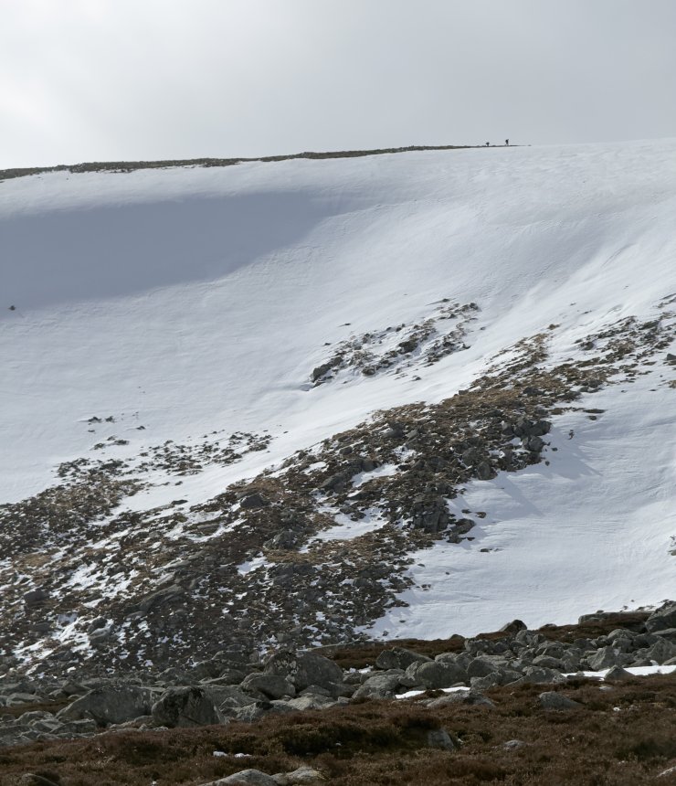
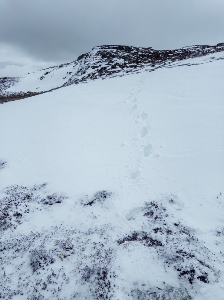
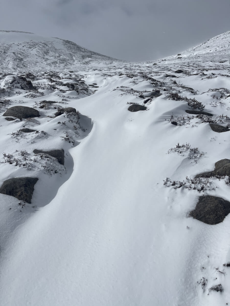
Keep up to date by subscribing to our RSS feed
This report is supported by